– Lat/Long: 41.22° S 172.68° E
 Mount Arthur
Weather Forecast, New ZealandIssued: 11 pm Mon 03 Aug Local TimeUpdates in: hr min sUpdate imminent
Issued: 11 pm Mon 03 Aug Local Time
Updates in:
Update imminent hr min s

Issued: 11 pm Mon 03 Aug Local Time
Updates in:
Update imminent hr min s
Days 1–4 Weather SummaryMostly dry. Temperatures will be below freezing (max -1°C on Mon night, min -5°C on Tue morning). Winds decreasing (gales from the WSW on Mon night, light winds from the WSW by Wed night). | Days 5–7 Weather SummaryA dusting of new snow. Freeze-thaw conditions (max 1°C on Fri night, min -1°C on Thu night). Wind will be generally light. | |||||||||||||||
Tuesday 4 | Wednesday 5 | Thursday 6 | Friday 7 | Saturday 8 | ||||||||||||
night | AM | PM | night | AM | PM | night | AM | PM | night | AM | PM | night | AM | PM | night | |
some clouds | some clouds | clear | clear | clear | clear | clear | clear | clear | some clouds | some clouds | light snow | cloudy | cloudy | light snow | some clouds | |
Cloud base (m) | 600 | 850 | 550 | 5850 | 700 | 400 | 2200 | 350 | 850 | |||||||
km/h | ||||||||||||||||
 |  |  |  |  |  | |||||||||||
— | — | — | — | — | — | — | — | — | — | — | 2 | — | — | 1 | — | |
mm | — | — | — | — | — | — | — | — | — | — | — | — | — | — | — | — |
max °C | -1 | -4 | -5 | -4 | -4 | -3 | -2 | -2 | -2 | 0 | 0 | 0 | 1 | 0 | -1 | -1 |
min °C | -3 | -5 | -5 | -5 | -4 | -3 | -3 | -3 | -2 | -1 | -1 | -1 | 1 | -1 | -1 | -1 |
chill °C | -12 | -12 | -12 | -12 | -8 | -8 | -7 | -7 | -6 | -4 | -6 | -7 | -3 | -3 | -4 | -4 |
Freezing level m | 1400 | 1100 | 1150 | 300 | 950 | 1350 | 750 | 1250 | 1500 | 1650 | 1700 | 1600 | 1950 | 1750 | 1500 | 1600 |
— | 7:33 | — | — | 7:33 | — | — | 7:31 | — | — | 7:31 | — | — | 7:30 | — | — | |
— | — | 5:36 | — | — | 5:37 | — | — | 5:37 | — | — | 5:38 | — | — | 5:39 | — | |
Loading...
Mount Arthur Weather (Days 0-3):
The weather forecast for Mount Arthur is: Mostly dry. Temperatures will be below freezing (max -1°C on Mon night, min -5°C on Tue morning). Winds decreasing (gales from the WSW on Mon night, light winds from the WSW by Wed night).
Mount Arthur Weather (Days 3-6):
A dusting of new snow. Freeze-thaw conditions (max 1°C on Fri night, min -1°C on Thu night). Wind will be generally light.
This table gives the weather forecast for Mount Arthur at the specific elevation of 1795 m. Our advanced weather models allow us to provide distinct weather forecasts for several elevations of Mount Arthur. To see the weather forecasts for the other elevations, use the tab navigation above the table. For a wider overview of the weather, consult the Weather Map of New Zealand.
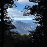
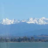
Mount Arthur Photos
View all
Nelson Ranges photos (35) |
New Zealand photos (156) |
photos from mountains in New Zealand (160) |
all photos
 Upload new photo
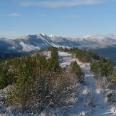
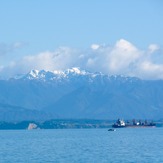
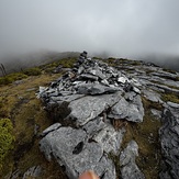
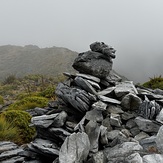
 See 8 more Mount Arthur photos
Hoary Head, Crusader etc
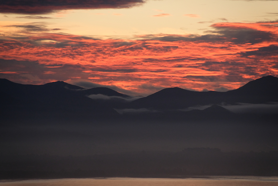
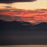
Sunset over the Arthur Ranges
From Nelson Boulder Bank
At the top
Near Arthur hut
View from the track
Western Ranges - Nelson