
– Lat/Long: 42.78° S 72.43° W
 Minchinmavida
Weather Forecast, ChileIssued: 1 am Thu 02 Jul Local TimeUpdates in: hr min sUpdate imminent
Issued: 1 am Thu 02 Jul Local Time
Updates in:
Update imminent hr min s

Issued: 1 am Thu 02 Jul Local Time
Updates in:
Update imminent hr min s
Days 1–3 Weather SummaryMostly dry. Freeze-thaw conditions (max 7°C on Thu night, min -1°C on Sat night). Wind will be generally light. | Days 4–6 Weather SummaryA heavy fall of snow, heaviest during Tue morning. Becoming milder with heavy rain (total 71mm) on Tue night. Freeze-thaw conditions (max 4°C on Tue night, min -3°C on Mon night). Winds increasing (light winds from the WNW on Sun afternoon, strong winds from the WNW by Tue night). | |||||||||||||||||
Thursday 2 | Friday 3 | Saturday 4 | Sunday 5 | Monday 6 | Tuesday 7 | |||||||||||||
AM | PM | night | AM | PM | night | AM | PM | night | AM | PM | night | AM | PM | night | AM | PM | night | |
clear | clear | clear | clear | clear | some clouds | clear | clear | clear | clear | clear | some clouds | clear | some clouds | mod. snow | heavy snow | mod. snow | heavy rain | |
km/h | ||||||||||||||||||
 |  |  |  |  |  | |||||||||||||
— | — | — | — | — | — | — | — | — | — | — | — | — | — | 7 | 12 | 9 | — | |
mm | — | — | — | — | — | — | — | — | — | — | — | — | — | — | — | — | — | 71 |
max °C | 5 | 6 | 7 | 4 | 4 | 4 | 2 | 1 | 1 | -1 | -2 | 1 | 2 | 2 | 0 | 0 | 1 | 4 |
min °C | 5 | 6 | 4 | 4 | 4 | 3 | 2 | 1 | -1 | -1 | -2 | -2 | 2 | 0 | -3 | 0 | 1 | 2 |
chill °C | 0 | 2 | 4 | 4 | 4 | 3 | 1 | 0 | -4 | -4 | -5 | -5 | -2 | -6 | -10 | -6 | -2 | -2 |
Freezing level m | 3100 | 3000 | 0 | 2850 | 2500 | 2150 | 1950 | 1700 | 1550 | 1200 | 1150 | 1300 | 2100 | 1600 | 1550 | 1550 | 1950 | 2300 |
Cloud base (m) | 500 | 550 | 500 | 900 | 600 | 9250 | 500 | 500 | 550 | 500 | 500 | |||||||
8:21 | — | — | 8:19 | — | — | 8:19 | — | — | 8:19 | — | — | 8:19 | — | — | 8:18 | — | — | |
— | 5:25 | — | — | 5:27 | — | — | 5:27 | — | — | 5:28 | — | — | 5:28 | — | — | 5:29 | — | |
Loading...
Minchinmavida Weather (Days 0-3):
The weather forecast for Minchinmavida is: Mostly dry. Freeze-thaw conditions (max 7°C on Thu night, min -1°C on Sat night). Wind will be generally light.
Minchinmavida Weather (Days 3-6):
A heavy fall of snow, heaviest during Tue morning. Becoming milder with heavy rain (total 71mm) on Tue night. Freeze-thaw conditions (max 4°C on Tue night, min -3°C on Mon night). Winds increasing (light winds from the WNW on Sun afternoon, strong winds from the WNW by Tue night).
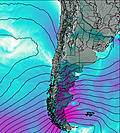
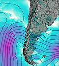
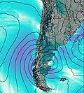
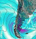
This table gives the weather forecast for Minchinmavida at the specific elevation of 1500 m. Our advanced weather models allow us to provide distinct weather forecasts for several elevations of Minchinmavida. To see the weather forecasts for the other elevations, use the tab navigation above the table. For a wider overview of the weather, consult the Weather Map of Chile.
| Weather Station | Temp. | Weather | Wind | Gusts | Cloud / Visibility |
|---|---|---|---|---|---|
Nuevo Chaitén Airport | |||||
Futaleufu Airport | |||||
Monopulli Airport | |||||
Osorn / añal Bajo Carlos Hott Siebert Airport | |||||
Balmaceda Airport | |||||
Valdivi / ichoy Airport | |||||
Temuco Airport | |||||
Enrique Moscon / omodoro Rivadavia Airport |
* NOTE: not all weather observatories update at the same frequency which is the reason why some locations may show data from stations that are further away than known closer ones.