– Lat/Long: 53.16° N 6.23° W
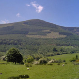
 Maulin
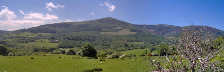
Weather Forecast, IrelandIssued: 12 pm Mon 03 Aug Local TimeUpdates in: hr min sUpdate imminent
Issued: 12 pm Mon 03 Aug Local Time
Updates in:
Update imminent hr min s

Issued: 12 pm Mon 03 Aug Local Time
Updates in:
Update imminent hr min s
Days 1–3 Weather SummaryModerate rain (total 13mm), heaviest on Mon night. Warm (max 23°C on Tue morning, min 10°C on Wed night). Winds increasing (light winds from the SSE on Mon night, fresh winds from the W by Wed morning). | Days 4–6 Weather SummaryMostly dry. Warm (max 22°C on Sat afternoon, min 11°C on Thu night). Wind will be generally light. | |||||||||||||||||
Monday 3 | Tuesday 4 | Wednesday 5 | Thursday 6 | Friday 7 | Saturday 8 | |||||||||||||
AM | PM | night | AM | PM | night | AM | PM | night | AM | PM | night | AM | PM | night | AM | PM | night | |
some clouds | light rain | mod. rain | rain shwrs | rain shwrs | rain shwrs | rain shwrs | rain shwrs | clear | some clouds | some clouds | rain shwrs | cloudy | light rain | some clouds | cloudy | rain shwrs | rain shwrs | |
Cloud base (m) | 2850 | 2750 | 250 | 800 | 1550 | 550 | 250 | 850 | 2050 | 1950 | 1900 | 1850 | 6150 | 2850 | 1600 | 1800 | ||
km/h | ||||||||||||||||||
 |  |  |  |  |  | |||||||||||||
— | — | — | — | — | — | — | — | — | — | — | — | — | — | — | — | — | — | |
mm | — | 2 | 9 | 1.3 | 0.5 | 0.2 | 0.2 | 0.2 | — | — | — | 0.1 | — | 0.1 | — | — | 0.2 | 0.1 |
max °C | 21 | 19 | 17 | 23 | 23 | 17 | 16 | 18 | 14 | 18 | 20 | 15 | 20 | 20 | 17 | 21 | 22 | 18 |
min °C | 19 | 15 | 14 | 21 | 22 | 13 | 14 | 17 | 10 | 14 | 19 | 11 | 17 | 20 | 13 | 18 | 21 | 16 |
chill °C | 19 | 15 | 14 | 21 | 22 | 11 | 12 | 16 | 8 | 12 | 19 | 11 | 17 | 20 | 13 | 18 | 21 | 16 |
Freezing level m | 3300 | 3450 | 3550 | 3300 | 3300 | 3050 | 2600 | 2650 | 2450 | 2450 | 2850 | 2800 | 2650 | 2850 | 2950 | 3300 | 3500 | 3450 |
5:43 | — | — | 5:45 | — | — | 5:47 | — | — | 5:48 | — | — | 5:50 | — | — | 5:52 | — | — | |
— | 9:15 | — | — | 9:15 | — | — | 9:13 | — | — | 9:10 | — | — | 9:08 | — | — | 9:07 | — | |
Loading...
Maulin Weather (Days 0-3):
The weather forecast for Maulin is: Moderate rain (total 13mm), heaviest on Mon night. Warm (max 23°C on Tue morning, min 10°C on Wed night). Winds increasing (light winds from the SSE on Mon night, fresh winds from the W by Wed morning).
Maulin Weather (Days 3-6):
Mostly dry. Warm (max 22°C on Sat afternoon, min 11°C on Thu night). Wind will be generally light.
This table gives the weather forecast for Maulin at the specific elevation of 0 m. Our advanced weather models allow us to provide distinct weather forecasts for several elevations of Maulin. To see the weather forecasts for the other elevations, use the tab navigation above the table. For a wider overview of the weather, consult the Weather Map of Ireland.