– Lat/Long: 39.28° S 176.38° E
 Kaweka J
Weather Forecast, New ZealandIssued: 5 pm Mon 03 Aug Local TimeUpdates in: hr min sUpdate imminent
Issued: 5 pm Mon 03 Aug Local Time
Updates in:
Update imminent hr min s

Issued: 5 pm Mon 03 Aug Local Time
Updates in:
Update imminent hr min s
Days 1–4 Weather SummaryA light covering of new snow mostly falling on Tue morning. Freeze-thaw conditions (max 3°C on Mon afternoon, min -9°C on Tue night). Winds decreasing (severe gales from the WSW on Mon afternoon, light winds from the SSW by Thu morning). | Days 5–7 Weather SummaryMostly dry. Freeze-thaw conditions (max 2°C on Sun morning, min -3°C on Thu afternoon). Winds increasing (light winds from the SW on Thu night, gales from the WNW by Sat night). | ||||||||||||||||
Mon 3 | Tuesday 4 | Wednesday 5 | Thursday 6 | Friday 7 | Saturday 8 | ||||||||||||
PM | night | AM | PM | night | AM | PM | night | AM | PM | night | AM | PM | night | AM | PM | night | |
clear | some clouds | light snow | snow shwrs | some clouds | some clouds | some clouds | clear | clear | clear | clear | some clouds | some clouds | cloudy | cloudy | cloudy | cloudy | |
Cloud base (m) | 8700 | 900 | 450 | 550 | 700 | 600 | 650 | 600 | 450 | 450 | 8600 | 6050 | 2550 | 800 | 450 | 450 | |
km/h | |||||||||||||||||
 |  |  |  |  |  | ||||||||||||
— | — | 3 | 3 | — | — | — | — | — | — | — | — | — | — | — | — | — | |
mm | — | — | — | — | — | — | — | — | — | — | — | — | — | — | — | — | — |
max °C | 3 | 1 | -3 | -7 | -7 | -6 | -6 | -5 | -4 | -3 | 0 | 1 | 1 | 1 | 1 | 1 | 1 |
min °C | 2 | -2 | -6 | -8 | -9 | -7 | -6 | -5 | -4 | -3 | -2 | 0 | 0 | 1 | 1 | 0 | 0 |
chill °C | -7 | -10 | -14 | -18 | -21 | -18 | -15 | -13 | -11 | -8 | -6 | -4 | -4 | -5 | -7 | -8 | -8 |
Freezing level m | 2450 | 1550 | 1150 | 800 | 250 | 700 | 950 | 350 | 950 | 1350 | 1600 | 1950 | 1900 | 1900 | 1950 | 1900 | 1850 |
— | — | 7:15 | — | — | 7:13 | — | — | 7:13 | — | — | 7:11 | — | — | 7:11 | — | — | |
5:24 | — | — | 5:25 | — | — | 5:25 | — | — | 5:27 | — | — | 5:28 | — | — | 5:29 | — | |
Loading...
Kaweka J Weather (Days 0-3):
The weather forecast for Kaweka J is: A light covering of new snow mostly falling on Tue morning. Freeze-thaw conditions (max 3°C on Mon afternoon, min -9°C on Tue night). Winds decreasing (severe gales from the WSW on Mon afternoon, light winds from the SSW by Thu morning).
Kaweka J Weather (Days 3-6):
Mostly dry. Freeze-thaw conditions (max 2°C on Sun morning, min -3°C on Thu afternoon). Winds increasing (light winds from the SW on Thu night, gales from the WNW by Sat night).
This table gives the weather forecast for Kaweka J at the specific elevation of 1724 m. Our advanced weather models allow us to provide distinct weather forecasts for several elevations of Kaweka J. To see the weather forecasts for the other elevations, use the tab navigation above the table. For a wider overview of the weather, consult the Weather Map of New Zealand.
Kaweka J Photos
View all
Kaweka Range photos (7) |
New Zealand photos (156) |
photos from mountains in New Zealand (160) |
all photos
 Upload new photo
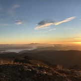
View in the morning
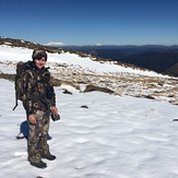
Kaweka J
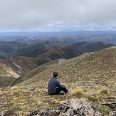
Top of Kawekas
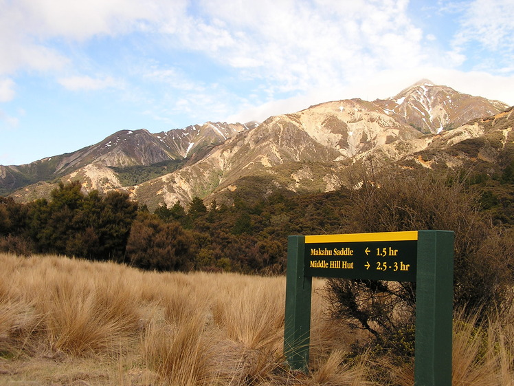
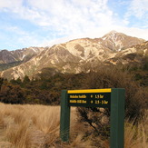
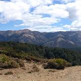
Kaweka Range
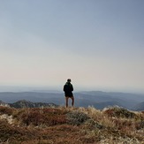
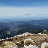
View from Kaweka J Summit