– Lat/Long: 54.50° N 2.99° W
 Fairfield
Weather Forecast, United KingdomIssued: 12 am Mon 03 Aug Local TimeUpdates in: hr min sUpdate imminent
Issued: 12 am Mon 03 Aug Local Time
Updates in:
Update imminent hr min s

Issued: 12 am Mon 03 Aug Local Time
Updates in:
Update imminent hr min s
Days 1–4 Weather SummaryLight rain (total 9mm), mostly falling on Wed afternoon. Warm (max 24°C on Mon afternoon, min 14°C on Sun night). Winds increasing (calm on Sun night, fresh winds from the SW by Wed afternoon). | Days 5–7 Weather SummaryLight rain (total 8mm), mostly falling on Fri night. Very mild (max 16°C on Thu afternoon, min 11°C on Thu night). Wind will be generally light. | ||||||||||||||||||
Monday 3 | Tuesday 4 | Wednesday 5 | Thursday 6 | Friday 7 | Saturday 8 | ||||||||||||||
night | AM | PM | night | AM | PM | night | AM | PM | night | AM | PM | night | AM | PM | night | AM | PM | night | |
light rain | some clouds | some clouds | light rain | light rain | light rain | rain shwrs | rain shwrs | light rain | light rain | rain shwrs | some clouds | clear | rain shwrs | clear | rain shwrs | light rain | rain shwrs | rain shwrs | |
Cloud base (m) | 2050 | 2350 | 2350 | 1550 | 500 | 650 | 450 | 600 | 250 | 550 | 1850 | 6100 | 2150 | 2400 | 250 | 450 | 650 | ||
km/h | |||||||||||||||||||
 |  |  |  |  |  |  | |||||||||||||
— | — | — | — | — | — | — | — | — | — | — | — | — | — | — | — | — | — | — | |
mm | 0.1 | — | — | 0.4 | 0.1 | 1.4 | 1.7 | 1.3 | 4 | 3 | 0.2 | — | — | 0.1 | — | 2 | 2 | 0.8 | 0.1 |
max °C | 17 | 21 | 24 | 17 | 19 | 20 | 16 | 14 | 14 | 14 | 15 | 16 | 12 | 16 | 16 | 14 | 15 | 16 | 13 |
min °C | 14 | 18 | 21 | 16 | 17 | 19 | 15 | 14 | 14 | 13 | 14 | 15 | 11 | 15 | 16 | 12 | 14 | 15 | 12 |
chill °C | 14 | 18 | 21 | 16 | 17 | 19 | 14 | 13 | 12 | 13 | 14 | 14 | 11 | 14 | 15 | 11 | 12 | 14 | 12 |
Freezing level m | 2900 | 3000 | 3250 | 3300 | 3550 | 3450 | 3100 | 3100 | 2500 | 2650 | 2500 | 2400 | 2700 | 2500 | 2500 | 2650 | 3250 | 3200 | 3400 |
— | 5:24 | — | — | 5:26 | — | — | 5:28 | — | — | 5:30 | — | — | 5:31 | — | — | 5:33 | — | — | |
— | — | 9:08 | — | — | 9:07 | — | — | 9:05 | — | — | 9:02 | — | — | 9:00 | — | — | 8:59 | — | |
Loading...
Fairfield Weather (Days 0-3):
The weather forecast for Fairfield is: Light rain (total 9mm), mostly falling on Wed afternoon. Warm (max 24°C on Mon afternoon, min 14°C on Sun night). Winds increasing (calm on Sun night, fresh winds from the SW by Wed afternoon).
Fairfield Weather (Days 3-6):
Light rain (total 8mm), mostly falling on Fri night. Very mild (max 16°C on Thu afternoon, min 11°C on Thu night). Wind will be generally light.
This table gives the weather forecast for Fairfield at the specific elevation of 128 m. Our advanced weather models allow us to provide distinct weather forecasts for several elevations of Fairfield. To see the weather forecasts for the other elevations, use the tab navigation above the table. For a wider overview of the weather, consult the Weather Map of United Kingdom.
| Weather Station | Temp. | Weather | Wind | Gusts | Cloud / Visibility |
|---|---|---|---|---|---|
Shap | |||||
SHIP1639 | |||||
SHIP2829 | |||||
SHIP1181 | |||||
Morecambe Bay Waverider |
* NOTE: not all weather observatories update at the same frequency which is the reason why some locations may show data from stations that are further away than known closer ones.
Fairfield Photos
View all
photos (729) |
Lake District photos (738) |
photos from mountains in United Kingdom (2125) |
all photos
 Upload new photo
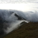
 See 9 more Fairfield photos
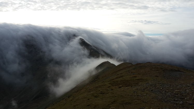
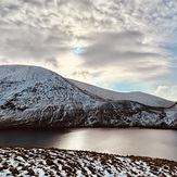
Inversion in the Lakes
Inversion in the Lakes
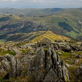
Fairfield summit
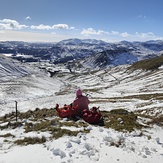
Fairfield from Grizedale Tarn
Hart Cragg
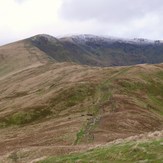
Halfway up Fairfield
fairfield approach from nab scar