– Lat/Long: 38.58° N 23.83° E
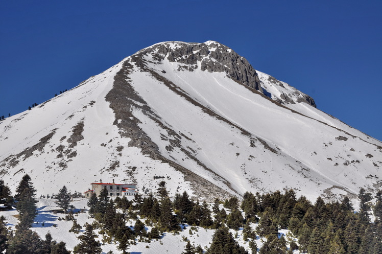
 Dirfys (Evia)
Weather Forecast, GreeceIssued: 2 pm Mon 03 Aug Local TimeUpdates in: hr min sUpdate imminent
Issued: 2 pm Mon 03 Aug Local Time
Updates in:
Update imminent hr min s

Issued: 2 pm Mon 03 Aug Local Time
Updates in:
Update imminent hr min s
Days 1–4 Weather SummaryMostly dry. Very mild (max 19°C on Tue afternoon, min 16°C on Mon afternoon). Winds increasing (moderate winds from the ENE on Mon night, near gales from the NNE by Thu morning). | Days 5–7 Weather SummaryMostly dry. Warm (max 21°C on Sat night, min 16°C on Fri morning). Mainly strong winds. | ||||||||||||||||
Mon 3 | Tuesday 4 | Wednesday 5 | Thursday 6 | Friday 7 | Saturday 8 | ||||||||||||
PM | night | AM | PM | night | AM | PM | night | AM | PM | night | AM | PM | night | AM | PM | night | |
clear | clear | clear | clear | clear | clear | clear | clear | clear | clear | clear | clear | clear | clear | clear | clear | clear | |
Cloud base (m) | 4300 | ||||||||||||||||
km/h | |||||||||||||||||
 |  |  |  |  |  | ||||||||||||
— | — | — | — | — | — | — | — | — | — | — | — | — | — | — | — | — | |
mm | — | — | — | — | — | — | — | — | — | — | — | — | — | — | — | — | — |
max °C | 17 | 18 | 17 | 19 | 19 | 18 | 18 | 19 | 17 | 18 | 18 | 17 | 18 | 19 | 19 | 20 | 21 |
min °C | 16 | 17 | 17 | 18 | 18 | 17 | 18 | 17 | 16 | 17 | 17 | 16 | 18 | 19 | 19 | 19 | 20 |
chill °C | 14 | 16 | 16 | 17 | 17 | 15 | 17 | 15 | 14 | 15 | 15 | 14 | 17 | 18 | 18 | 18 | 20 |
Freezing level m | 4550 | 4700 | 4350 | 4400 | 4400 | 4350 | 4450 | 4450 | 4350 | 4550 | 4450 | 4300 | 4650 | 4700 | 4500 | 4550 | 4650 |
— | — | 6:28 | — | — | 6:28 | — | — | 6:30 | — | — | 6:30 | — | — | 6:31 | — | — | |
8:32 | — | — | 8:31 | — | — | 8:30 | — | — | 8:30 | — | — | 8:29 | — | — | 8:28 | — | |
Loading...
Dirfys (Evia) Weather (Days 0-3):
The weather forecast for Dirfys (Evia) is: Mostly dry. Very mild (max 19°C on Tue afternoon, min 16°C on Mon afternoon). Winds increasing (moderate winds from the ENE on Mon night, near gales from the NNE by Thu morning).
Dirfys (Evia) Weather (Days 3-6):
Mostly dry. Warm (max 21°C on Sat night, min 16°C on Fri morning). Mainly strong winds.
This table gives the weather forecast for Dirfys (Evia) at the specific elevation of 1743 m. Our advanced weather models allow us to provide distinct weather forecasts for several elevations of Dirfys (Evia). To see the weather forecasts for the other elevations, use the tab navigation above the table. For a wider overview of the weather, consult the Weather Map of Greece.
| Weather Station | Temp. | Weather | Wind | Gusts | Cloud / Visibility |
|---|---|---|---|---|---|
Tatoi | |||||
* NOTE: not all weather observatories update at the same frequency which is the reason why some locations may show data from stations that are further away than known closer ones.
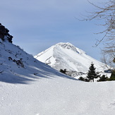
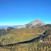
Dirfys (Evia) Photos
View all
Greek Islands photos (59) |
Balkan Peninsula photos (1075) |
photos from mountains in Greece (690) |
all photos
 Upload new photo
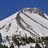
 See 11 more Dirfys (Evia) photos
Dirfys mountain - ΔΙΡΦΥΣ
mountain Dirfys
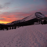
Dirfys on winter
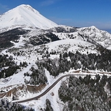
Dirfys -Steni's Aesthetic Forest
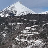
Dirfys - Η Δίρφυς
Dirfys - Η Δίρφυς χιονισμένη
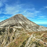
Dirfys mountain on November