– Lat/Long: 37.82° N 35.17° E
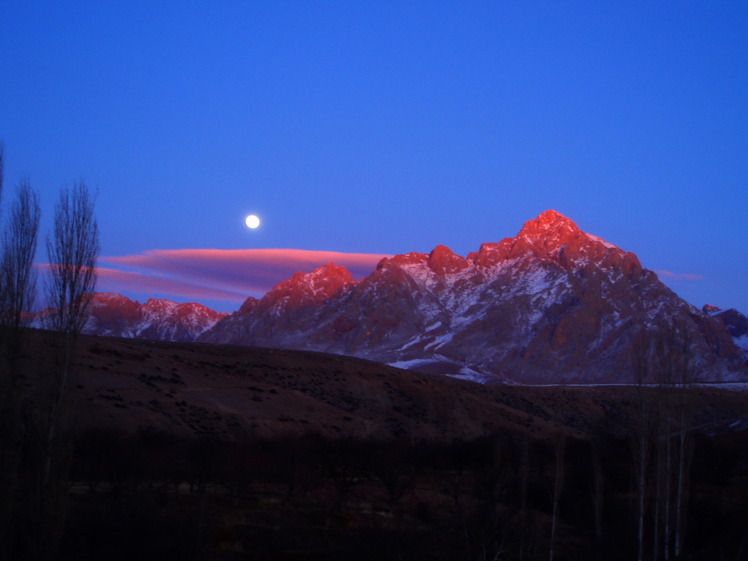
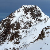
 Demirkazik
Weather Forecast, TurkeyIssued: 8 pm Sun 02 Aug Local TimeUpdates in: hr min sUpdate imminent
Issued: 8 pm Sun 02 Aug Local Time
Updates in:
Update imminent hr min s

Issued: 8 pm Sun 02 Aug Local Time
Updates in:
Update imminent hr min s
Days 1–4 Weather SummaryMostly dry. Very mild (max 15°C on Tue afternoon, min 11°C on Sun night). Wind will be generally light. | Days 5–7 Weather SummaryMostly dry. Very mild (max 16°C on Sat afternoon, min 12°C on Wed night). Wind will be generally light. | ||||||||||||||||||
Monday 3 | Tuesday 4 | Wednesday 5 | Thursday 6 | Friday 7 | Saturday 8 | ||||||||||||||
night | AM | PM | night | AM | PM | night | AM | PM | night | AM | PM | night | AM | PM | night | AM | PM | night | |
clear | clear | clear | clear | clear | some clouds | clear | clear | clear | clear | clear | clear | rain shwrs | clear | clear | clear | clear | clear | clear | |
Cloud base (m) | 4800 | 4700 | 4800 | 4950 | |||||||||||||||
km/h | |||||||||||||||||||
 |  |  |  |  |  |  | |||||||||||||
— | — | — | — | — | — | — | — | — | — | — | — | — | — | — | — | — | — | — | |
mm | — | — | — | — | — | — | — | — | — | — | — | — | 0.1 | — | — | — | — | — | — |
max °C | 12 | 13 | 14 | 13 | 13 | 15 | 14 | 13 | 15 | 13 | 13 | 15 | 13 | 13 | 15 | 14 | 14 | 16 | 15 |
min °C | 11 | 11 | 14 | 12 | 12 | 15 | 12 | 12 | 15 | 12 | 12 | 15 | 12 | 12 | 15 | 13 | 13 | 16 | 15 |
chill °C | 11 | 11 | 14 | 12 | 11 | 15 | 11 | 11 | 15 | 11 | 11 | 15 | 11 | 11 | 15 | 12 | 11 | 16 | 14 |
Freezing level m | 5200 | 5150 | 5500 | 5450 | 5400 | 5750 | 5700 | 5600 | 5750 | 5550 | 5450 | 5650 | 5650 | 5550 | 5700 | 5600 | 5400 | 5600 | 5600 |
— | 5:43 | — | — | 5:45 | — | — | 5:45 | — | — | 5:46 | — | — | 5:47 | — | — | 5:48 | — | — | |
— | — | 7:45 | — | — | 7:45 | — | — | 7:44 | — | — | 7:43 | — | — | 7:42 | — | — | 7:39 | — | |
Loading...
Demirkazik Weather (Days 0-3):
The weather forecast for Demirkazik is: Mostly dry. Very mild (max 15°C on Tue afternoon, min 11°C on Sun night). Wind will be generally light.
Demirkazik Weather (Days 3-6):
Mostly dry. Very mild (max 16°C on Sat afternoon, min 12°C on Wed night). Wind will be generally light.
This table gives the weather forecast for Demirkazik at the specific elevation of 3000 m. Our advanced weather models allow us to provide distinct weather forecasts for several elevations of Demirkazik. To see the weather forecasts for the other elevations, use the tab navigation above the table. For a wider overview of the weather, consult the Weather Map of Turkey.
| Weather Station | Temp. | Weather | Wind | Gusts | Cloud / Visibility |
|---|---|---|---|---|---|
İncirlik Havalimani | |||||
Eregl / onya | |||||
Kayseri Erkilet Airport | |||||
Kayser / rkilet | |||||
* NOTE: not all weather observatories update at the same frequency which is the reason why some locations may show data from stations that are further away than known closer ones.
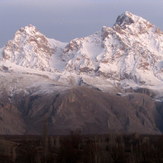
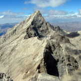
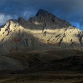
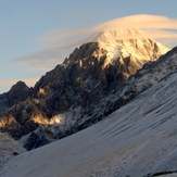
Demirkazik Photos
View all
Taurus Mountains photos (152) |
Anatolia photos (529) |
photos from mountains in Turkey (496) |
all photos
 Upload new photo
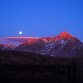
 See 39 more Demirkazik photos
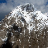
Demirkazik
Güneşin ışıkları gitse de DAĞLARIN ışıkları bize yeter
Demirkazık
Demirkazık
Demirkazık
Demirkazık
Demirkazık