– Lat/Long: 31.76° S 24.54° E
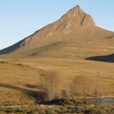
 Compassberg
Weather Forecast, South AfricaIssued: 7 am Mon 03 Aug Local TimeUpdates in: hr min sUpdate imminent
Issued: 7 am Mon 03 Aug Local Time
Updates in:
Update imminent hr min s

Issued: 7 am Mon 03 Aug Local Time
Updates in:
Update imminent hr min s
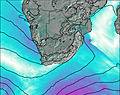
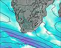
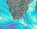
Days 1–3 Weather SummaryMostly dry. Very mild (max 10°C on Tue afternoon, min 6°C on Tue night). Winds increasing (calm on Mon afternoon, strong winds from the NW by Wed afternoon). | Days 4–6 Weather SummaryMostly dry. Very mild (max 10°C on Sat afternoon, min 4°C on Fri morning). Winds increasing (light winds from the W on Fri night, near gales from the WNW by Sat afternoon). | |||||||||||||||||
Monday 3 | Tuesday 4 | Wednesday 5 | Thursday 6 | Friday 7 | Saturday 8 | |||||||||||||
AM | PM | night | AM | PM | night | AM | PM | night | AM | PM | night | AM | PM | night | AM | PM | night | |
clear | clear | clear | clear | clear | some clouds | clear | clear | clear | clear | some clouds | clear | clear | clear | clear | clear | some clouds | some clouds | |
Cloud base (m) | 8950 | 8850 | 5350 | 4150 | 9400 | 2550 | 8400 | 6900 | ||||||||||
km/h | ||||||||||||||||||
 |  |  |  |  |  | |||||||||||||
— | — | — | — | — | — | — | — | — | — | — | — | — | — | — | — | — | — | |
mm | — | — | — | — | — | — | — | — | — | — | — | — | — | — | — | — | — | — |
max °C | 9 | 9 | 9 | 9 | 10 | 7 | 8 | 9 | 8 | 7 | 8 | 7 | 6 | 5 | 6 | 9 | 10 | 8 |
min °C | 8 | 9 | 7 | 7 | 8 | 6 | 6 | 9 | 6 | 6 | 7 | 5 | 4 | 5 | 5 | 6 | 9 | 6 |
chill °C | 7 | 8 | 4 | 4 | 5 | 2 | 1 | 4 | 1 | 1 | 2 | -1 | -2 | 0 | 1 | 1 | 4 | 0 |
Freezing level m | 3850 | 3700 | 3900 | 3850 | 3450 | 3400 | 3400 | 3700 | 3550 | 3500 | 3350 | 3550 | 3300 | 3450 | 3900 | 3900 | 3700 | 3700 |
7:07 | — | — | 7:07 | — | — | 7:07 | — | — | 7:05 | — | — | 7:05 | — | — | 7:03 | — | — | |
— | 5:46 | — | — | 5:47 | — | — | 5:47 | — | — | 5:49 | — | — | 5:50 | — | — | 5:50 | — | |
Loading...
Compassberg Weather (Days 0-3):
The weather forecast for Compassberg is: Mostly dry. Very mild (max 10°C on Tue afternoon, min 6°C on Tue night). Winds increasing (calm on Mon afternoon, strong winds from the NW by Wed afternoon).
Compassberg Weather (Days 3-6):
Mostly dry. Very mild (max 10°C on Sat afternoon, min 4°C on Fri morning). Winds increasing (light winds from the W on Fri night, near gales from the WNW by Sat afternoon).
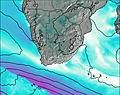
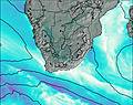
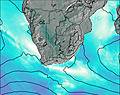
This table gives the weather forecast for Compassberg at the specific elevation of 2502 m. Our advanced weather models allow us to provide distinct weather forecasts for several elevations of Compassberg. To see the weather forecasts for the other elevations, use the tab navigation above the table. For a wider overview of the weather, consult the Weather Map of South Africa.
| Weather Station | Temp. | Weather | Wind | Gusts | Cloud / Visibility |
|---|---|---|---|---|---|
Graaff -Reinet | |||||
DE Aar | |||||
De Aar Military Airport | |||||
Gariep Dam | |||||
Somerset East | |||||
* NOTE: not all weather observatories update at the same frequency which is the reason why some locations may show data from stations that are further away than known closer ones.
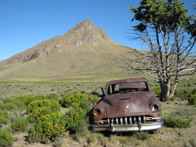
Compassberg Photos
View all
Groot Winterhoek Range photos (2) |
Southern Africa photos (72) |
photos from mountains in South Africa (66) |
all photos
 Upload new photo
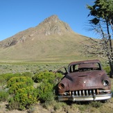
Compassberg
Compassberg