– Lat/Long: 44.12° N 7.39° E
 Cime du Gélas (Cime du Gelas)
Weather Forecast, FranceIssued: 7 pm Sun 02 Aug Local TimeUpdates in: hr min sUpdate imminent
Issued: 7 pm Sun 02 Aug Local Time
Updates in:
Update imminent hr min s

Issued: 7 pm Sun 02 Aug Local Time
Updates in:
Update imminent hr min s
Days 1–4 Weather SummaryModerate rain (total 12mm), heaviest on Sun night. Warm (max 28°C on Wed afternoon, min 21°C on Sun night). Wind will be generally light. | Days 5–7 Weather SummaryLight rain (total 7mm), mostly falling on Thu night. Warm (max 28°C on Thu afternoon, min 22°C on Thu night). Wind will be generally light. | ||||||||||||||||||
Monday 3 | Tuesday 4 | Wednesday 5 | Thursday 6 | Friday 7 | Saturday 8 | ||||||||||||||
night | AM | PM | night | AM | PM | night | AM | PM | night | AM | PM | night | AM | PM | night | AM | PM | night | |
risk tstorm | rain shwrs | risk tstorm | risk tstorm | clear | some clouds | rain shwrs | clear | rain shwrs | rain shwrs | clear | risk tstorm | risk tstorm | clear | clear | clear | clear | rain shwrs | risk tstorm | |
Cloud base (m) | 3050 | 4700 | 9500 | 2900 | 4100 | 4300 | 5250 | ||||||||||||
km/h | |||||||||||||||||||
 |  |  |  |  |  |  | |||||||||||||
— | — | — | — | — | — | — | — | — | — | — | — | — | — | — | — | — | — | — | |
mm | 8 | 0.1 | 0.8 | 0.8 | — | — | 2 | — | 0.7 | 0.9 | — | 2 | 4 | — | — | — | — | 0.2 | 0.3 |
max °C | 24 | 25 | 27 | 24 | 25 | 27 | 24 | 26 | 28 | 24 | 27 | 28 | 22 | 26 | 28 | 25 | 25 | 28 | 25 |
min °C | 21 | 22 | 27 | 22 | 23 | 27 | 22 | 23 | 25 | 23 | 24 | 25 | 22 | 23 | 27 | 22 | 23 | 28 | 22 |
chill °C | 21 | 22 | 27 | 22 | 23 | 27 | 22 | 23 | 25 | 23 | 24 | 25 | 22 | 23 | 27 | 22 | 23 | 28 | 22 |
Freezing level m | 4550 | 4500 | 4600 | 4550 | 4450 | 4450 | 4450 | 4450 | 4550 | 4600 | 4450 | 4550 | 4650 | 4550 | 4650 | 4600 | 4600 | 4650 | 4500 |
— | 6:18 | — | — | 6:20 | — | — | 6:20 | — | — | 6:22 | — | — | 6:24 | — | — | 6:24 | — | — | |
— | — | — | 8:52 | — | — | 8:51 | — | — | 8:50 | — | — | 8:49 | — | — | 8:46 | — | — | 8:45 | |
Loading...
Cime du Gélas Weather (Days 0-3):
The weather forecast for Cime du Gélas is: Moderate rain (total 12mm), heaviest on Sun night. Warm (max 28°C on Wed afternoon, min 21°C on Sun night). Wind will be generally light.
Cime du Gélas Weather (Days 3-6):
Light rain (total 7mm), mostly falling on Thu night. Warm (max 28°C on Thu afternoon, min 22°C on Thu night). Wind will be generally light.
This table gives the weather forecast for Cime du Gélas at the specific elevation of 1000 m. Our advanced weather models allow us to provide distinct weather forecasts for several elevations of Cime du Gélas. To see the weather forecasts for the other elevations, use the tab navigation above the table. For a wider overview of the weather, consult the Weather Map of France.
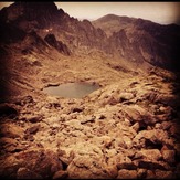
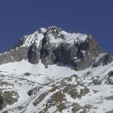
Cime du Gélas Photos
View all
Maritime Alps photos (29) |
Alps photos (1485) |
photos from mountains in France (302) |
all photos
 Upload new photo
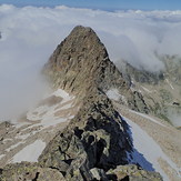
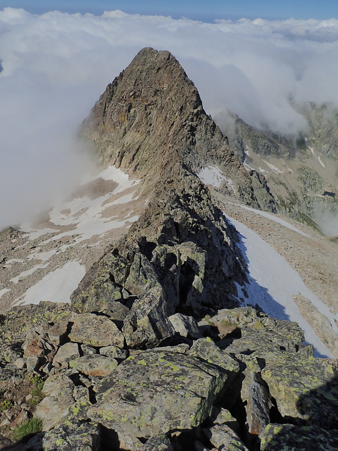
Ridge WSW
Cime du Gélas