– Lat/Long: 44.12° N 7.39° E
 Cime du Gélas (Cime du Gelas)
Weather Forecast, FranceIssued: 1 pm Mon 03 Aug Local TimeUpdates in: hr min sUpdate imminent
Issued: 1 pm Mon 03 Aug Local Time
Updates in:
Update imminent hr min s

Issued: 1 pm Mon 03 Aug Local Time
Updates in:
Update imminent hr min s
Days 1–4 Weather SummaryLight rain (total 4mm), mostly falling on Tue night. Very mild (max 10°C on Tue afternoon, min 8°C on Wed morning). Wind will be generally light. | Days 5–7 Weather SummaryLight rain (total 9mm), mostly falling on Sat afternoon. Mild temperatures (max 9°C on Thu afternoon, min 8°C on Fri morning). Wind will be generally light. | ||||||||||||||||
Mon 3 | Tuesday 4 | Wednesday 5 | Thursday 6 | Friday 7 | Saturday 8 | ||||||||||||
PM | night | AM | PM | night | AM | PM | night | AM | PM | night | AM | PM | night | AM | PM | night | |
risk tstorm | risk tstorm | some clouds | some clouds | risk tstorm | rain shwrs | risk tstorm | rain shwrs | clear | rain shwrs | risk tstorm | clear | risk tstorm | risk tstorm | clear | risk tstorm | risk tstorm | |
Cloud base (m) | 5350 | 5100 | 4950 | 2700 | 4100 | 3550 | 2550 | 2200 | |||||||||
km/h | |||||||||||||||||
 |  |  |  |  |  | ||||||||||||
— | — | — | — | — | — | — | — | — | — | — | — | — | — | — | — | — | |
mm | 1 | 0.5 | — | — | 2 | 0.2 | 0.5 | 0.1 | — | 1.6 | 1.8 | — | 1.8 | 0.6 | — | 2 | 0.9 |
max °C | 9 | 9 | 9 | 10 | 9 | 9 | 9 | 9 | 9 | 9 | 9 | 8 | 9 | 9 | 8 | 9 | 9 |
min °C | 9 | 9 | 9 | 9 | 9 | 8 | 8 | 9 | 9 | 9 | 9 | 8 | 8 | 8 | 8 | 8 | 8 |
chill °C | 8 | 7 | 6 | 7 | 8 | 8 | 8 | 6 | 9 | 8 | 6 | 7 | 7 | 7 | 6 | 6 | 7 |
Freezing level m | 4600 | 4500 | 4400 | 4500 | 4500 | 4500 | 4550 | 4600 | 4400 | 4500 | 4500 | 4400 | 4500 | 4450 | 4350 | 4500 | 4500 |
— | — | 6:20 | — | — | 6:20 | — | — | 6:22 | — | — | 6:24 | — | — | 6:24 | — | — | |
— | 8:52 | — | — | 8:51 | — | — | 8:50 | — | — | 8:49 | — | — | 8:46 | — | — | 8:45 | |
Loading...
Cime du Gélas Weather (Days 0-3):
The weather forecast for Cime du Gélas is: Light rain (total 4mm), mostly falling on Tue night. Very mild (max 10°C on Tue afternoon, min 8°C on Wed morning). Wind will be generally light.
Cime du Gélas Weather (Days 3-6):
Light rain (total 9mm), mostly falling on Sat afternoon. Mild temperatures (max 9°C on Thu afternoon, min 8°C on Fri morning). Wind will be generally light.
This table gives the weather forecast for Cime du Gélas at the specific elevation of 3143 m. Our advanced weather models allow us to provide distinct weather forecasts for several elevations of Cime du Gélas. To see the weather forecasts for the other elevations, use the tab navigation above the table. For a wider overview of the weather, consult the Weather Map of France.
| Weather Station | Temp. | Weather | Wind | Gusts | Cloud / Visibility |
|---|---|---|---|---|---|
lightning 15km NNE of Saint-Martin-Vesubie | |||||
lightning 12km WNW of Tende | |||||
lightning 13km SW of Vernante | |||||
lightning 6km ENE of Limone Piemonte | |||||
lightning 6km S of Peveragno | |||||
lightning 9km S of Chiusa di Pesio | |||||
lightning 6km WSW of Bernezzo |
* NOTE: not all weather observatories update at the same frequency which is the reason why some locations may show data from stations that are further away than known closer ones.
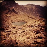
Cime du Gélas Photos
View all
Maritime Alps photos (29) |
Alps photos (1485) |
photos from mountains in France (302) |
all photos
 Upload new photo
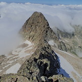
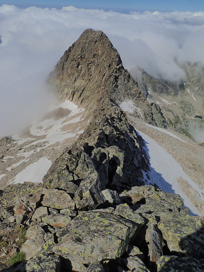
Ridge WSW
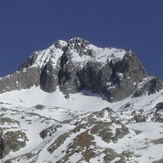
Cime du Gélas