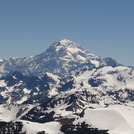
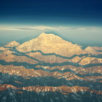
miguel from ARGENTINA writes:
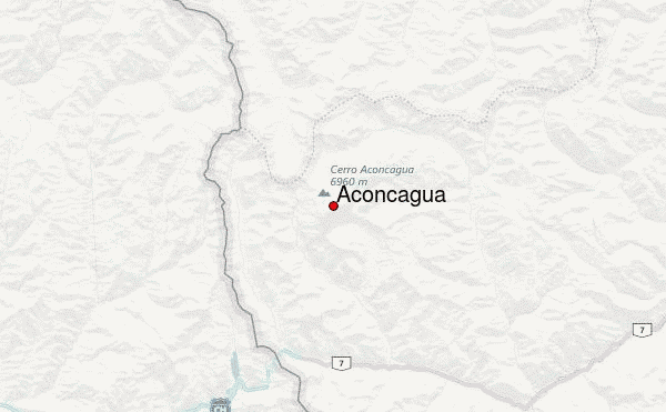
NORMAL ROUTE, WAY TO THE BASE CAMP “PLAZA DE MULAS”.
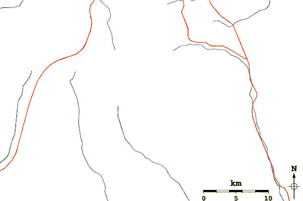
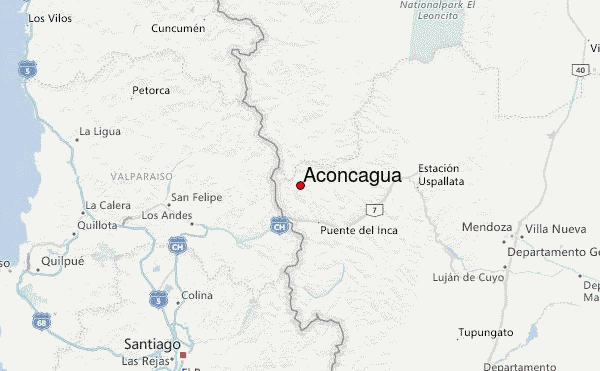
The last village to start your trip to the Mt.Aconcagua is called “Puente del Inca”, it is at 2800 m high in the middle of the Andes, it is well famous for its natural bridge stone and yours spring waters. There are a couples of places for accommodations, for backpackers “La vieja estación” (a hostel in an old train station), a few more expensive but more confortable, of course, the hotel “Hostería Puente del Inca”, other good option is in the military base, that it be in this village, that usually offer rooms for climbers.
Puente del Inca is the last place where you can hire mules (if you didn't do that already) for send your staff to the base camp.
Importat, hiring mules: send everything that is not necessary to carry on your hiking to Plaza de Mulas. For safety of your belonging pack properly all your stuff, remember that it will go up-hill on a mule without any space care. Put clear tags on each bag you are sending. You must to be clear where the loads are going to.
PUENTE DEL INCA TO CONFLUENCIA (2 to 4 hs.)
To go to the base camp, the best option is to spent first one night in Confluencia, around three hours from Puente del Inca (from 2800 m to 3350 aprox). It is convenient to start not later the noon to have a pleasant trip. At the entrance of the “Quebrada de Horcones” there is the ranger´s house, where you must show your permit to enter to the Park Aconcagua. As you go on you will pass by the “Horcones” lake and further down you will cross the first bridge at “El Durazno” area (by the way, its bridge has been made for the film “seven years in Tibet” with Brad Pitt), a good place for camp and one of the last one where you´ll find covered with grass. As you continue the trip you´ll find a trace left by the mules. You´ll have the river on your left at all times. Confluencia is good place to camp with bathrooms, rangers, dorms and food service.
CONFLUENCIA TO PLAZA DE MULAS (6 to 10 hs)
It is convenient to begin at dawn to get there before sunset. Always take drinking water because you may just find it at the beginning or the end of the walk. The way is so clear, you will cross a little bridge, then go up, and after crossing a esplanade you´ll find “Playa ancha” (width beach), although its name should be “long beach”, a long way along the river that you´ll walk for several hours, be careful with the sun (if it sunny day, of course…), you´ll cross more than once little streams of zig-zagging water that are less filthy and less powerful in the morning than in the afternoon. It is convenient to follow the trace and don´t miss them, you will save yourself a lot of trouble such as twisted ankles. When you get close to the hill on the West with three clear peaks called “Dedos” (fingers) and where the esplanade starts getting strain you´ll find a big rock on the way, here you leave “Playa ancha” and go to keeping your right, be careful it´s easy to get confuse and go straight… After going up and down you´ll find was one day the “Columbia” shelter. This is a good place to rest before making the last stage called “Cuesta brava” (difficult upwards) for obvious reasons… , be careful if there is snow or ice…
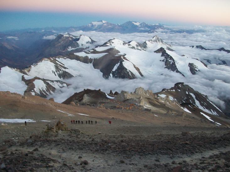
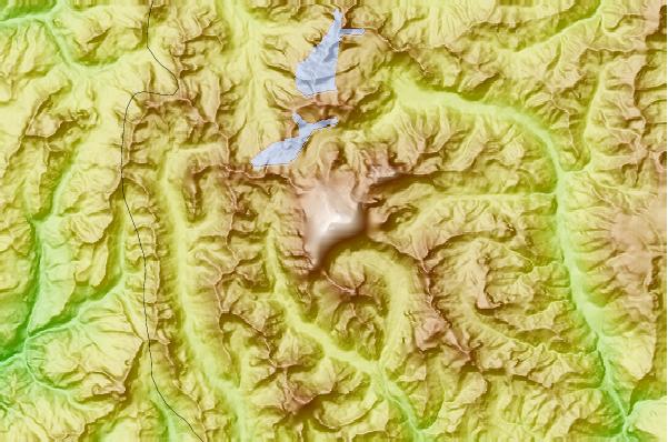
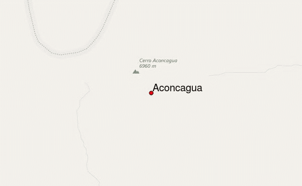
IN PLAZA DE MULAS
It is just a cosmopolitan little village of small and biggers tents with people of around the world. Is an excellent idea to stay at least two or three days for your acclimatization. Here you can find a few tents “restaurants”, people renting equipments, a webcam showing the base camp, showers, internet, phone an even an art gallery (the highest art gallery in the world)…
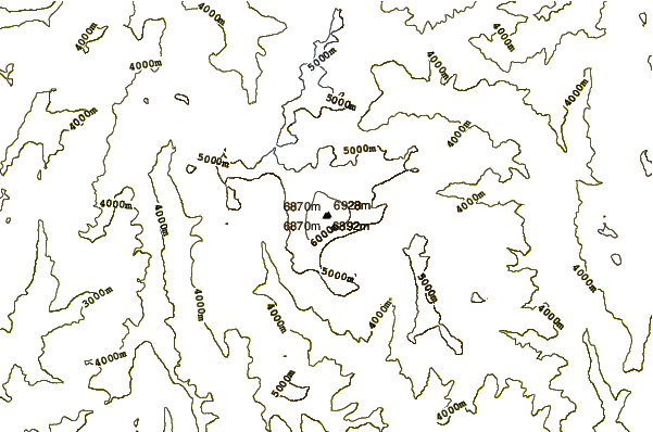
There is not an only one plan to climb the mountain, of course, but usually, depending on the meteorology, your shape, acclimatization, etc. a normal plan is stay at least a couples of days in “Plaza de Mulas “ (4300 m), carry with some stuff to “Canada” (3 to 5 hs.) (4900 m) and back to the base camp again, sleep one day and then go up again with all your stuff to Canada, sleep there, then go to “Nido de Cóndores” (5300 m), other day in Nido de Cóndores, then go to “Berlín” (5800 m) or “Cólera” (5800 m) and the other day, early in the morning, try to reach the summit and then came back to “Berlín”, “Cólera” or “Nido de Cóndores”.
“PLAZA DE MULAS” TO “NIDO DE CONDORES” (6 to 9 hs.)
It is conveniente to leave early, the path is made along a zig-zagging hill down to “cambio de pendiente”. 1/3 on this way up and towards the South (on your right) you will find a small crag called “Canada” or “Canada place”. A good place to camp or to leave a load. From “cambio de pendiente” you won´t see any longer, behind you, the way down or the camp after walking through a straight land and get to a rock on your left you´ll find the camp-site called “Nido de Cóndores”. Here is a place to leave load, and go down again to “Plaza de Mulas”. It is suggested to rest at least one day and then go up again.
“NIDO DE CONDORES” TO “BERLIN” (3 to 6 hs.)
The way to the shelter “Berlín” (5830 m) it is relatively short but in a continuos way-up. First towards the North-East and then towards the South. You will find just across an edge a couple of shelters, if not occupied, which will make it easier for you instead of having to make a tent. Otherwise make your tent as soon as possible, hydrate, eat and rest. Take care when you melting snow for make water, a lot of people make pee just close to those shelters.
“NIDO DE CONDORES” TO “COLERA” (4 to 7 hs.)
It is the same way to “Berlín”, but when arrive at “Berlín” you must turn to your left , just to the north, make a crossing until a crag, one step up. Note that it is a very windy area.
“BERLIN” OR “COLERA” TO THE SUMMIT (8 to 12 hs.)
It is convenient to wake-up early to have a good breakfast and get enough liquids.
Be careful on the way back not to mistaken the path, keep the big rocks on your left.
You will get a little shelter at around 6300 m called “Independencia”, then the path goes on through a steep way-up towards the South until a edge called “Portezuelo del viento”, then a long traverse until the base of the “Canaleta”, be extremely careful, most accidents happen around here. This is the final stage constantly up. It is convenient to walk close to you right wall
2010-09-05 |
 Aconcagua – Climbing, Hiking & Mountaineering information