– Lat/Long: 42.83° N 140.81° E
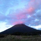
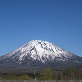
 Yotei
Yotei
Weather Forecast, JapanIssued: 8 pm Mon 03 Aug Local TimeUpdates in: hr min sUpdate imminent
Issued: 8 pm Mon 03 Aug Local Time
Updates in:
Update imminent hr min s

Issued: 8 pm Mon 03 Aug Local Time
Updates in:
Update imminent hr min s
Days 1–4 Weather SummaryMostly dry. Warm (max 20°C on Wed afternoon, min 15°C on Mon night). Wind will be generally light. | Days 5–7 Weather SummaryLight rain (total 7mm), mostly falling on Sat afternoon. Very mild (max 19°C on Thu night, min 13°C on Sat night). Wind will be generally light. | |||||||||||||||
Tuesday 4 | Wednesday 5 | Thursday 6 | Friday 7 | Saturday 8 | ||||||||||||
night | AM | PM | night | AM | PM | night | AM | PM | night | AM | PM | night | AM | PM | night | |
clear | clear | clear | clear | clear | clear | clear | clear | clear | clear | clear | clear | clear | rain shwrs | risk tstorm | rain shwrs | |
Cloud base (m) | 9750 | 6650 | 6050 | 9800 | 250 | 8800 | 850 | 600 | 500 | |||||||
km/h | ||||||||||||||||
 |  |  |  |  |  | |||||||||||
— | — | — | — | — | — | — | — | — | — | — | — | — | — | — | — | |
mm | — | — | — | — | — | — | — | — | — | — | — | — | — | 1.5 | 3 | 0.8 |
max °C | 16 | 16 | 18 | 19 | 19 | 20 | 20 | 19 | 19 | 19 | 19 | 18 | 17 | 15 | 15 | 15 |
min °C | 15 | 16 | 17 | 18 | 19 | 19 | 20 | 19 | 18 | 19 | 18 | 18 | 16 | 15 | 15 | 13 |
chill °C | 14 | 16 | 17 | 18 | 19 | 19 | 20 | 19 | 18 | 19 | 18 | 18 | 15 | 15 | 15 | 12 |
Freezing level m | 5250 | 5300 | 5500 | 5550 | 5550 | 5550 | 5450 | 5350 | 5400 | 5350 | 5300 | 5350 | 5200 | 5000 | 4800 | 4600 |
— | 4:30 | — | — | 4:31 | — | — | 4:31 | — | — | 4:33 | — | — | 4:33 | — | — | |
— | — | 6:53 | — | — | 6:52 | — | — | 6:52 | — | — | 6:50 | — | — | 6:49 | — | |
Loading...
Yotei Weather (Days 0-3):
The weather forecast for Yotei is: Mostly dry. Warm (max 20°C on Wed afternoon, min 15°C on Mon night). Wind will be generally light.
Yotei Weather (Days 3-6):
Light rain (total 7mm), mostly falling on Sat afternoon. Very mild (max 19°C on Thu night, min 13°C on Sat night). Wind will be generally light.
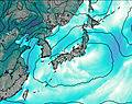
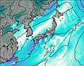
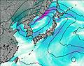
This table gives the weather forecast for Yotei at the specific elevation of 1893 m. Our advanced weather models allow us to provide distinct weather forecasts for several elevations of Yotei. To see the weather forecasts for the other elevations, use the tab navigation above the table. For a wider overview of the weather, consult the Weather Map of Japan.
| Weather Station | Temp. | Weather | Wind | Gusts | Cloud / Visibility |
|---|---|---|---|---|---|
Sapporo Airport | |||||
Chitose Airport | |||||
hy2c140E43N | |||||
Hakodate Airport | |||||
hy2c140E44N | |||||
hy2c141E44N | |||||
Asahikawa Airport | |||||
hy2c139E44N | |||||
hy2c139E43N | |||||
hy2c142E42N |
* NOTE: not all weather observatories update at the same frequency which is the reason why some locations may show data from stations that are further away than known closer ones.
Yotei Photos
View all
Mount Raiden Volcanic Group photos (6) |
Japanese Archipelago photos (294) |
photos from mountains in Japan (376) |
all photos
 Upload new photo
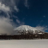
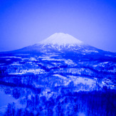
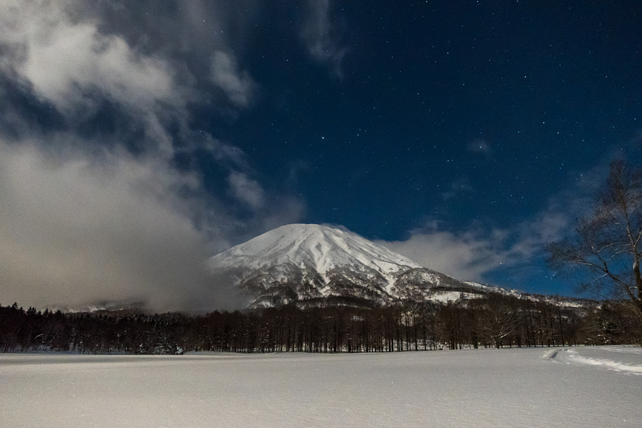
Mt.Yotei at Night
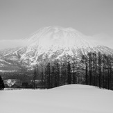
A beautiful volcano
Yotei, Japan
Yotei by night
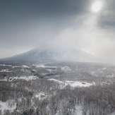
yotei
Yotei