– Lat/Long: 37.10° N 118.52° W
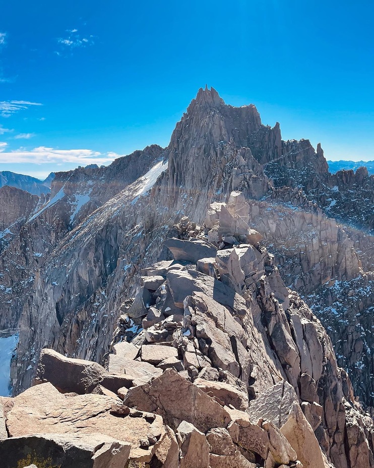
 Thunderbolt Peak
Weather Forecast, United StatesIssued: 4 am Mon 03 Aug Local TimeUpdates in: hr min sUpdate imminent
Issued: 4 am Mon 03 Aug Local Time
Updates in:
Update imminent hr min s

Issued: 4 am Mon 03 Aug Local Time
Updates in:
Update imminent hr min s
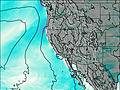
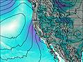
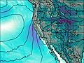
Days 1–3 Weather SummaryMostly dry. Very mild (max 18°C on Mon afternoon, min 13°C on Mon morning). Wind will be generally light. | Days 4–6 Weather SummaryMostly dry. Very mild (max 18°C on Fri afternoon, min 13°C on Thu morning). Wind will be generally light. | |||||||||||||||||
Monday 3 | Tuesday 4 | Wednesday 5 | Thursday 6 | Friday 7 | Saturday 8 | |||||||||||||
AM | PM | night | AM | PM | night | AM | PM | night | AM | PM | night | AM | PM | night | AM | PM | night | |
clear | clear | clear | clear | clear | clear | clear | clear | clear | clear | some clouds | clear | clear | some clouds | clear | clear | light rain | clear | |
Cloud base (m) | 6500 | 5700 | 5750 | 5750 | 5450 | |||||||||||||
km/h | ||||||||||||||||||
 |  |  |  |  |  | |||||||||||||
— | — | — | — | — | — | — | — | — | — | — | — | — | — | — | — | — | — | |
mm | — | — | — | — | — | — | — | — | — | — | — | — | — | — | — | — | 0.1 | — |
max °C | 16 | 18 | 15 | 16 | 18 | 15 | 16 | 18 | 15 | 15 | 17 | 15 | 16 | 18 | 16 | 16 | 18 | 16 |
min °C | 13 | 17 | 14 | 14 | 18 | 14 | 14 | 17 | 13 | 13 | 17 | 14 | 14 | 18 | 15 | 15 | 17 | 14 |
chill °C | 13 | 17 | 14 | 14 | 18 | 14 | 14 | 16 | 12 | 13 | 17 | 14 | 14 | 18 | 15 | 15 | 17 | 14 |
Freezing level m | 5550 | 5750 | 5500 | 5550 | 5700 | 5600 | 5550 | 5650 | 5450 | 5500 | 5600 | 5500 | 5550 | 5650 | 5550 | 5600 | 5600 | 5550 |
6:00 | — | — | 6:01 | — | — | 6:01 | — | — | 6:01 | — | — | 6:03 | — | — | 6:03 | — | — | |
— | 7:59 | — | — | 7:58 | — | — | 7:57 | — | — | 7:55 | — | — | 7:54 | — | — | 7:53 | — | |
Loading...
Thunderbolt Peak Weather (Days 0-3):
The weather forecast for Thunderbolt Peak is: Mostly dry. Very mild (max 18°C on Mon afternoon, min 13°C on Mon morning). Wind will be generally light.
Thunderbolt Peak Weather (Days 3-6):
Mostly dry. Very mild (max 18°C on Fri afternoon, min 13°C on Thu morning). Wind will be generally light.
This table gives the weather forecast for Thunderbolt Peak at the specific elevation of 3500 m. Our advanced weather models allow us to provide distinct weather forecasts for several elevations of Thunderbolt Peak. To see the weather forecasts for the other elevations, use the tab navigation above the table. For a wider overview of the weather, consult the Weather Map of California.
| Weather Station | Temp. | Weather | Wind | Gusts | Cloud / Visibility |
|---|---|---|---|---|---|
Bishop Airport | |||||
Visalia Municipal Airport | |||||
Fresno Chandler | |||||
Hanford Airport | |||||
Lemoore Naval Air Statio / eeves Field Airport |
* NOTE: not all weather observatories update at the same frequency which is the reason why some locations may show data from stations that are further away than known closer ones.
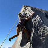
Thunderbolt Peak Photos
View all
photos (140) |
Sierra Nevada photos (212) |
photos from mountains in United States (3056) |
all photos
 Upload new photo
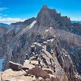
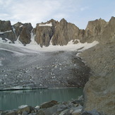

The foreboding Starlight Peak
Thunderbolt Peak
Exposed class 3
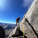
Holly cruising her way up
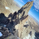
Climbing out the notch
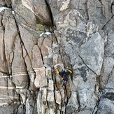
Going for the 5.8 half-dyno on toprope
Sunset over the palisades