– Lat/Long: 28.73° S 28.88° E
 Sentinel
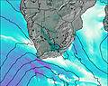
Weather Forecast, South AfricaIssued: 1 pm Mon 03 Aug Local TimeUpdates in: hr min sUpdate imminent
Issued: 1 pm Mon 03 Aug Local Time
Updates in:
Update imminent hr min s

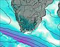
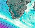
Issued: 1 pm Mon 03 Aug Local Time
Updates in:
Update imminent hr min s
Days 1–4 Weather SummaryMostly dry. Mild temperatures (max 5°C on Tue morning, min 2°C on Tue night). Winds increasing (calm on Mon night, fresh winds from the WSW by Tue night). | Days 5–7 Weather SummaryMostly dry. Mild temperatures (max 7°C on Sat afternoon, min 3°C on Thu night). Winds increasing (calm on Thu afternoon, fresh winds from the WNW by Sat night). | ||||||||||||||||
Mon 3 | Tuesday 4 | Wednesday 5 | Thursday 6 | Friday 7 | Saturday 8 | ||||||||||||
PM | night | AM | PM | night | AM | PM | night | AM | PM | night | AM | PM | night | AM | PM | night | |
clear | clear | clear | clear | clear | clear | clear | clear | clear | clear | clear | clear | clear | clear | clear | clear | clear | |
Cloud base (m) | 9700 | 9600 | |||||||||||||||
km/h | |||||||||||||||||
 |  |  |  |  |  | ||||||||||||
— | — | — | — | — | — | — | — | — | — | — | — | — | — | — | — | — | |
mm | — | — | — | — | — | — | — | — | — | — | — | — | — | — | — | — | — |
max °C | 4 | 4 | 5 | 5 | 3 | 3 | 5 | 4 | 5 | 6 | 5 | 4 | 6 | 5 | 5 | 7 | 5 |
min °C | 3 | 3 | 4 | 4 | 2 | 2 | 4 | 4 | 3 | 6 | 3 | 4 | 6 | 5 | 4 | 6 | 4 |
chill °C | 0 | 1 | 4 | 2 | -4 | -4 | 1 | 1 | -1 | 6 | 0 | 1 | 3 | 0 | 2 | 3 | -2 |
Freezing level m | 3750 | 3800 | 3950 | 3850 | 3600 | 3750 | 3950 | 3850 | 3900 | 4050 | 3800 | 3850 | 4000 | 3900 | 3950 | 4050 | 3850 |
— | — | 6:45 | — | — | 6:45 | — | — | 6:43 | — | — | 6:43 | — | — | 6:41 | — | — | |
5:35 | — | — | 5:35 | — | — | 5:36 | — | — | 5:36 | — | — | 5:37 | — | — | 5:37 | — | |
Loading...
Sentinel Weather (Days 0-3):
The weather forecast for Sentinel is: Mostly dry. Mild temperatures (max 5°C on Tue morning, min 2°C on Tue night). Winds increasing (calm on Mon night, fresh winds from the WSW by Tue night).
Sentinel Weather (Days 3-6):
Mostly dry. Mild temperatures (max 7°C on Sat afternoon, min 3°C on Thu night). Winds increasing (calm on Thu afternoon, fresh winds from the WNW by Sat night).
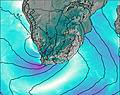
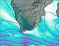
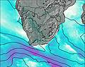
This table gives the weather forecast for Sentinel at the specific elevation of 3165 m. Our advanced weather models allow us to provide distinct weather forecasts for several elevations of Sentinel. To see the weather forecasts for the other elevations, use the tab navigation above the table. For a wider overview of the weather, consult the Weather Map of South Africa.
| Weather Station | Temp. | Weather | Wind | Gusts | Cloud / Visibility |
|---|---|---|---|---|---|
Royal National Park | |||||
Van Reenen | |||||
Bethlehem | |||||
Giants Castle | |||||
Vrede |
* NOTE: not all weather observatories update at the same frequency which is the reason why some locations may show data from stations that are further away than known closer ones.
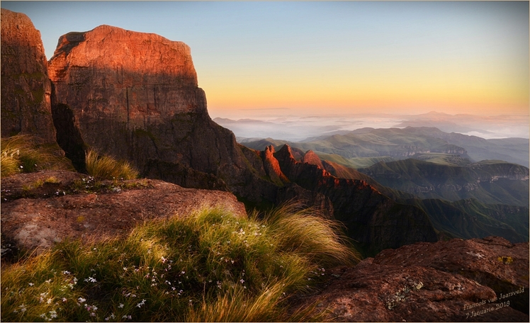
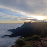
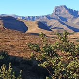
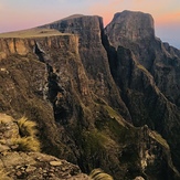
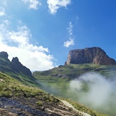
Sentinel Photos
View all
Drakensberg photos (42) |
Southern Africa photos (72) |
photos from mountains in South Africa (66) |
all photos
 Upload new photo
 See 11 more Sentinel photos
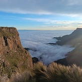
Sunday morning in the valley
Sunday morning
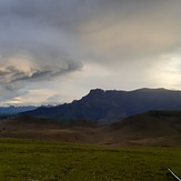
Sentinel Peak
Sentinel
Sentinel Peak
Storm coming