– Lat/Long: 45.53° N 2.81° E
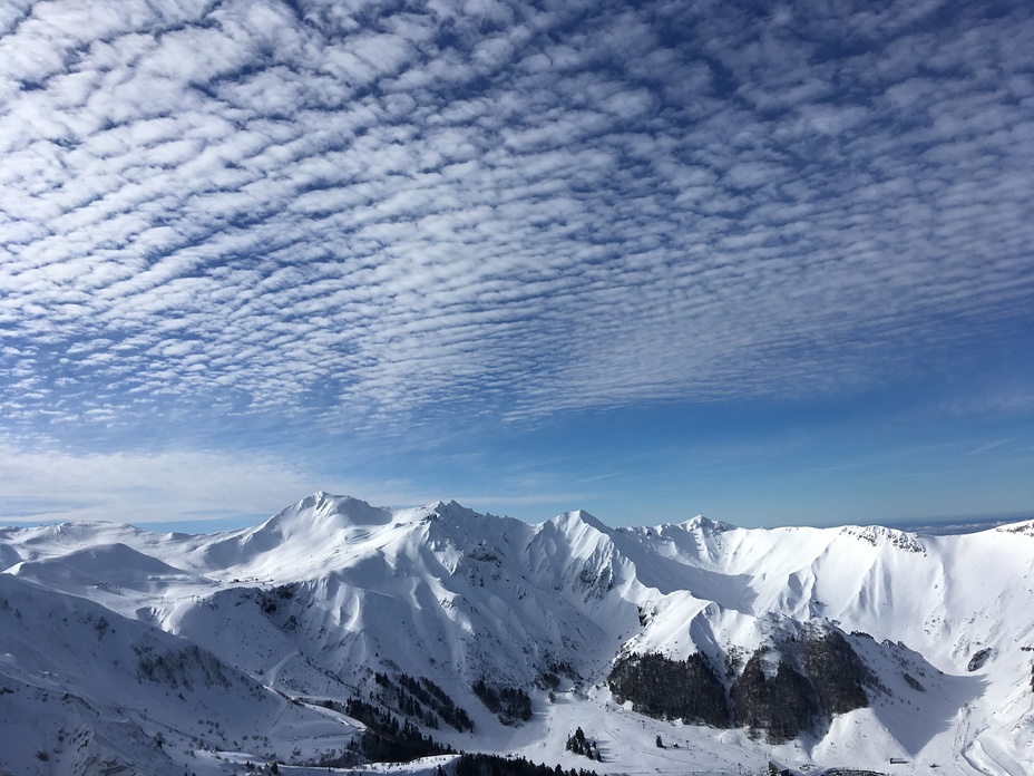
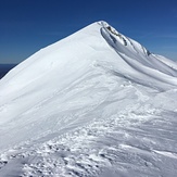
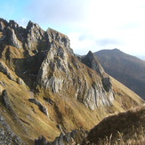
 Puy de Sancy
Weather Forecast, FranceIssued: 7 am Mon 03 Aug Local TimeUpdates in: hr min sUpdate imminent
Issued: 7 am Mon 03 Aug Local Time
Updates in:
Update imminent hr min s

Issued: 7 am Mon 03 Aug Local Time
Updates in:
Update imminent hr min s
Days 1–3 Weather SummaryLight rain (total 10mm), mostly falling on Mon night. Warm (max 27°C on Mon afternoon, min 18°C on Mon night). Wind will be generally light. | Days 4–6 Weather SummaryLight rain (total 2mm), mostly falling on Thu morning. Warm (max 26°C on Sat afternoon, min 15°C on Thu night). Wind will be generally light. | |||||||||||||||||
Monday 3 | Tuesday 4 | Wednesday 5 | Thursday 6 | Friday 7 | Saturday 8 | |||||||||||||
AM | PM | night | AM | PM | night | AM | PM | night | AM | PM | night | AM | PM | night | AM | PM | night | |
rain shwrs | light rain | risk tstorm | rain shwrs | clear | rain shwrs | clear | some clouds | rain shwrs | light rain | cloudy | clear | clear | clear | clear | clear | clear | clear | |
Cloud base (m) | 3900 | 3050 | 1900 | 3850 | 5300 | 3600 | 3150 | 800 | 2600 | 9300 | 4200 | |||||||
km/h | ||||||||||||||||||
 |  |  |  |  |  | |||||||||||||
— | — | — | — | — | — | — | — | — | — | — | — | — | — | — | — | — | — | |
mm | 0.2 | 0.7 | 8 | 0.2 | — | 0.1 | — | — | 0.4 | 2 | — | — | — | — | — | — | — | — |
max °C | 24 | 27 | 23 | 20 | 26 | 24 | 21 | 24 | 22 | 17 | 20 | 19 | 18 | 22 | 21 | 21 | 26 | 24 |
min °C | 23 | 27 | 18 | 18 | 24 | 19 | 19 | 23 | 18 | 17 | 20 | 15 | 15 | 20 | 18 | 18 | 24 | 22 |
chill °C | 23 | 27 | 18 | 18 | 24 | 19 | 19 | 23 | 18 | 17 | 20 | 14 | 14 | 20 | 18 | 18 | 24 | 22 |
Freezing level m | 4450 | 4450 | 4100 | 4150 | 4200 | 4250 | 4200 | 4250 | 4200 | 4150 | 3950 | 4000 | 4100 | 4050 | 4200 | 4250 | 4200 | 4250 |
6:33 | — | — | 6:35 | — | — | 6:35 | — | — | 6:37 | — | — | 6:37 | — | — | 6:39 | — | — | |
— | — | 9:15 | — | — | 9:13 | — | — | 9:12 | — | — | 9:09 | — | — | 9:08 | — | — | 9:07 | |
Loading...
Puy de Sancy Weather (Days 0-3):
The weather forecast for Puy de Sancy is: Light rain (total 10mm), mostly falling on Mon night. Warm (max 27°C on Mon afternoon, min 18°C on Mon night). Wind will be generally light.
Puy de Sancy Weather (Days 3-6):
Light rain (total 2mm), mostly falling on Thu morning. Warm (max 26°C on Sat afternoon, min 15°C on Thu night). Wind will be generally light.
This table gives the weather forecast for Puy de Sancy at the specific elevation of 1000 m. Our advanced weather models allow us to provide distinct weather forecasts for several elevations of Puy de Sancy. To see the weather forecasts for the other elevations, use the tab navigation above the table. For a wider overview of the weather, consult the Weather Map of France.
| Weather Station | Temp. | Weather | Wind | Gusts | Cloud / Visibility |
|---|---|---|---|---|---|
Puy de la Tâche (63) | |||||
Valbeleix | |||||
St-Sandoux (Dpt 63) | |||||
Corent (Dpt 63) | |||||
Clermont -Ferrand | |||||
lightning 6km NNE of Brioude | |||||
lightning 5km NW of Ambert | |||||
lightning 11km NNW of Job |
* NOTE: not all weather observatories update at the same frequency which is the reason why some locations may show data from stations that are further away than known closer ones.
Puy de Sancy Photos
View all
Chaîne des Puys photos (6) |
Massif Central photos (10) |
photos from mountains in France (302) |
all photos
 Upload new photo
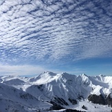
Massif du Sancy en mode hiver
sommet
Puy de Sancy