– Lat/Long: 46.51° N 10.54° E
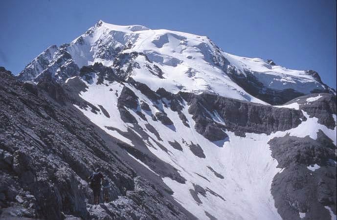
 Ortler
Weather Forecast, ItalyIssued: 1 pm Mon 03 Aug Local TimeUpdates in: hr min sUpdate imminent
Issued: 1 pm Mon 03 Aug Local Time
Updates in:
Update imminent hr min s

Issued: 1 pm Mon 03 Aug Local Time
Updates in:
Update imminent hr min s
Days 1–4 Weather SummaryLight rain (total 4mm), mostly falling on Wed night. Mild temperatures (max 6°C on Wed afternoon, min 3°C on Mon night). Wind will be generally light. | Days 5–7 Weather SummaryA dusting of snow. Milder later with heavy rain (total 21mm) on Fri night. Temperatures will be slightly above freezing (max 4°C on Thu afternoon, min 1°C on Fri afternoon). Wind will be generally light. | ||||||||||||||||
Mon 3 | Tuesday 4 | Wednesday 5 | Thursday 6 | Friday 7 | Saturday 8 | ||||||||||||
PM | night | AM | PM | night | AM | PM | night | AM | PM | night | AM | PM | night | AM | PM | night | |
risk tstorm | risk tstorm | clear | risk tstorm | risk tstorm | clear | risk tstorm | risk tstorm | rain shwrs | risk tstorm | snow shwrs | some clouds | snow shwrs | rain shwrs | clear | risk tstorm | risk tstorm | |
Cloud base (m) | 4250 | 4400 | 4450 | 3300 | 2750 | 3200 | 3350 | 9150 | 3350 | ||||||||
km/h | |||||||||||||||||
 |  |  |  |  |  | ||||||||||||
— | — | — | — | — | — | — | — | — | — | 1 | — | 1 | — | — | — | — | |
mm | 1.1 | 0.5 | — | 0.4 | 0.2 | — | 0.3 | 1.4 | 0.3 | 3 | 3 | — | 3 | 5 | — | 5 | 2 |
max °C | 4 | 4 | 4 | 5 | 5 | 4 | 6 | 5 | 3 | 4 | 4 | 2 | 2 | 2 | 2 | 2 | 3 |
min °C | 4 | 3 | 3 | 5 | 3 | 3 | 5 | 3 | 3 | 3 | 2 | 2 | 1 | 2 | 2 | 2 | 2 |
chill °C | 1 | 0 | 0 | 2 | 1 | 2 | 2 | 1 | 1 | 0 | 0 | 1 | -3 | -1 | -1 | -1 | -1 |
Freezing level m | 4500 | 4450 | 4450 | 4650 | 4400 | 4500 | 4800 | 4500 | 4450 | 4450 | 4250 | 4150 | 4250 | 4250 | 4200 | 4300 | 4350 |
— | — | 6:01 | — | — | 6:01 | — | — | 6:03 | — | — | 6:05 | — | — | 6:05 | — | — | |
— | 8:46 | — | — | 8:45 | — | — | 8:44 | — | — | 8:42 | — | — | 8:40 | — | — | 8:38 | |
Loading...
Ortler Weather (Days 0-3):
The weather forecast for Ortler is: Light rain (total 4mm), mostly falling on Wed night. Mild temperatures (max 6°C on Wed afternoon, min 3°C on Mon night). Wind will be generally light.
Ortler Weather (Days 3-6):
A dusting of snow. Milder later with heavy rain (total 21mm) on Fri night. Temperatures will be slightly above freezing (max 4°C on Thu afternoon, min 1°C on Fri afternoon). Wind will be generally light.
This table gives the weather forecast for Ortler at the specific elevation of 3905 m. Our advanced weather models allow us to provide distinct weather forecasts for several elevations of Ortler. To see the weather forecasts for the other elevations, use the tab navigation above the table. For a wider overview of the weather, consult the Weather Map of Italy.
| Weather Station | Temp. | Weather | Wind | Gusts | Cloud / Visibility |
|---|---|---|---|---|---|
Sta. Maria- Val Muestair | |||||
lightning 10km NNE of Livigno | |||||
Lagalb Bergstation | |||||
Poschiavo / Robbia | |||||
lightning 8km NW of Scuol | |||||
lightning 9km WNW of Nauders |
* NOTE: not all weather observatories update at the same frequency which is the reason why some locations may show data from stations that are further away than known closer ones.
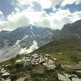
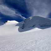
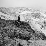
Ortler Photos
View all
Ortler Alps photos (30) |
Alps photos (1485) |
photos from mountains in Italy (430) |
all photos
 Upload new photo
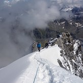

 See 10 more Ortler photos
Ortler
clouds
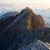
Ortler
Ortler
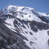
Ortler
Ortler
Ortler