– Lat/Long: 52.45° N 158.20° E
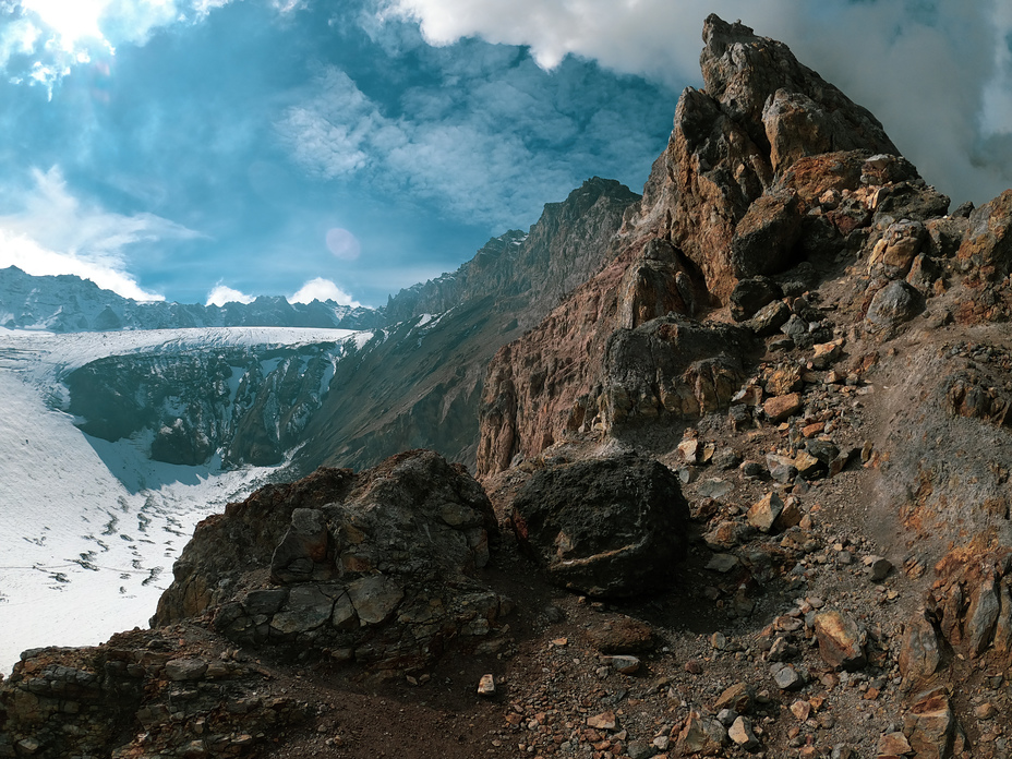
 Mutnovsky
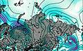
Weather Forecast, RussiaIssued: 5 am Tue 04 Aug Local TimeUpdates in: hr min sUpdate imminent
Issued: 5 am Tue 04 Aug Local Time
Updates in:
Update imminent hr min s

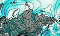
Issued: 5 am Tue 04 Aug Local Time
Updates in:
Update imminent hr min s
Days 1–3 Weather SummarySome drizzle, heaviest during Wed night. Very mild (max 11°C on Thu night, min 6°C on Wed afternoon). Winds increasing (light winds from the WNW on Tue morning, near gales from the SW by Wed afternoon). | Days 4–6 Weather SummaryLight rain (total 5mm), mostly falling on Sat morning. Very mild (max 12°C on Sat afternoon, min 6°C on Sun night). Winds increasing (light winds from the WNW on Fri morning, near gales from the SW by Sun night). | |||||||||||||||||
Tuesday 4 | Wednesday 5 | Thursday 6 | Friday 7 | Saturday 8 | Sunday 9 | |||||||||||||
AM | PM | night | AM | PM | night | AM | PM | night | AM | PM | night | AM | PM | night | AM | PM | night | |
clear | clear | some clouds | cloudy | light rain | rain shwrs | some clouds | some clouds | clear | clear | some clouds | some clouds | rain shwrs | rain shwrs | some clouds | some clouds | some clouds | light rain | |
Cloud base (m) | 6350 | 2850 | 600 | 4300 | 9150 | 9600 | 6700 | 650 | 700 | 1850 | 2500 | 1850 | 800 | |||||
km/h | ||||||||||||||||||
 |  |  |  |  |  | |||||||||||||
— | — | — | — | — | — | — | — | — | — | — | — | — | — | — | — | — | — | |
mm | — | — | — | — | 0.4 | 0.6 | — | — | — | — | — | — | 3 | 0.2 | — | — | — | 1.4 |
max °C | 10 | 10 | 10 | 9 | 7 | 10 | 10 | 10 | 11 | 11 | 11 | 11 | 11 | 12 | 11 | 9 | 8 | 7 |
min °C | 9 | 10 | 10 | 7 | 6 | 7 | 10 | 10 | 11 | 11 | 11 | 10 | 11 | 12 | 10 | 9 | 8 | 6 |
chill °C | 7 | 8 | 8 | 2 | 0 | 2 | 7 | 8 | 9 | 10 | 10 | 6 | 8 | 9 | 5 | 4 | 3 | 0 |
Freezing level m | 3700 | 3850 | 3900 | 3950 | 3850 | 4200 | 4150 | 4100 | 4150 | 4300 | 4400 | 4600 | 4650 | 4650 | 4400 | 4050 | 4050 | 3750 |
5:50 | — | — | 5:52 | — | — | 5:54 | — | — | 5:54 | — | — | 5:56 | — | — | 5:58 | — | — | |
— | — | 9:14 | — | — | 9:12 | — | — | 9:09 | — | — | 9:08 | — | — | 9:07 | — | — | 9:05 | |
Loading...
Mutnovsky Weather (Days 0-3):
The weather forecast for Mutnovsky is: Some drizzle, heaviest during Wed night. Very mild (max 11°C on Thu night, min 6°C on Wed afternoon). Winds increasing (light winds from the WNW on Tue morning, near gales from the SW by Wed afternoon).
Mutnovsky Weather (Days 3-6):
Light rain (total 5mm), mostly falling on Sat morning. Very mild (max 12°C on Sat afternoon, min 6°C on Sun night). Winds increasing (light winds from the WNW on Fri morning, near gales from the SW by Sun night).
This table gives the weather forecast for Mutnovsky at the specific elevation of 2322 m. Our advanced weather models allow us to provide distinct weather forecasts for several elevations of Mutnovsky. To see the weather forecasts for the other elevations, use the tab navigation above the table. For a wider overview of the weather, consult the Weather Map of Russia.
| Weather Station | Temp. | Weather | Wind | Gusts | Cloud / Visibility |
|---|---|---|---|---|---|
Petropavlovsk -Kamchatskij (32583 -0) | |||||
Petropavlovsk (32580 -0) | |||||
Bol Sheretzk | |||||
Mys Lopatka | |||||
Semyachik | |||||
Sobolevo | |||||
Kljuchi |
* NOTE: not all weather observatories update at the same frequency which is the reason why some locations may show data from stations that are further away than known closer ones.
Mutnovsky Photos
View all
Kamchatka photos (79) |
Siberia Ranges photos (79) |
photos from mountains in Russia (279) |
all photos
 Upload new photo
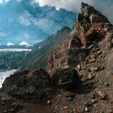
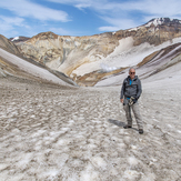
 See 8 more Mutnovsky photos
Mutnovsky
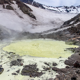
Boiling lake of sulfuric acid
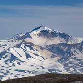
Mutnovsky as seen from Gorely crater rim
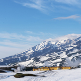
starting at the geothermal power plant, 11 km north of the canon
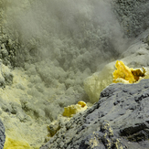
sulfur minerals
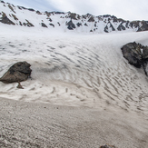
another glacier inside Mutnovsky
one of the glaciers inside the Mutnovsky caldera