– Lat/Long: 45.80° N 6.42° E
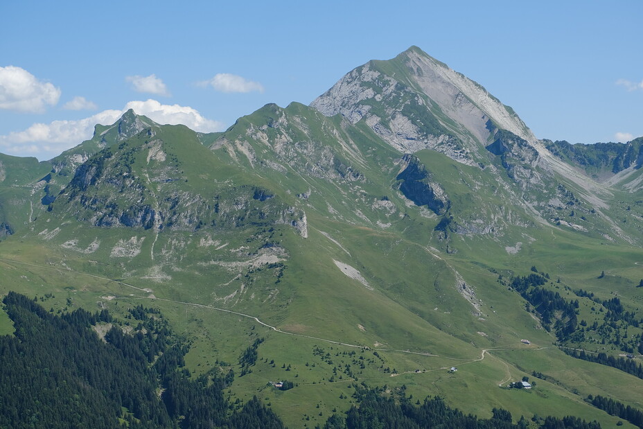
 Mont Charvin (Aravis)
Weather Forecast, FranceIssued: 7 pm Wed 01 Jul Local TimeUpdates in: hr min sUpdate imminent
Issued: 7 pm Wed 01 Jul Local Time
Updates in:
Update imminent hr min s

Issued: 7 pm Wed 01 Jul Local Time
Updates in:
Update imminent hr min s
Days 1–4 Weather SummaryMostly dry. Warm (max 23°C on Thu afternoon, min 13°C on Wed night). Wind will be generally light. | Days 5–7 Weather SummaryMostly dry. Warm (max 26°C on Tue afternoon, min 16°C on Sat night). Wind will be generally light. | ||||||||||||||||||
Thursday 2 | Friday 3 | Saturday 4 | Sunday 5 | Monday 6 | Tuesday 7 | ||||||||||||||
night | AM | PM | night | AM | PM | night | AM | PM | night | AM | PM | night | AM | PM | night | AM | PM | night | |
rain shwrs | clear | clear | clear | clear | some clouds | clear | clear | clear | clear | clear | clear | clear | clear | clear | clear | clear | clear | clear | |
km/h | |||||||||||||||||||
 |  |  |  |  |  |  | |||||||||||||
— | — | — | — | — | — | — | — | — | — | — | — | — | — | — | — | — | — | — | |
mm | 0.4 | — | — | — | — | — | — | — | — | — | — | — | — | — | — | — | — | — | — |
max °C | 18 | 18 | 23 | 21 | 19 | 22 | 20 | 19 | 23 | 21 | 20 | 24 | 22 | 22 | 25 | 23 | 23 | 26 | 24 |
min °C | 13 | 15 | 21 | 16 | 17 | 22 | 15 | 16 | 22 | 16 | 17 | 23 | 18 | 19 | 24 | 19 | 20 | 25 | 20 |
chill °C | 12 | 15 | 21 | 16 | 17 | 22 | 15 | 16 | 22 | 16 | 17 | 23 | 18 | 19 | 24 | 19 | 20 | 25 | 20 |
Freezing level m | 3900 | 4200 | 4000 | 4250 | 4100 | 3950 | 4300 | 4200 | 4050 | 4300 | 4200 | 4100 | 4100 | 4100 | 4100 | 4200 | 4250 | 4250 | 4400 |
Cloud base (m) | 9100 | 9150 | 9750 | ||||||||||||||||
— | 5:48 | — | — | 5:48 | — | — | 5:48 | — | — | 5:50 | — | — | 5:50 | — | — | 5:50 | — | — | |
— | — | — | 9:27 | — | — | 9:27 | — | — | 9:27 | — | — | 9:25 | — | — | 9:25 | — | — | 9:25 | |
Loading...
Mont Charvin (Aravis) Weather (Days 0-3):
The weather forecast for Mont Charvin (Aravis) is: Mostly dry. Warm (max 23°C on Thu afternoon, min 13°C on Wed night). Wind will be generally light.
Mont Charvin (Aravis) Weather (Days 3-6):
Mostly dry. Warm (max 26°C on Tue afternoon, min 16°C on Sat night). Wind will be generally light.
This table gives the weather forecast for Mont Charvin (Aravis) at the specific elevation of 1000 m. Our advanced weather models allow us to provide distinct weather forecasts for several elevations of Mont Charvin (Aravis). To see the weather forecasts for the other elevations, use the tab navigation above the table. For a wider overview of the weather, consult the Weather Map of France.
| Weather Station | Temp. | Weather | Wind | Gusts | Cloud / Visibility |
|---|---|---|---|---|---|
Sommet TK Lanchettes | |||||
Col du Joly | |||||
Aéroport Annecy Haute-Savoie Mont Blanc (Meythet) | |||||
Haute-Savoie Mont Blanc Airpor / éroport Annec / eythet | |||||
Bourg ST -Maurice | |||||
Arrivee | |||||
Eclipse | |||||
G4 Pas du Lac |
* NOTE: not all weather observatories update at the same frequency which is the reason why some locations may show data from stations that are further away than known closer ones.
Mont Charvin (Aravis) Photos
View all
Savoy Alps photos (140) |
Alps photos (1484) |
photos from mountains in France (301) |
all photos
 Upload new photo
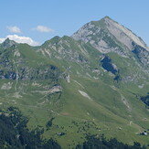
Mont Charvin
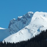
Porte des Aravis
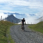
Route de La Soif