– Lat/Long: 45.00° N 6.28° E
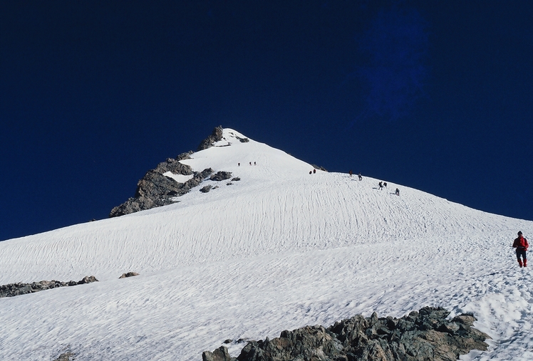
 Le Râteau (Le Rateau)
Weather Forecast, FranceIssued: 7 pm Mon 20 Jul Local TimeUpdates in: hr min sUpdate imminent
Issued: 7 pm Mon 20 Jul Local Time
Updates in:
Update imminent hr min s

Issued: 7 pm Mon 20 Jul Local Time
Updates in:
Update imminent hr min s
Days 1–4 Weather SummaryLight rain (total 2mm), mostly falling on Mon night. Mild temperatures (max 9°C on Mon night, min 5°C on Tue night). Wind will be generally light. | Days 5–7 Weather SummaryHeavy rain (total 22mm), heaviest during Sat night. Later becoming colder with a dusting of snow on Sun morning. Very mild (max 10°C on Sat morning, min 1°C on Sun morning). Wind will be generally light. | ||||||||||||||||||
Tuesday 21 | Wednesday 22 | Thursday 23 | Friday 24 | Saturday 25 | Sunday 26 | ||||||||||||||
night | AM | PM | night | AM | PM | night | AM | PM | night | AM | PM | night | AM | PM | night | AM | PM | night | |
rain shwrs | risk tstorm | risk tstorm | clear | clear | clear | clear | clear | clear | clear | clear | clear | clear | rain shwrs | rain shwrs | risk tstorm | snow shwrs | rain shwrs | rain shwrs | |
Cloud base (m) | 6100 | 8650 | 8400 | 8900 | 5050 | 5800 | 2850 | 2300 | 3000 | 2350 | |||||||||
km/h | |||||||||||||||||||
 |  |  |  |  |  |  | |||||||||||||
— | — | — | — | — | — | — | — | — | — | — | — | — | — | — | — | 1 | — | — | |
mm | 1.4 | 0.4 | 0.2 | — | — | — | — | — | — | — | — | — | — | 0.1 | 0.1 | 16 | 4 | 1.7 | 1.1 |
max °C | 9 | 7 | 7 | 7 | 8 | 8 | 8 | 7 | 6 | 8 | 8 | 9 | 9 | 10 | 10 | 7 | 2 | 3 | 2 |
min °C | 8 | 7 | 7 | 5 | 8 | 7 | 6 | 6 | 6 | 5 | 8 | 8 | 9 | 9 | 10 | 2 | 1 | 2 | 2 |
chill °C | 6 | 4 | 4 | 2 | 6 | 6 | 3 | 3 | 3 | 2 | 7 | 6 | 7 | 7 | 8 | -2 | -3 | -1 | -1 |
Freezing level m | 4100 | 3900 | 3900 | 4100 | 4150 | 4100 | 4150 | 3950 | 3900 | 4450 | 4250 | 4300 | 4350 | 4250 | 4250 | 3650 | 3250 | 3450 | 3350 |
— | 6:07 | — | — | 6:07 | — | — | 6:09 | — | — | 6:09 | — | — | 6:11 | — | — | 6:11 | — | — | |
— | — | — | 9:14 | — | — | 9:13 | — | — | 9:12 | — | — | 9:10 | — | — | 9:09 | — | — | 9:08 | |
Loading...
Le Râteau Weather (Days 0-3):
The weather forecast for Le Râteau is: Light rain (total 2mm), mostly falling on Mon night. Mild temperatures (max 9°C on Mon night, min 5°C on Tue night). Wind will be generally light.
Le Râteau Weather (Days 3-6):
Heavy rain (total 22mm), heaviest during Sat night. Later becoming colder with a dusting of snow on Sun morning. Very mild (max 10°C on Sat morning, min 1°C on Sun morning). Wind will be generally light.
This table gives the weather forecast for Le Râteau at the specific elevation of 3000 m. Our advanced weather models allow us to provide distinct weather forecasts for several elevations of Le Râteau. To see the weather forecasts for the other elevations, use the tab navigation above the table. For a wider overview of the weather, consult the Weather Map of France.
Le Râteau Photos
View all
Dauphine Alps photos (34) |
Alps photos (1484) |
photos from mountains in France (301) |
all photos
 Upload new photo
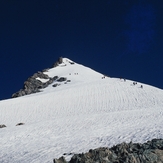
Le Râteau