– Lat/Long: 45.00° N 6.28° E
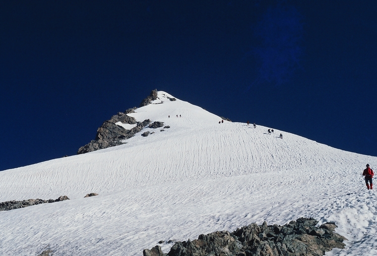
 Le Râteau (Le Rateau)
Weather Forecast, FranceIssued: 1 am Fri 17 Jul Local TimeUpdates in: hr min sUpdate imminent
Issued: 1 am Fri 17 Jul Local Time
Updates in:
Update imminent hr min s

Issued: 1 am Fri 17 Jul Local Time
Updates in:
Update imminent hr min s
Days 1–3 Weather SummaryMostly dry. Warm (max 20°C on Fri afternoon, min 13°C on Fri night). Wind will be generally light. | Days 4–6 Weather SummaryMostly dry. Very mild (max 18°C on Mon afternoon, min 8°C on Wed night). Wind will be generally light. | |||||||||||||||||
Friday 17 | Saturday 18 | Sunday 19 | Monday 20 | Tuesday 21 | Wednesday 22 | |||||||||||||
AM | PM | night | AM | PM | night | AM | PM | night | AM | PM | night | AM | PM | night | AM | PM | night | |
risk tstorm | clear | risk tstorm | clear | clear | some clouds | clear | clear | clear | clear | some clouds | clear | clear | clear | clear | clear | clear | some clouds | |
km/h | ||||||||||||||||||
 |  |  |  |  |  | |||||||||||||
— | — | — | — | — | — | — | — | — | — | — | — | — | — | — | — | — | — | |
mm | 0.3 | — | 0.5 | — | — | — | — | — | — | — | — | — | — | — | — | — | — | — |
max °C | 17 | 20 | 17 | 16 | 17 | 16 | 16 | 17 | 16 | 16 | 18 | 16 | 15 | 16 | 13 | 14 | 16 | 13 |
min °C | 16 | 19 | 13 | 13 | 17 | 14 | 14 | 17 | 14 | 14 | 18 | 13 | 13 | 14 | 11 | 11 | 15 | 8 |
chill °C | 16 | 19 | 12 | 12 | 16 | 14 | 14 | 16 | 14 | 14 | 18 | 13 | 13 | 13 | 10 | 11 | 15 | 6 |
Freezing level m | 4250 | 4500 | 4200 | 4200 | 4200 | 4100 | 4000 | 4200 | 4100 | 4100 | 4200 | 4100 | 3850 | 3800 | 4150 | 3800 | 4000 | 3500 |
Cloud base (m) | 4450 | 4100 | 8650 | 4200 | 4500 | 9350 | 6200 | |||||||||||
6:03 | — | — | 6:03 | — | — | 6:05 | — | — | 6:05 | — | — | 6:07 | — | — | 6:07 | — | — | |
— | — | 9:16 | — | — | 9:15 | — | — | 9:15 | — | — | 9:15 | — | — | 9:14 | — | — | 9:13 | |
Loading...
Le Râteau Weather (Days 0-3):
The weather forecast for Le Râteau is: Mostly dry. Warm (max 20°C on Fri afternoon, min 13°C on Fri night). Wind will be generally light.
Le Râteau Weather (Days 3-6):
Mostly dry. Very mild (max 18°C on Mon afternoon, min 8°C on Wed night). Wind will be generally light.
This table gives the weather forecast for Le Râteau at the specific elevation of 2000 m. Our advanced weather models allow us to provide distinct weather forecasts for several elevations of Le Râteau. To see the weather forecasts for the other elevations, use the tab navigation above the table. For a wider overview of the weather, consult the Weather Map of France.
| Weather Station | Temp. | Weather | Wind | Gusts | Cloud / Visibility |
|---|---|---|---|---|---|
lightning 7km N of Mont-de-Lans | |||||
lightning 13km NE of Huez | |||||
lightning 12km W of Valloire | |||||
lightning 8km N of Le Monetier-les-Bains | |||||
TC Montfrais g4 | |||||
lightning 12km SW of Villargondran | |||||
TMX clos giraud g2 | |||||
lightning 5km S of Livet-et-Gavet | |||||
lightning 11km ESE of Froges | |||||
lightning 9km ESE of Theys |
* NOTE: not all weather observatories update at the same frequency which is the reason why some locations may show data from stations that are further away than known closer ones.
Le Râteau Photos
View all
Dauphine Alps photos (34) |
Alps photos (1484) |
photos from mountains in France (301) |
all photos
 Upload new photo
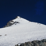
Le Râteau