Eiger Guide
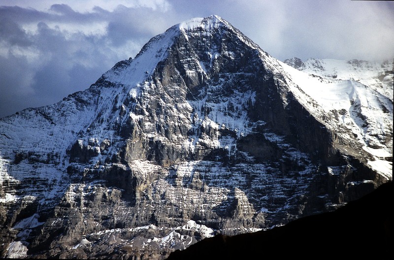
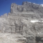
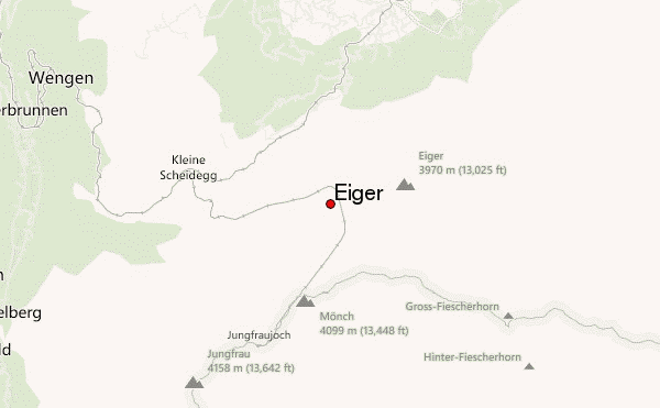
Eiger
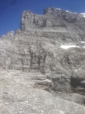
Photo credit: Peter Salmon
- Elevation: 3970
- Difficulty: Technical Climb
- Best months to climb: July, August, September
- Convenient center: Grindelwald, Switzerland
Eiger climbers Notes
Peter Salmon Mountaineering UK from UNITED KINGDOM writes:
Eiger- West ridge ascent: First successful summit Aug 11 1858. Charles Barrington, Christian Almer and Peter Bohren.
My first solo attempt was July 5th 2017,at 2.30 pm approaching from Kleine Scheidegg to Eigergletcher 1/2hr, bearing east of VF Rotstock dry zig zag for first 200 metres, keeping to north face/west ridge at Rotstock level with lots loose scree on top of smooth dry limestone,6 or 7 fixed ropes (check pitons!)to approx 3000mtr, good bivvy place close to edge too. Lots of old cairns above second ice field,not easily seen on descent,care! keep to edge of north face before traverse right and back again before large overhang serac at 3,300 mt at the Kanseli. Conditions are very dry in the day and verglas early to mid morning. No water but plenty ice melt for drink so extra gas is lighter than a water haul. Watch for loose rock fall around this point. I turned around approx 300 mt from summit needing remaining energy for down climb, route finding on descent is very difficult, but the views are magnificent.
Happy climbing.
Peter Salmon, MountaineeringUK Henley on Thames.
2017-12-11 |
Click here to read 1 more climbing note for Eiger or submit your own
|
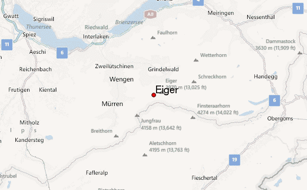
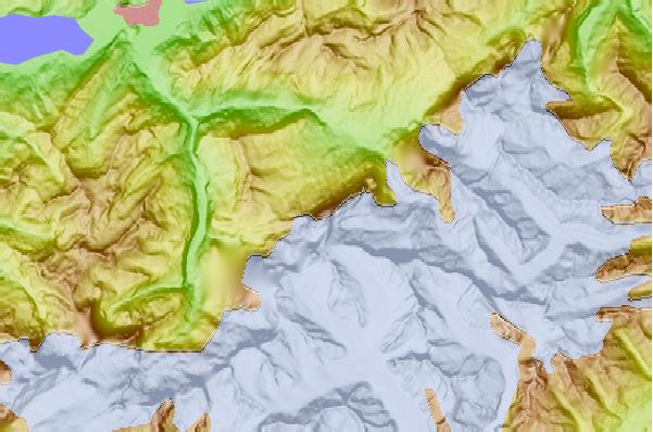
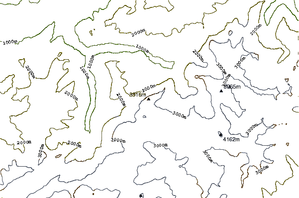
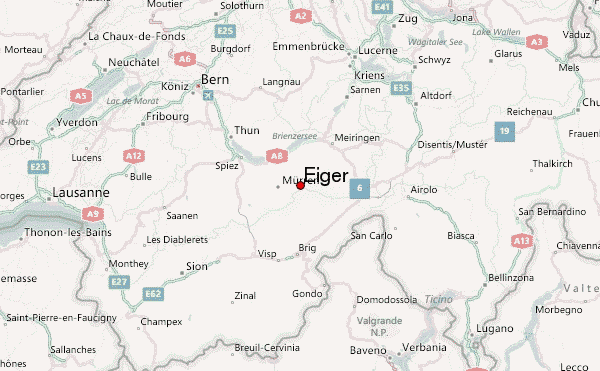
Select Eiger Location Map Detail:
Use this relief map to navigate to mountain peaks in the area of Eiger.
10 other mountain peaks closest to Eiger:
 Eiger – Climbing, Hiking & Mountaineering information
