– Lat/Long: 54.75° N 8.08° W
 Croaghgorm
Weather Forecast, IrelandIssued: 12 pm Mon 03 Aug Local TimeUpdates in: hr min sUpdate imminent
Issued: 12 pm Mon 03 Aug Local Time
Updates in:
Update imminent hr min s

Issued: 12 pm Mon 03 Aug Local Time
Updates in:
Update imminent hr min s
Days 1–3 Weather SummaryModerate rain (total 19mm), heaviest on Wed morning. Very mild (max 15°C on Tue morning, min 7°C on Wed night). Winds increasing (light winds from the SE on Mon morning, near gales from the WNW by Wed morning). | Days 4–6 Weather SummaryLight rain (total 3mm), mostly falling on Sat morning. Very mild (max 12°C on Fri afternoon, min 8°C on Thu night). Winds decreasing (fresh winds from the WSW on Fri night, light winds from the WSW by Sat night). | |||||||||||||||||
Monday 3 | Tuesday 4 | Wednesday 5 | Thursday 6 | Friday 7 | Saturday 8 | |||||||||||||
AM | PM | night | AM | PM | night | AM | PM | night | AM | PM | night | AM | PM | night | AM | PM | night | |
light rain | light rain | light rain | rain shwrs | risk tstorm | rain shwrs | mod. rain | light rain | rain shwrs | rain shwrs | rain shwrs | rain shwrs | rain shwrs | rain shwrs | light rain | light rain | rain shwrs | clear | |
Cloud base (m) | 750 | 700 | 750 | 300 | 400 | 250 | 150 | 200 | 200 | 500 | 750 | 400 | 850 | 1850 | 200 | 300 | 500 | |
km/h | ||||||||||||||||||
 |  |  |  |  |  | |||||||||||||
— | — | — | — | — | — | — | — | — | — | — | — | — | — | — | — | — | — | |
mm | 0.6 | 0.2 | 4 | 0.2 | 3 | 1.7 | 6 | 1.6 | 1.5 | 0.2 | 0.6 | 0.2 | 0.1 | 0.3 | 0.3 | 0.9 | 0.2 | — |
max °C | 12 | 14 | 13 | 15 | 15 | 11 | 9 | 9 | 9 | 11 | 11 | 9 | 11 | 12 | 11 | 11 | 12 | 11 |
min °C | 10 | 14 | 12 | 14 | 13 | 9 | 9 | 9 | 7 | 9 | 11 | 8 | 10 | 12 | 11 | 11 | 12 | 10 |
chill °C | 8 | 12 | 10 | 13 | 11 | 4 | 4 | 5 | 4 | 6 | 8 | 5 | 7 | 9 | 8 | 8 | 9 | 8 |
Freezing level m | 2950 | 3150 | 3350 | 3000 | 3050 | 2750 | 2450 | 2200 | 2100 | 2300 | 2500 | 2450 | 2300 | 2450 | 2850 | 3350 | 3350 | 3200 |
5:43 | — | — | 5:46 | — | — | 5:48 | — | — | 5:50 | — | — | 5:50 | — | — | 5:52 | — | — | |
— | 9:30 | — | — | 9:29 | — | — | 9:27 | — | — | 9:24 | — | — | 9:22 | — | — | 9:21 | — | |
Loading...
Croaghgorm Weather (Days 0-3):
The weather forecast for Croaghgorm is: Moderate rain (total 19mm), heaviest on Wed morning. Very mild (max 15°C on Tue morning, min 7°C on Wed night). Winds increasing (light winds from the SE on Mon morning, near gales from the WNW by Wed morning).
Croaghgorm Weather (Days 3-6):
Light rain (total 3mm), mostly falling on Sat morning. Very mild (max 12°C on Fri afternoon, min 8°C on Thu night). Winds decreasing (fresh winds from the WSW on Fri night, light winds from the WSW by Sat night).
This table gives the weather forecast for Croaghgorm at the specific elevation of 674 m. Our advanced weather models allow us to provide distinct weather forecasts for several elevations of Croaghgorm. To see the weather forecasts for the other elevations, use the tab navigation above the table. For a wider overview of the weather, consult the Weather Map of Ireland.
| Weather Station | Temp. | Weather | Wind | Gusts | Cloud / Visibility |
|---|---|---|---|---|---|
Sligo Airport | |||||
Eglinto / ondonderry Airport | |||||
Connaught Airport | |||||
* NOTE: not all weather observatories update at the same frequency which is the reason why some locations may show data from stations that are further away than known closer ones.
Croaghgorm Photos
View all
Derryveagh Mountains photos (43) |
Ireland Ranges photos (377) |
photos from mountains in Ireland (426) |
all photos
 Upload new photo
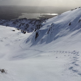
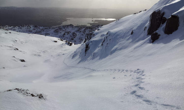
Croaghgorm with Lough Eske in background, taken 15 February 2014
Croaghgorm