– Lat/Long: 19.48° N 97.13° W

Cofre De Perote – Climbing, Hiking & Mountaineering information

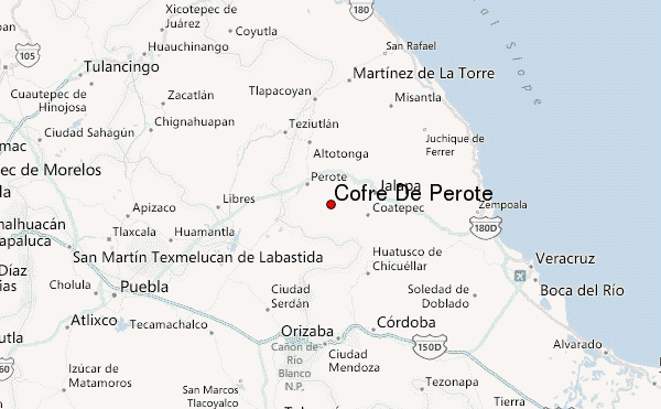
Cofre De Perote Guide

Ice cascade below the summit, Cofre de Perote, Veracruz state, México.  photo

Cofre De Perote

Photo credit: Dr. Mario Caba

Frozen trees, above Ramsa. Cofre de Perote, Veracruz, México.  photo

Cofre De Perote

Photo credit: Dr. Mario Caba

Ice cascade, below the Peña, Cofre de Perote, Veracruz, México. photo

Cofre De Perote

Photo credit: Dr. Mario Caba

Peña Cofre de Perote photo

Cofre De Perote

Photo credit: Dr. Mario Caba

Ice waterfall, Cofre De Perote photo

Cofre De Perote

Photo credit: Dr. Mario Caba

  • Elevation: 4283
  • Difficulty: -
  • Best months to climb: -
  • Convenient center: -

Cofre De Perote climbers Notes

Rodolfo from MEXICO writes:

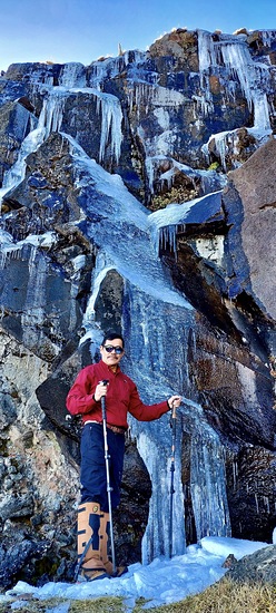
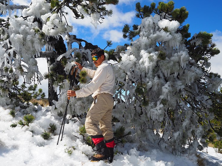
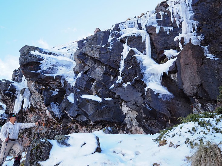
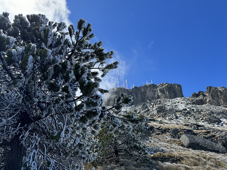
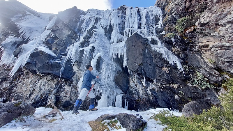
Ir bien abrigado ya que por las noches es muy seguro que la temperatura en cualquier época del año descienda a menos cero grados, seguir los senderos marcados, por el lado del camino es más fácil llegar sin problema, de la otra cara hay que tener más cuidado sobre todo si se hace de noche, o hay neblina o mal tiempo.

Dress warmly as temperatures are very likely to drop below zero degrees at any time of year. Follow the marked trails; it's easier to reach the trails along the road, but you need to be more careful on the other side, especially if it gets dark, foggy, or the weather is bad.

2025-07-29

Click here to read 1 more climbing note for Cofre De Perote or submit your own

Cofre De Perote Location Map

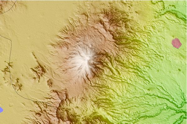
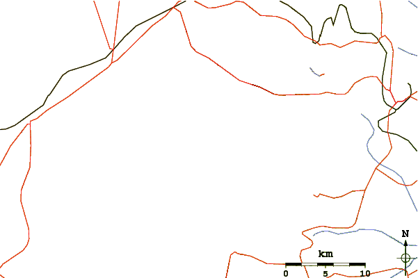
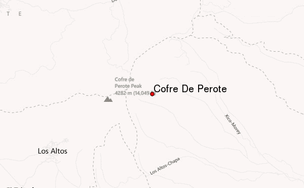
Select Cofre De Perote Location Map Detail:


Latest Gallery Images for Cofre De Perote

visit the
gallery
or click to view
Cofre de Perote, cara orientalSnow in Cofre de Perote, Veracruz, MéxicoCofre de Perote in a clear dayIce cascade and communication towers frozen

Upload your photo of Cofre De Perote

Select a mountain summit from the menu
Select a Mountain Summit
Surf breaks located close to Cofre De Perote Mountain peaks around Cofre De Perote Roads and rivers around Cofre De Perote

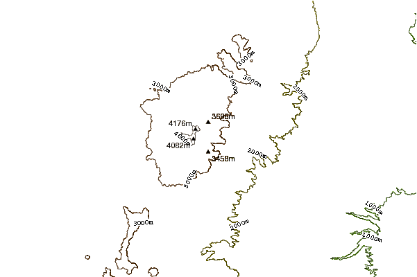
Use this relief map to navigate to mountain peaks in the area of Cofre De Perote.

10 other mountain peaks closest to Cofre De Perote:

1. Pico de Orizaba (5610 m) 52.4 km
2. Sierra Negra (4640 m) 58.9 km
3. Malinche (4462 m) 98.3 km
4. Matlalcueitl (volcano) (4462 m) 98.5 km
5. Murciélagos Bike Park (2317 m) 118.8 km
6. Iztaccihuatl (5286 m) 162.0 km
7. Tlalocatepetl (4119 m) 162.8 km
8. Telepon (4081 m) 162.8 km
9. Popocatepetl (5452 m) 164.6 km
10. Papayo (3600 m) 165.7 km