– Lat/Long: 45.98° N 7.55° E
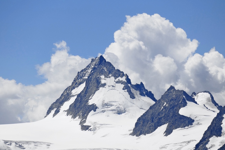
 Bouquetins
Weather Forecast, ItalyIssued: 7 pm Thu 09 Jul Local TimeUpdates in: hr min sUpdate imminent
Issued: 7 pm Thu 09 Jul Local Time
Updates in:
Update imminent hr min s

Issued: 7 pm Thu 09 Jul Local Time
Updates in:
Update imminent hr min s
Days 1–4 Weather SummaryHeavy rain (total 30mm), heaviest during Sat night. Very mild (max 19°C on Sun afternoon, min 12°C on Sat night). Wind will be generally light. | Days 5–7 Weather SummaryModerate rain (total 11mm), heaviest on Tue night. Warm (max 22°C on Wed afternoon, min 15°C on Sun night). Wind will be generally light. | ||||||||||||||||||
Friday 10 | Saturday 11 | Sunday 12 | Monday 13 | Tuesday 14 | Wednesday 15 | ||||||||||||||
night | AM | PM | night | AM | PM | night | AM | PM | night | AM | PM | night | AM | PM | night | AM | PM | night | |
risk tstorm | risk tstorm | risk tstorm | rain shwrs | rain shwrs | mod. rain | rain shwrs | clear | risk tstorm | risk tstorm | clear | risk tstorm | risk tstorm | some clouds | risk tstorm | risk tstorm | clear | rain shwrs | rain shwrs | |
km/h | |||||||||||||||||||
 |  |  |  |  |  |  | |||||||||||||
— | — | — | — | — | — | — | — | — | — | — | — | — | — | — | — | — | — | — | |
mm | 0.6 | 0.9 | 4 | 8 | 0.7 | 7 | 8 | — | 1.6 | 1.1 | — | 0.7 | 1.2 | — | 1.6 | 6 | — | 0.4 | 4 |
max °C | 18 | 18 | 18 | 15 | 16 | 17 | 14 | 17 | 19 | 17 | 18 | 20 | 19 | 20 | 20 | 18 | 21 | 22 | 16 |
min °C | 15 | 16 | 18 | 13 | 14 | 13 | 12 | 14 | 18 | 15 | 15 | 20 | 16 | 18 | 20 | 17 | 18 | 21 | 15 |
chill °C | 15 | 16 | 18 | 13 | 14 | 12 | 12 | 14 | 18 | 15 | 15 | 20 | 16 | 18 | 20 | 17 | 18 | 21 | 15 |
Freezing level m | 4450 | 4450 | 4500 | 4300 | 4250 | 4000 | 4300 | 4400 | 4500 | 4350 | 4500 | 4750 | 4600 | 4700 | 4750 | 4600 | 4700 | 4850 | 4550 |
Cloud base (m) | 3550 | 6750 | 3050 | 8200 | 9200 | 4150 | 9500 | 8900 | 4850 | 6100 | 4600 | 4350 | 8750 | 4950 | 4250 | ||||
— | 5:48 | — | — | 5:48 | — | — | 5:50 | — | — | 5:50 | — | — | 5:52 | — | — | 5:52 | — | — | |
— | — | — | 9:20 | — | — | 9:20 | — | — | 9:19 | — | — | 9:19 | — | — | 9:17 | — | — | 9:16 | |
Loading...
Bouquetins Weather (Days 0-3):
The weather forecast for Bouquetins is: Heavy rain (total 30mm), heaviest during Sat night. Very mild (max 19°C on Sun afternoon, min 12°C on Sat night). Wind will be generally light.
Bouquetins Weather (Days 3-6):
Moderate rain (total 11mm), heaviest on Tue night. Warm (max 22°C on Wed afternoon, min 15°C on Sun night). Wind will be generally light.
This table gives the weather forecast for Bouquetins at the specific elevation of 2000 m. Our advanced weather models allow us to provide distinct weather forecasts for several elevations of Bouquetins. To see the weather forecasts for the other elevations, use the tab navigation above the table. For a wider overview of the weather, consult the Weather Map of Italy.
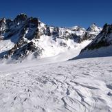
Bouquetins Photos
View all
Pennine Alps photos (202) |
Alps photos (1484) |
photos from mountains in Italy (430) |
all photos
 Upload new photo
Bouquetins
Bouquetins