– Lat/Long: 56.80° N 5.00° W
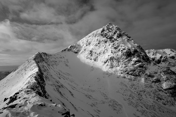
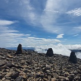
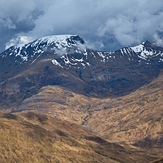
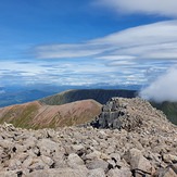
 Ben Nevis
Weather Forecast, United KingdomIssued: 6 am Mon 03 Aug Local TimeUpdates in: hr min sUpdate imminent
Issued: 6 am Mon 03 Aug Local Time
Updates in:
Update imminent hr min s

Issued: 6 am Mon 03 Aug Local Time
Updates in:
Update imminent hr min s
Days 1–3 Weather SummaryHeavy rain (total 35mm), heaviest during Mon night. Very mild (max 13°C on Tue morning, min 7°C on Wed night). Wind will be generally light. | Days 4–6 Weather SummaryHeavy rain (total 27mm), heaviest during Fri night. Very mild (max 12°C on Thu afternoon, min 8°C on Thu night). Wind will be generally light. | |||||||||||||||||
Monday 3 | Tuesday 4 | Wednesday 5 | Thursday 6 | Friday 7 | Saturday 8 | |||||||||||||
AM | PM | night | AM | PM | night | AM | PM | night | AM | PM | night | AM | PM | night | AM | PM | night | |
light rain | light rain | heavy rain | light rain | light rain | rain shwrs | mod. rain | light rain | rain shwrs | rain shwrs | some clouds | light rain | light rain | mod. rain | heavy rain | light rain | rain shwrs | light rain | |
Cloud base (m) | 950 | 300 | 750 | 250 | 250 | 250 | 250 | 300 | 300 | 700 | 850 | 450 | 300 | 250 | 250 | 750 | 650 | 600 |
km/h | ||||||||||||||||||
 |  |  |  |  |  | |||||||||||||
— | — | — | — | — | — | — | — | — | — | — | — | — | — | — | — | — | — | |
mm | 0.9 | 0.6 | 14 | 3 | 1.3 | 3 | 7 | 2 | 3 | 0.2 | — | 1 | 1.9 | 6 | 15 | 1 | 1 | 1.3 |
max °C | 12 | 12 | 12 | 13 | 13 | 13 | 13 | 12 | 10 | 11 | 12 | 9 | 10 | 11 | 12 | 10 | 10 | 10 |
min °C | 11 | 11 | 11 | 12 | 13 | 12 | 12 | 12 | 7 | 10 | 11 | 8 | 9 | 10 | 11 | 10 | 10 | 9 |
chill °C | 10 | 10 | 9 | 10 | 12 | 12 | 12 | 11 | 6 | 9 | 10 | 5 | 7 | 7 | 8 | 7 | 7 | 6 |
Freezing level m | 2450 | 2600 | 3050 | 3150 | 3200 | 3000 | 2750 | 2800 | 2400 | 1900 | 2150 | 2200 | 2100 | 2350 | 2600 | 2750 | 2700 | 2450 |
5:22 | — | — | 5:24 | — | — | 5:26 | — | — | 5:28 | — | — | 5:30 | — | — | 5:31 | — | — | |
— | 9:28 | — | — | 9:25 | — | — | 9:23 | — | — | 9:22 | — | — | 9:19 | — | — | 9:16 | — | |
Loading...
Ben Nevis Weather (Days 0-3):
The weather forecast for Ben Nevis is: Heavy rain (total 35mm), heaviest during Mon night. Very mild (max 13°C on Tue morning, min 7°C on Wed night). Wind will be generally light.
Ben Nevis Weather (Days 3-6):
Heavy rain (total 27mm), heaviest during Fri night. Very mild (max 12°C on Thu afternoon, min 8°C on Thu night). Wind will be generally light.
This table gives the weather forecast for Ben Nevis at the specific elevation of 500 m. Our advanced weather models allow us to provide distinct weather forecasts for several elevations of Ben Nevis. To see the weather forecasts for the other elevations, use the tab navigation above the table. For a wider overview of the weather, consult the Weather Map of United Kingdom.
| Weather Station | Temp. | Weather | Wind | Gusts | Cloud / Visibility |
|---|---|---|---|---|---|
CIC Hut Ben Nevis | |||||
SAIS Aonach Mor | |||||
Quad- Nevis Range | |||||
657 | |||||
SAIS Drumochter | |||||
SHIP5385 | |||||
SHIP267 | |||||
SHIP1468 | |||||
SHIP1623 |
* NOTE: not all weather observatories update at the same frequency which is the reason why some locations may show data from stations that are further away than known closer ones.
Ben Nevis Photos
View all
Grampians photos (167) |
Scottish Highlands photos (301) |
photos from mountains in United Kingdom (2125) |
all photos
 Upload new photo
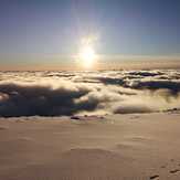

 See 54 more Ben Nevis photos
Misty View
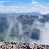
Top of The Ben
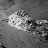
Ben Nevis
Ben Nevis
Ben Nevis
Ben Nevis