– Lat/Long: 43.60° S 170.14° E
 Aoraki/Mount Cook (Aoraki-Mount Cook)
Weather Forecast, New ZealandIssued: 5 am Mon 03 Aug Local TimeUpdates in: hr min sUpdate imminent
Issued: 5 am Mon 03 Aug Local Time
Updates in:
Update imminent hr min s

Issued: 5 am Mon 03 Aug Local Time
Updates in:
Update imminent hr min s
Days 1–3 Weather SummaryA dusting of new snow. Extremely cold (max -13°C on Mon afternoon, min -16°C on Mon night). Winds decreasing (extremely windy from the S on Tue morning, light winds from the SW by Wed night). | Days 4–6 Weather SummaryA heavy fall of snow, heaviest during Fri morning. Extremely cold (max -11°C on Thu afternoon, min -16°C on Sat morning). Winds decreasing (gales from the NW on Fri morning, calm by Sat night). | |||||||||||||||||
Monday 3 | Tuesday 4 | Wednesday 5 | Thursday 6 | Friday 7 | Saturday 8 | |||||||||||||
AM | PM | night | AM | PM | night | AM | PM | night | AM | PM | night | AM | PM | night | AM | PM | night | |
snow shwrs | snow shwrs | clear | clear | clear | clear | clear | clear | clear | clear | clear | snow shwrs | snow shwrs | snow shwrs | heavy snow | snow shwrs | light snow | clear | |
Cloud base (m) | 1500 | 1550 | 1550 | 1650 | 1700 | 8450 | 8500 | 8200 | 1050 | 1000 | 1000 | 1500 | 1650 | 1700 | 1650 | |||
km/h | ||||||||||||||||||
 |  |  |  |  |  | |||||||||||||
2 | 1 | — | — | — | — | — | — | — | — | — | 1 | 10 | 4 | 14 | 2 | 2 | — | |
mm | — | — | — | — | — | — | — | — | — | — | — | — | — | — | — | — | — | — |
max °C | -14 | -13 | -14 | -16 | -16 | -15 | -14 | -14 | -13 | -12 | -11 | -11 | -13 | -13 | -13 | -16 | -15 | -14 |
min °C | -15 | -15 | -16 | -16 | -16 | -16 | -14 | -14 | -14 | -12 | -11 | -13 | -14 | -14 | -15 | -16 | -16 | -15 |
chill °C | -31 | -30 | -32 | -34 | -32 | -30 | -24 | -24 | -24 | -20 | -17 | -26 | -27 | -27 | -27 | -26 | -23 | -15 |
Freezing level m | 1450 | 1450 | 550 | 0 | 750 | 0 | 1100 | 1350 | 900 | 1050 | 1200 | 950 | 1350 | 1600 | 1650 | 1450 | 1400 | 1150 |
7:50 | — | — | 7:50 | — | — | 7:48 | — | — | 7:47 | — | — | 7:46 | — | — | 7:45 | — | — | |
— | 5:39 | — | — | 5:40 | — | — | 5:42 | — | — | 5:43 | — | — | 5:44 | — | — | 5:45 | — | |
Loading...
Aoraki/Mount Cook Weather (Days 0-3):
The weather forecast for Aoraki/Mount Cook is: A dusting of new snow. Extremely cold (max -13°C on Mon afternoon, min -16°C on Mon night). Winds decreasing (extremely windy from the S on Tue morning, light winds from the SW by Wed night).
Aoraki/Mount Cook Weather (Days 3-6):
A heavy fall of snow, heaviest during Fri morning. Extremely cold (max -11°C on Thu afternoon, min -16°C on Sat morning). Winds decreasing (gales from the NW on Fri morning, calm by Sat night).
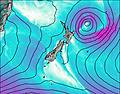
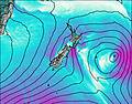
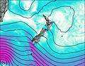
This table gives the weather forecast for Aoraki/Mount Cook at the specific elevation of 3754 m. Our advanced weather models allow us to provide distinct weather forecasts for several elevations of Aoraki/Mount Cook. To see the weather forecasts for the other elevations, use the tab navigation above the table. For a wider overview of the weather, consult the Weather Map of New Zealand.
| Weather Station | Temp. | Weather | Wind | Gusts | Cloud / Visibility |
|---|---|---|---|---|---|
Franz Josef AWS | |||||
Franz - Greens Rd | |||||
Glentanner | |||||
Whataroa | |||||
Clayton | |||||
Pukaki Aero |
* NOTE: not all weather observatories update at the same frequency which is the reason why some locations may show data from stations that are further away than known closer ones.
Aoraki/Mount Cook Photos
View all
Southern Alps photos (37) |
New Zealand photos (156) |
photos from mountains in New Zealand (160) |
all photos
 Upload new photo
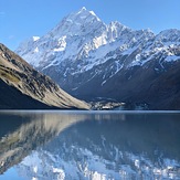

 See 10 more Aoraki/Mount Cook photos
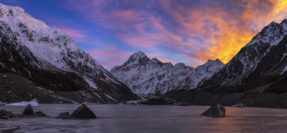
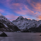
Aoraki/Mt Cook across the Hooker Glacier terminal lake
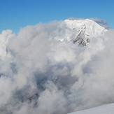
Inception
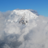
A Glimpse Of Mount Cook
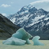
Mt Cook
Mount Cook
Mount Cook
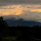
Aoraki/Mt Cook at sunset