
– Lat/Long: 18.37° S 69.05° W
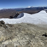
 Acotango
Weather Forecast, BoliviaIssued: 7 am Mon 03 Aug Local TimeUpdates in: hr min sUpdate imminent
Issued: 7 am Mon 03 Aug Local Time
Updates in:
Update imminent hr min s

Issued: 7 am Mon 03 Aug Local Time
Updates in:
Update imminent hr min s
Days 1–3 Weather SummaryMostly dry. Temperatures will be well below freezing (max -6°C on Wed afternoon, min -9°C on Mon morning). Mainly strong winds. | Days 4–6 Weather SummaryMostly dry. Temperatures will be below freezing (max -5°C on Thu morning, min -9°C on Sat night). Winds increasing (moderate winds from the WSW on Thu night, near gales from the WNW by Sat afternoon). | |||||||||||||||||
Monday 3 | Tuesday 4 | Wednesday 5 | Thursday 6 | Friday 7 | Saturday 8 | |||||||||||||
AM | PM | night | AM | PM | night | AM | PM | night | AM | PM | night | AM | PM | night | AM | PM | night | |
clear | clear | clear | clear | clear | clear | clear | clear | clear | clear | clear | clear | clear | clear | clear | clear | clear | clear | |
Cloud base (m) | 7450 | |||||||||||||||||
km/h | ||||||||||||||||||
 |  |  |  |  |  | |||||||||||||
— | — | — | — | — | — | — | — | — | — | — | — | — | — | — | — | — | — | |
mm | — | — | — | — | — | — | — | — | — | — | — | — | — | — | — | — | — | — |
max °C | -8 | -7 | -8 | -7 | -7 | -8 | -7 | -6 | -8 | -5 | -5 | -6 | -5 | -5 | -6 | -6 | -5 | -7 |
min °C | -9 | -7 | -9 | -9 | -7 | -9 | -9 | -6 | -8 | -7 | -5 | -7 | -6 | -5 | -7 | -7 | -6 | -9 |
chill °C | -17 | -15 | -18 | -18 | -16 | -18 | -19 | -15 | -17 | -16 | -14 | -15 | -15 | -14 | -16 | -17 | -16 | -20 |
Freezing level m | 5000 | 5150 | 4800 | 5050 | 5150 | 4700 | 5100 | 5200 | 4800 | 5350 | 5400 | 5000 | 5400 | 5400 | 4850 | 5300 | 5250 | 4750 |
7:01 | — | — | 7:01 | — | — | 7:01 | — | — | 7:01 | — | — | 7:00 | — | — | 7:00 | — | — | |
— | 6:22 | — | — | 6:22 | — | — | 6:22 | — | — | 6:22 | — | — | 6:22 | — | — | 6:22 | — | |
Loading...
Acotango Weather (Days 0-3):
The weather forecast for Acotango is: Mostly dry. Temperatures will be well below freezing (max -6°C on Wed afternoon, min -9°C on Mon morning). Mainly strong winds.
Acotango Weather (Days 3-6):
Mostly dry. Temperatures will be below freezing (max -5°C on Thu morning, min -9°C on Sat night). Winds increasing (moderate winds from the WSW on Thu night, near gales from the WNW by Sat afternoon).
This table gives the weather forecast for Acotango at the specific elevation of 6052 m. Our advanced weather models allow us to provide distinct weather forecasts for several elevations of Acotango. To see the weather forecasts for the other elevations, use the tab navigation above the table. For a wider overview of the weather, consult the Weather Map of Bolivia.
| Weather Station | Temp. | Weather | Wind | Gusts | Cloud / Visibility |
|---|---|---|---|---|---|
Aric / hacalluta Airport | |||||
Ilo Airport | |||||
Cochabamb / orge Wilsterman Airport | |||||
* NOTE: not all weather observatories update at the same frequency which is the reason why some locations may show data from stations that are further away than known closer ones.
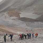
Acotango Photos
View all
Bolivian Andes photos (99) |
Andes photos (1029) |
photos from mountains in Bolivia (86) |
all photos
 Upload new photo
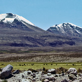
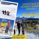
 See 9 more Acotango photos
Acotango
---
---
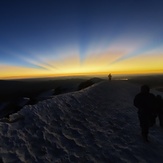
Sunrise Acotango 6am
Top of Acotango
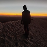
Climbing Acotango_almost on top
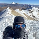
Acotango Summit