– Lat/Long: 51.86° N 2.97° W
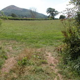
 Ysgyryd Fawr
Weather Forecast, United KingdomIssued: 12 pm Mon 03 Aug Local TimeUpdates in: hr min sUpdate imminent
Issued: 12 pm Mon 03 Aug Local Time
Updates in:
Update imminent hr min s

Issued: 12 pm Mon 03 Aug Local Time
Updates in:
Update imminent hr min s
Days 1–3 Weather SummaryMostly dry. Warm (max 25°C on Mon afternoon, min 8°C on Wed night). Winds increasing (light winds from the SW on Mon night, fresh winds from the SW by Tue afternoon). | Days 4–6 Weather SummaryMostly dry. Warm (max 22°C on Sat afternoon, min 9°C on Thu night). Wind will be generally light. | |||||||||||||||||
Monday 3 | Tuesday 4 | Wednesday 5 | Thursday 6 | Friday 7 | Saturday 8 | |||||||||||||
AM | PM | night | AM | PM | night | AM | PM | night | AM | PM | night | AM | PM | night | AM | PM | night | |
some clouds | some clouds | some clouds | light rain | rain shwrs | rain shwrs | rain shwrs | clear | clear | some clouds | clear | some clouds | some clouds | cloudy | clear | clear | clear | clear | |
Cloud base (m) | 4700 | 500 | 1450 | 600 | 400 | 1500 | 2050 | 9050 | 6100 | 2150 | 3050 | 3450 | ||||||
km/h | ||||||||||||||||||
 |  |  |  |  |  | |||||||||||||
— | — | — | — | — | — | — | — | — | — | — | — | — | — | — | — | — | — | |
mm | — | — | — | 0.1 | 0.1 | 0.3 | 0.1 | — | — | — | — | — | — | — | — | — | — | — |
max °C | 23 | 25 | 19 | 21 | 21 | 16 | 15 | 17 | 12 | 16 | 17 | 12 | 18 | 19 | 13 | 20 | 22 | 16 |
min °C | 19 | 25 | 16 | 18 | 18 | 12 | 13 | 15 | 8 | 13 | 16 | 9 | 15 | 17 | 11 | 16 | 21 | 14 |
chill °C | 19 | 25 | 15 | 17 | 17 | 9 | 10 | 13 | 5 | 11 | 15 | 9 | 15 | 17 | 11 | 16 | 21 | 14 |
Freezing level m | 3650 | 3650 | 3750 | 3800 | 3500 | 3750 | 3200 | 3000 | 2900 | 2500 | 2950 | 3350 | 3050 | 2850 | 3150 | 3450 | 3600 | 3500 |
5:35 | — | — | 5:37 | — | — | 5:39 | — | — | 5:41 | — | — | 5:41 | — | — | 5:43 | — | — | |
— | 8:58 | — | — | 8:57 | — | — | 8:54 | — | — | 8:52 | — | — | 8:51 | — | — | 8:49 | — | |
Loading...
Ysgyryd Fawr Weather (Days 0-3):
The weather forecast for Ysgyryd Fawr is: Mostly dry. Warm (max 25°C on Mon afternoon, min 8°C on Wed night). Winds increasing (light winds from the SW on Mon night, fresh winds from the SW by Tue afternoon).
Ysgyryd Fawr Weather (Days 3-6):
Mostly dry. Warm (max 22°C on Sat afternoon, min 9°C on Thu night). Wind will be generally light.
This table gives the weather forecast for Ysgyryd Fawr at the specific elevation of 486 m. Our advanced weather models allow us to provide distinct weather forecasts for several elevations of Ysgyryd Fawr. To see the weather forecasts for the other elevations, use the tab navigation above the table. For a wider overview of the weather, consult the Weather Map of United Kingdom.
| Weather Station | Temp. | Weather | Wind | Gusts | Cloud / Visibility |
|---|---|---|---|---|---|
Blorenge | |||||
Llantrithyd Park | |||||
Gloucestershire Airpor / taverton Airport | |||||
Weston Bay Waverider | |||||
Bristo / ulsgate Airport | |||||
Cardiff-Wales Airport | |||||
Hinkley Point 2 Waverider | |||||
Long Mynd | |||||
Lyneham |
* NOTE: not all weather observatories update at the same frequency which is the reason why some locations may show data from stations that are further away than known closer ones.
Ysgyryd Fawr Photos
View all
Black Mountains photos (20) |
Cambrian Mountains photos (384) |
photos from mountains in United Kingdom (2125) |
all photos
 Upload new photo
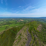
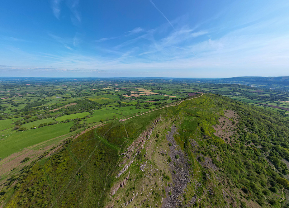
Aerial view of Skirrid Fawr looking SE
Aerial view of Skirrid Fawr looking SW
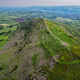
Skirrid Fawr viewed from Llanvetherine
Ysgyryd Fawr