– Lat/Long: 40.14° N 29.11° E
 Uludag
Weather Forecast, TurkeyIssued: 2 am Mon 03 Aug Local TimeUpdates in: hr min sUpdate imminent
Issued: 2 am Mon 03 Aug Local Time
Updates in:
Update imminent hr min s

Issued: 2 am Mon 03 Aug Local Time
Updates in:
Update imminent hr min s
Days 1–3 Weather SummaryMostly dry. Very mild (max 17°C on Tue afternoon, min 14°C on Mon morning). Wind will be generally light. | Days 4–6 Weather SummaryMostly dry. Very mild (max 19°C on Thu afternoon, min 15°C on Thu morning). Winds increasing (calm on Thu night, fresh winds from the ENE by Sat night). | |||||||||||||||||
Monday 3 | Tuesday 4 | Wednesday 5 | Thursday 6 | Friday 7 | Saturday 8 | |||||||||||||
AM | PM | night | AM | PM | night | AM | PM | night | AM | PM | night | AM | PM | night | AM | PM | night | |
clear | rain shwrs | clear | clear | clear | clear | clear | clear | clear | clear | clear | clear | clear | clear | clear | clear | clear | clear | |
Cloud base (m) | 4400 | |||||||||||||||||
km/h | ||||||||||||||||||
 |  |  |  |  |  | |||||||||||||
— | — | — | — | — | — | — | — | — | — | — | — | — | — | — | — | — | — | |
mm | — | 0.1 | — | — | — | — | — | — | — | — | — | — | — | — | — | — | — | — |
max °C | 14 | 16 | 15 | 15 | 17 | 16 | 16 | 17 | 17 | 16 | 19 | 18 | 18 | 19 | 18 | 17 | 18 | 18 |
min °C | 14 | 15 | 14 | 14 | 17 | 15 | 15 | 17 | 16 | 15 | 18 | 18 | 17 | 18 | 16 | 15 | 18 | 17 |
chill °C | 14 | 15 | 13 | 13 | 17 | 14 | 14 | 17 | 16 | 15 | 18 | 18 | 17 | 18 | 16 | 15 | 18 | 16 |
Freezing level m | 4350 | 4500 | 4700 | 4650 | 4700 | 4800 | 4700 | 4850 | 4950 | 4950 | 5000 | 5050 | 5000 | 5250 | 5050 | 4950 | 4950 | 5050 |
6:03 | — | — | 6:03 | — | — | 6:05 | — | — | 6:05 | — | — | 6:05 | — | — | 6:07 | — | — | |
— | 8:15 | — | — | 8:14 | — | — | 8:13 | — | — | 8:12 | — | — | 8:10 | — | — | 8:08 | — | |
Loading...
Uludag Weather (Days 0-3):
The weather forecast for Uludag is: Mostly dry. Very mild (max 17°C on Tue afternoon, min 14°C on Mon morning). Wind will be generally light.
Uludag Weather (Days 3-6):
Mostly dry. Very mild (max 19°C on Thu afternoon, min 15°C on Thu morning). Winds increasing (calm on Thu night, fresh winds from the ENE by Sat night).
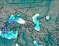
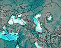
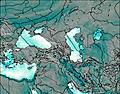
This table gives the weather forecast for Uludag at the specific elevation of 2000 m. Our advanced weather models allow us to provide distinct weather forecasts for several elevations of Uludag. To see the weather forecasts for the other elevations, use the tab navigation above the table. For a wider overview of the weather, consult the Weather Map of Turkey.
| Weather Station | Temp. | Weather | Wind | Gusts | Cloud / Visibility |
|---|---|---|---|---|---|
Bilecik | |||||
Istanbul Bölge (Kartal) | |||||
Kocaeli | |||||
Bandirma Havalimani | |||||
* NOTE: not all weather observatories update at the same frequency which is the reason why some locations may show data from stations that are further away than known closer ones.
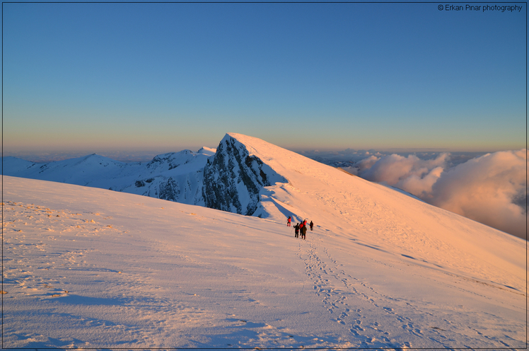
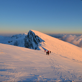
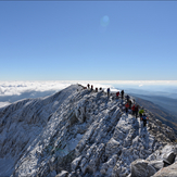
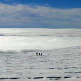
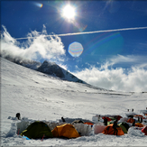
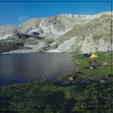
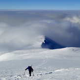
Uludag Photos
View all
Western Anatolia photos (23) |
Anatolia photos (529) |
photos from mountains in Turkey (496) |
all photos
 Upload new photo
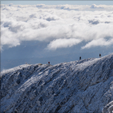
 See 26 more Uludag photos
ULUDAĞ
ULUDAĞ ZİRVE
ULUDAĞ
Uludag mountain
ULUDAĞ VOLFRAM
ULUDAĞ GÖLLER BÖLGESİ
Uludag mountain