– Lat/Long: 53.12° N 4.00° W
 Tryfan
Weather Forecast, United KingdomIssued: 12 am Sat 25 Jul Local TimeUpdates in: hr min sUpdate imminent
Issued: 12 am Sat 25 Jul Local Time
Updates in:
Update imminent hr min s

Issued: 12 am Sat 25 Jul Local Time
Updates in:
Update imminent hr min s
Days 1–4 Weather SummaryLight rain (total 4mm), mostly falling on Sat night. Very mild (max 14°C on Mon afternoon, min 8°C on Sun night). Winds increasing (light winds from the WNW on Fri night, strong winds from the WNW by Sun morning). | Days 5–7 Weather SummaryMostly dry. Very mild (max 17°C on Tue afternoon, min 12°C on Wed night). Mainly fresh winds. | ||||||||||||||||||
Saturday 25 | Sunday 26 | Monday 27 | Tuesday 28 | Wednesday 29 | Thursday 30 | ||||||||||||||
night | AM | PM | night | AM | PM | night | AM | PM | night | AM | PM | night | AM | PM | night | AM | PM | night | |
some clouds | rain shwrs | light rain | light rain | light rain | light rain | rain shwrs | some clouds | some clouds | cloudy | some clouds | cloudy | rain shwrs | some clouds | cloudy | some clouds | some clouds | some clouds | some clouds | |
Cloud base (m) | 1550 | 250 | 300 | 250 | 350 | 450 | 800 | 300 | 400 | 300 | 7550 | 6550 | 6850 | 6400 | 300 | 6050 | 6850 | ||
km/h | |||||||||||||||||||
 |  |  |  |  |  |  | |||||||||||||
— | — | — | — | — | — | — | — | — | — | — | — | — | — | — | — | — | — | — | |
mm | — | 0.2 | 0.2 | 1.9 | 1.1 | 0.4 | 0.3 | — | — | — | — | — | 0.2 | — | — | — | — | — | — |
max °C | 12 | 12 | 12 | 12 | 10 | 10 | 11 | 13 | 14 | 14 | 16 | 17 | 16 | 16 | 16 | 14 | 14 | 14 | 13 |
min °C | 11 | 12 | 12 | 10 | 9 | 9 | 8 | 12 | 13 | 13 | 15 | 17 | 14 | 15 | 16 | 12 | 13 | 14 | 12 |
chill °C | 8 | 9 | 9 | 6 | 5 | 5 | 4 | 9 | 10 | 11 | 13 | 16 | 12 | 14 | 15 | 10 | 11 | 13 | 12 |
Freezing level m | 3500 | 3700 | 3850 | 3600 | 3900 | 3900 | 3800 | 3550 | 3850 | 4050 | 3750 | 3700 | 3650 | 3750 | 3750 | 3800 | 3650 | 3600 | 3450 |
— | 5:20 | — | — | 5:22 | — | — | 5:24 | — | — | 5:24 | — | — | 5:26 | — | — | 5:28 | — | — | |
— | — | 9:22 | — | — | 9:21 | — | — | 9:19 | — | — | 9:17 | — | — | 9:15 | — | — | 9:14 | — | |
Loading...
Tryfan Weather (Days 0-3):
The weather forecast for Tryfan is: Light rain (total 4mm), mostly falling on Sat night. Very mild (max 14°C on Mon afternoon, min 8°C on Sun night). Winds increasing (light winds from the WNW on Fri night, strong winds from the WNW by Sun morning).
Tryfan Weather (Days 3-6):
Mostly dry. Very mild (max 17°C on Tue afternoon, min 12°C on Wed night). Mainly fresh winds.
This table gives the weather forecast for Tryfan at the specific elevation of 915 m. Our advanced weather models allow us to provide distinct weather forecasts for several elevations of Tryfan. To see the weather forecasts for the other elevations, use the tab navigation above the table. For a wider overview of the weather, consult the Weather Map of United Kingdom.
| Weather Station | Temp. | Weather | Wind | Gusts | Cloud / Visibility |
|---|---|---|---|---|---|
Caernarfon Airport | |||||
Valley RAF Airport | |||||
BARCIAL | |||||
HORNACHOS IM2 | |||||
SHIP2148 | |||||
SHIP1335 | |||||
SHIP7822 |
* NOTE: not all weather observatories update at the same frequency which is the reason why some locations may show data from stations that are further away than known closer ones.
Tryfan Photos
View all
Snowdonia photos (206) |
Cambrian Mountains photos (384) |
photos from mountains in United Kingdom (2125) |
all photos
 Upload new photo


 See 21 more Tryfan photos
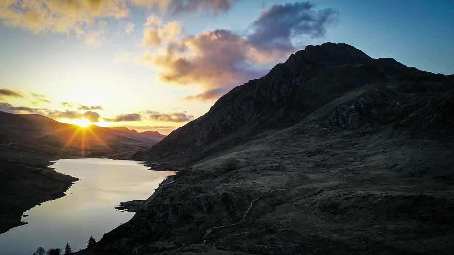
Tryfan sunrise
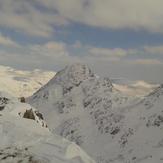
tryfan
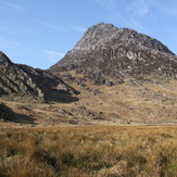
Tryfan from East Face of Bristley Ridge
April 2025
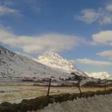
Tryfan from A5
Tryfan
Tryfan