Difficulty: Moderate to Hard depending on physical fitness
Duration: Approximately 40 minutes to an hour climb up, 20 mins (recommended time) for photos and volcano experience, less than 30 mins down. Timing-wise may look and sound easy but there are certain steep spots with loose volcanic rocks along the climb that can ware you down easily so be mentally and physically prepared and don't underestimate the climb before you start.
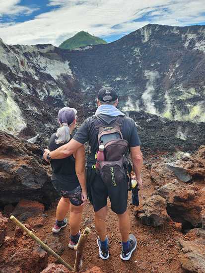
Clothes: Wear light pants (long/short is okay). Proper closed shoes (hiking shoes). Hats and sun glasses are necessary.
Recommended time to spend top according to the Volcanologists at Rabaul Volcano Observatory, is 20 mins.
Avoid the cracks on the edge of the caldera at all times when you are up there.
Along the track, the volcanic rocks are rather sharp. Watch where you put your hands for support.
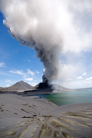
Bring a lot of water and drink a lot of water especially when you're climbing during the day when the sun is really hot. Also bring along a can of regular coke or any sugary soft drinks or a candy bar just in case you dehydrate and need sugar. If you have access to electrolytes, bring them along.
Altitude sickness or dizziness is normal about 3 quarters of the way up. We have had a good number of climbers experience that. We just let them rest, drink water, close their eyes and regain their mental balance and then we continue. Not too sure what others do. I am no expert but this is what I have done from the many experiences I have had along the climb.
 Tavurvur – Climbing, Hiking & Mountaineering information
