– Lat/Long: 64.80° N 23.78° W
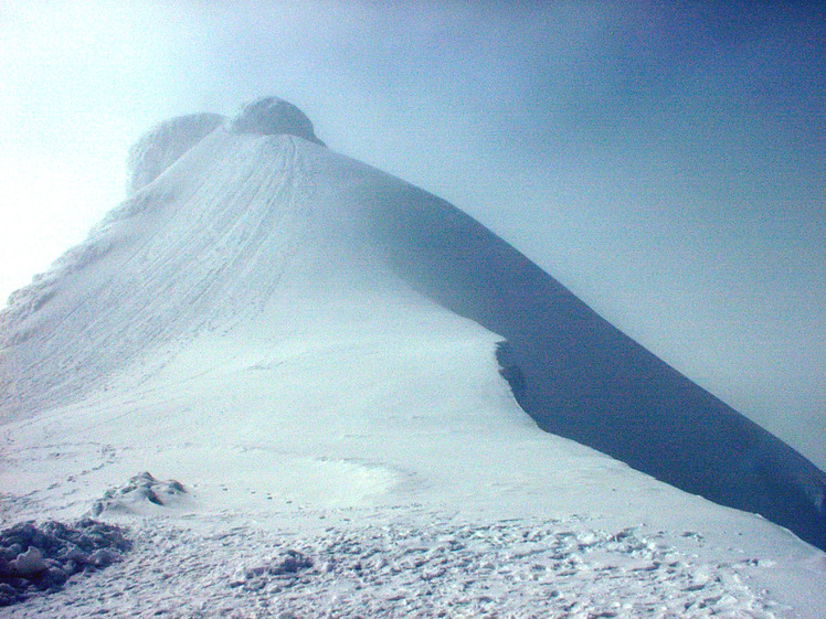
 Snæfellsjökull (Snoefellsjokull)
Weather Forecast, IcelandIssued: 11 pm Thu 09 Jul Local TimeUpdates in: hr min sUpdate imminent
Issued: 11 pm Thu 09 Jul Local Time
Updates in:
Update imminent hr min s

Issued: 11 pm Thu 09 Jul Local Time
Updates in:
Update imminent hr min s
Days 1–4 Weather SummaryModerate rain (total 16mm), heaviest on Sun morning. Freeze-thaw conditions (max 7°C on Fri night, min -1°C on Thu night). Winds increasing (moderate winds from the W on Thu night, stormy winds from the SSW by Sun morning). | Days 5–7 Weather SummaryHeavy rain (total 73mm), heaviest during Tue afternoon. Mild temperatures (max 8°C on Tue night, min 4°C on Wed morning). Winds increasing (light winds from the SSE on Tue morning, gales from the S by Wed morning). | ||||||||||||||||||
Friday 10 | Saturday 11 | Sunday 12 | Monday 13 | Tuesday 14 | Wednesday 15 | ||||||||||||||
night | AM | PM | night | AM | PM | night | AM | PM | night | AM | PM | night | AM | PM | night | AM | PM | night | |
some clouds | clear | rain shwrs | rain shwrs | rain shwrs | rain shwrs | rain shwrs | mod. rain | mod. rain | mod. rain | light rain | light rain | mod. rain | mod. rain | heavy rain | heavy rain | light rain | light rain | rain shwrs | |
km/h | |||||||||||||||||||
 |  |  |  |  |  |  | |||||||||||||
— | — | — | — | — | — | — | — | — | — | — | — | — | — | — | — | — | — | — | |
mm | — | — | 0.1 | 1.4 | 0.5 | 0.9 | 0.2 | 6 | 6 | 8 | 4 | 3 | 5 | 9 | 18 | 23 | 1.5 | 0.8 | 1 |
max °C | -1 | 1 | 3 | 7 | 7 | 7 | 7 | 6 | 6 | 6 | 5 | 5 | 6 | 5 | 6 | 8 | 6 | 4 | 4 |
min °C | -1 | 0 | 2 | 5 | 7 | 7 | 6 | 6 | 5 | 5 | 5 | 5 | 5 | 5 | 5 | 8 | 4 | 4 | 3 |
chill °C | -6 | -6 | -4 | -1 | 1 | 0 | 0 | -1 | -3 | -1 | -1 | -1 | -1 | 1 | 0 | 3 | -3 | -3 | -3 |
Freezing level m | 1200 | 1550 | 2250 | 2850 | 2650 | 2850 | 2700 | 2650 | 3150 | 2700 | 2450 | 2500 | 2650 | 2650 | 3100 | 3200 | 3050 | 3300 | 2350 |
Cloud base (m) | 700 | 200 | 100 | 300 | 200 | 200 | 350 | 850 | 150 | 150 | 200 | 150 | 200 | 150 | 100 | 100 | 100 | 100 | 150 |
— | 3:19 | — | — | 3:23 | — | — | 3:27 | — | — | 3:30 | — | — | 3:32 | — | — | 3:35 | — | — | |
— | — | — | 11:57 | — | — | 11:53 | — | — | 11:51 | — | — | 11:47 | — | — | 11:45 | — | — | 11:42 | |
Loading...
Snæfellsjökull Weather (Days 0-3):
The weather forecast for Snæfellsjökull is: Moderate rain (total 16mm), heaviest on Sun morning. Freeze-thaw conditions (max 7°C on Fri night, min -1°C on Thu night). Winds increasing (moderate winds from the W on Thu night, stormy winds from the SSW by Sun morning).
Snæfellsjökull Weather (Days 3-6):
Heavy rain (total 73mm), heaviest during Tue afternoon. Mild temperatures (max 8°C on Tue night, min 4°C on Wed morning). Winds increasing (light winds from the SSE on Tue morning, gales from the S by Wed morning).
This table gives the weather forecast for Snæfellsjökull at the specific elevation of 1446 m. Our advanced weather models allow us to provide distinct weather forecasts for several elevations of Snæfellsjökull. To see the weather forecasts for the other elevations, use the tab navigation above the table. For a wider overview of the weather, consult the Weather Map of Iceland.
Snæfellsjökull Photos
View all
Iceland photos (9) |
Atlantic Islands photos (85) |
photos from mountains in Iceland (29) |
all photos
 Upload new photo
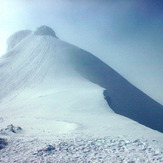
Snæfellsjökull