
– Lat/Long: 19.92° N 98.75° W
 Sierra De Las Pitos
Weather Forecast, MexicoIssued: 11 pm Sun 02 Aug Local TimeUpdates in: hr min sUpdate imminent
Issued: 11 pm Sun 02 Aug Local Time
Updates in:
Update imminent hr min s

Issued: 11 pm Sun 02 Aug Local Time
Updates in:
Update imminent hr min s
Days 1–4 Weather SummaryModerate rain (total 13mm), heaviest on Mon afternoon. Very mild (max 16°C on Tue afternoon, min 11°C on Mon night). Wind will be generally light. | Days 5–7 Weather SummaryModerate rain (total 15mm), heaviest on Fri night. Very mild (max 15°C on Thu afternoon, min 10°C on Thu night). Wind will be generally light. | ||||||||||||||||||
Monday 3 | Tuesday 4 | Wednesday 5 | Thursday 6 | Friday 7 | Saturday 8 | ||||||||||||||
night | AM | PM | night | AM | PM | night | AM | PM | night | AM | PM | night | AM | PM | night | AM | PM | night | |
clear | clear | mod. rain | rain shwrs | rain shwrs | rain shwrs | clear | rain shwrs | risk tstorm | rain shwrs | rain shwrs | rain shwrs | rain shwrs | some clouds | risk tstorm | rain shwrs | clear | rain shwrs | rain shwrs | |
Cloud base (m) | 5650 | 7950 | 4700 | 4500 | 6700 | 3550 | 2550 | 6550 | 2750 | ||||||||||
km/h | |||||||||||||||||||
 |  |  |  |  |  |  | |||||||||||||
— | — | — | — | — | — | — | — | — | — | — | — | — | — | — | — | — | — | — | |
mm | — | — | 8 | 2 | 0.1 | 0.6 | — | 0.1 | 1.8 | 1.5 | 0.2 | 3 | 1.7 | — | 3 | 6 | — | 0.4 | 1.2 |
max °C | 15 | 15 | 15 | 13 | 15 | 16 | 13 | 14 | 14 | 12 | 14 | 15 | 12 | 13 | 13 | 11 | 12 | 14 | 11 |
min °C | 13 | 13 | 12 | 11 | 12 | 13 | 11 | 11 | 13 | 11 | 11 | 12 | 10 | 10 | 11 | 10 | 10 | 12 | 10 |
chill °C | 13 | 13 | 11 | 11 | 12 | 11 | 11 | 11 | 11 | 10 | 11 | 10 | 8 | 10 | 8 | 10 | 10 | 10 | 10 |
Freezing level m | 5150 | 5000 | 5250 | 5050 | 4950 | 5300 | 5100 | 4900 | 5150 | 5050 | 4900 | 5250 | 4950 | 4650 | 5050 | 4850 | 4750 | 5150 | 4900 |
— | 6:11 | — | — | 6:11 | — | — | 6:11 | — | — | 6:11 | — | — | 6:11 | — | — | 6:11 | — | — | |
— | — | 7:09 | — | — | 7:09 | — | — | 7:08 | — | — | 7:08 | — | — | 7:07 | — | — | 7:07 | — | |
Loading...
Sierra De Las Pitos Weather (Days 0-3):
The weather forecast for Sierra De Las Pitos is: Moderate rain (total 13mm), heaviest on Mon afternoon. Very mild (max 16°C on Tue afternoon, min 11°C on Mon night). Wind will be generally light.
Sierra De Las Pitos Weather (Days 3-6):
Moderate rain (total 15mm), heaviest on Fri night. Very mild (max 15°C on Thu afternoon, min 10°C on Thu night). Wind will be generally light.
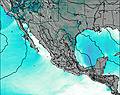
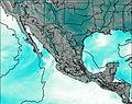
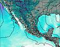
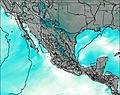
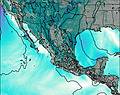
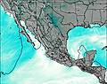
This table gives the weather forecast for Sierra De Las Pitos at the specific elevation of 3000 m. Our advanced weather models allow us to provide distinct weather forecasts for several elevations of Sierra De Las Pitos. To see the weather forecasts for the other elevations, use the tab navigation above the table. For a wider overview of the weather, consult the Weather Map of Mexico.
| Weather Station | Temp. | Weather | Wind | Gusts | Cloud / Visibility |
|---|---|---|---|---|---|
Tulancingo | |||||
Mexico City International Airpor / eropuerto Internacional de la Ciudad de México | |||||
Toluca Airpor / ose Maria Airport | |||||
Toluca- Mex. | |||||
lightning 20km NW of Jacala | |||||
lightning 21km WSW of Xilitla | |||||
El Peñon Take off |
* NOTE: not all weather observatories update at the same frequency which is the reason why some locations may show data from stations that are further away than known closer ones.