– Lat/Long: 34.24° N 118.10° W
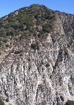
 San Gabriel Peak
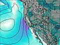
Weather Forecast, United StatesIssued: 10 pm Sun 02 Aug Local TimeUpdates in: hr min sUpdate imminent
Issued: 10 pm Sun 02 Aug Local Time
Updates in:
Update imminent hr min s

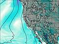
Issued: 10 pm Sun 02 Aug Local Time
Updates in:
Update imminent hr min s
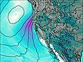
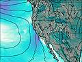
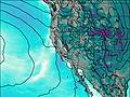
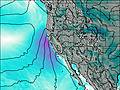
Days 1–4 Weather SummaryMostly dry. Warm (max 32°C on Tue afternoon, min 27°C on Sun night). Wind will be generally light. | Days 5–7 Weather SummaryMostly dry. Warm (max 31°C on Thu morning, min 27°C on Wed night). Wind will be generally light. | ||||||||||||||||||
Monday 3 | Tuesday 4 | Wednesday 5 | Thursday 6 | Friday 7 | Saturday 8 | ||||||||||||||
night | AM | PM | night | AM | PM | night | AM | PM | night | AM | PM | night | AM | PM | night | AM | PM | night | |
clear | clear | clear | clear | clear | clear | clear | clear | clear | clear | clear | clear | clear | clear | clear | clear | clear | clear | clear | |
Cloud base (m) | 5450 | 5400 | 5400 | ||||||||||||||||
km/h | |||||||||||||||||||
 |  |  |  |  |  |  | |||||||||||||
— | — | — | — | — | — | — | — | — | — | — | — | — | — | — | — | — | — | — | |
mm | — | — | — | — | — | — | — | — | — | — | — | — | — | — | — | — | — | — | — |
max °C | 28 | 30 | 31 | 28 | 30 | 32 | 28 | 30 | 31 | 29 | 31 | 30 | 29 | 30 | 31 | 28 | 30 | 30 | 28 |
min °C | 27 | 28 | 30 | 27 | 29 | 31 | 27 | 29 | 30 | 27 | 29 | 30 | 28 | 29 | 30 | 27 | 28 | 30 | 26 |
chill °C | 27 | 28 | 30 | 27 | 29 | 31 | 27 | 29 | 30 | 27 | 29 | 30 | 28 | 29 | 30 | 27 | 28 | 30 | 26 |
Freezing level m | 5650 | 5500 | 5600 | 5550 | 5550 | 5550 | 5550 | 5450 | 5550 | 5500 | 5450 | 5500 | 5500 | 5500 | 5550 | 5500 | 5400 | 5450 | 5400 |
— | 6:03 | — | — | 6:05 | — | — | 6:05 | — | — | 6:05 | — | — | 6:07 | — | — | 6:07 | — | — | |
— | — | 7:52 | — | — | 7:51 | — | — | 7:50 | — | — | 7:49 | — | — | 7:47 | — | — | 7:46 | — | |
Loading...
San Gabriel Peak Weather (Days 0-3):
The weather forecast for San Gabriel Peak is: Mostly dry. Warm (max 32°C on Tue afternoon, min 27°C on Sun night). Wind will be generally light.
San Gabriel Peak Weather (Days 3-6):
Mostly dry. Warm (max 31°C on Thu morning, min 27°C on Wed night). Wind will be generally light.
This table gives the weather forecast for San Gabriel Peak at the specific elevation of 1000 m. Our advanced weather models allow us to provide distinct weather forecasts for several elevations of San Gabriel Peak. To see the weather forecasts for the other elevations, use the tab navigation above the table. For a wider overview of the weather, consult the Weather Map of California.
| Weather Station | Temp. | Weather | Wind | Gusts | Cloud / Visibility |
|---|---|---|---|---|---|
Mount Wilson Airport | |||||
Burbank Airport | |||||
Kagel Launch | |||||
SHGA LZ | |||||
Van Nuys Airport | |||||
Hawthorne Airport | |||||
Los Angeles Airport |
* NOTE: not all weather observatories update at the same frequency which is the reason why some locations may show data from stations that are further away than known closer ones.
San Gabriel Peak Photos
View all
San Gabriel Mountains photos (155) |
Pacific Coast Ranges photos (1060) |
photos from mountains in United States (3056) |
all photos
 Upload new photo
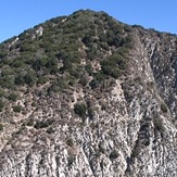
Southeast Face, San Gabriel Peak
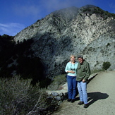
San Gabriel Peak, 6162 ft. Barbara and Mike
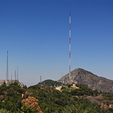
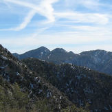
Mt. Markham and San Gabriel Peak From 100" Dome Catwalk, Mt. Wilson
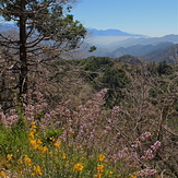
Ontario Peak, 8696 ft., from Eaton Saddle
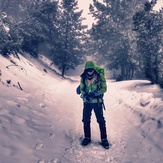
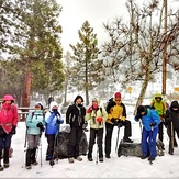
San Gabriel Peak Winter Hike
San Gabriel Peak
San Gabriel Peak