– Lat/Long: 51.79° N 10.65° E
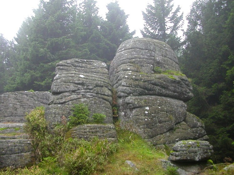
 Renneckenberg
Weather Forecast, GermanyIssued: 1 pm Fri 17 Jul Local TimeUpdates in: hr min sUpdate imminent
Issued: 1 pm Fri 17 Jul Local Time
Updates in:
Update imminent hr min s

Issued: 1 pm Fri 17 Jul Local Time
Updates in:
Update imminent hr min s
Days 1–4 Weather SummaryLight rain (total 4mm), mostly falling on Fri afternoon. Warm (max 23°C on Fri afternoon, min 11°C on Sat night). Wind will be generally light. | Days 5–7 Weather SummaryLight rain (total 3mm), mostly falling on Wed afternoon. Warm (max 21°C on Tue afternoon, min 11°C on Mon night). Wind will be generally light. | ||||||||||||||||
Fri 17 | Saturday 18 | Sunday 19 | Monday 20 | Tuesday 21 | Wednesday 22 | ||||||||||||
PM | night | AM | PM | night | AM | PM | night | AM | PM | night | AM | PM | night | AM | PM | night | |
risk tstorm | risk tstorm | clear | rain shwrs | rain shwrs | clear | clear | rain shwrs | rain shwrs | rain shwrs | clear | clear | some clouds | some clouds | cloudy | light rain | rain shwrs | |
Cloud base (m) | 1850 | 2300 | 5100 | 900 | 2000 | 800 | 550 | 1750 | 2450 | 2050 | 2600 | 2450 | 650 | 750 | |||
km/h | |||||||||||||||||
 |  |  |  |  |  | ||||||||||||
— | — | — | — | — | — | — | — | — | — | — | — | — | — | — | — | — | |
mm | 2 | 0.4 | — | 0.2 | 0.2 | — | — | 0.2 | 0.5 | 0.5 | — | — | — | — | — | 1.4 | 0.5 |
max °C | 23 | 23 | 19 | 22 | 20 | 15 | 17 | 14 | 15 | 17 | 17 | 18 | 21 | 19 | 16 | 18 | 14 |
min °C | 22 | 15 | 16 | 22 | 11 | 13 | 16 | 12 | 12 | 17 | 11 | 15 | 19 | 13 | 15 | 14 | 12 |
chill °C | 22 | 14 | 15 | 22 | 10 | 12 | 15 | 11 | 11 | 16 | 11 | 15 | 19 | 13 | 14 | 13 | 12 |
Freezing level m | 3550 | 3350 | 3100 | 3000 | 2900 | 2300 | 2500 | 2500 | 2300 | 2450 | 2550 | 2550 | 2600 | 2800 | 2500 | 2600 | 2500 |
— | — | 5:18 | — | — | 5:20 | — | — | 5:20 | — | — | 5:22 | — | — | 5:24 | — | — | |
— | 9:28 | — | — | 9:27 | — | — | 9:24 | — | — | 9:23 | — | — | 9:22 | — | — | 9:22 | |
Loading...
Renneckenberg Weather (Days 0-3):
The weather forecast for Renneckenberg is: Light rain (total 4mm), mostly falling on Fri afternoon. Warm (max 23°C on Fri afternoon, min 11°C on Sat night). Wind will be generally light.
Renneckenberg Weather (Days 3-6):
Light rain (total 3mm), mostly falling on Wed afternoon. Warm (max 21°C on Tue afternoon, min 11°C on Mon night). Wind will be generally light.
This table gives the weather forecast for Renneckenberg at the specific elevation of 200 m. Our advanced weather models allow us to provide distinct weather forecasts for several elevations of Renneckenberg. To see the weather forecasts for the other elevations, use the tab navigation above the table. For a wider overview of the weather, consult the Weather Map of Germany.
| Weather Station | Temp. | Weather | Wind | Gusts | Cloud / Visibility |
|---|---|---|---|---|---|
Brocken | |||||
lightning 5km S of Darlingerode | |||||
lightning 4km E of Wernigerode | |||||
Stapelburg Airfield | |||||
lightning 6km SSW of Derenburg | |||||
thunderstorm affecting Heudeber | |||||
Rammelsberg HDGV | |||||
lightning 5km N of Langeln | |||||
* NOTE: not all weather observatories update at the same frequency which is the reason why some locations may show data from stations that are further away than known closer ones.
Renneckenberg Photos
View all
Minor ranges of Europe photos (96) |
photos from mountains in Germany (124) |
all photos
 Upload new photo
Renneckenberg