
– Lat/Long: 34.23° N 36.10° E
 Qornet As Sawda
Weather Forecast, LebanonIssued: 8 pm Sun 02 Aug Local TimeUpdates in: hr min sUpdate imminent
Issued: 8 pm Sun 02 Aug Local Time
Updates in:
Update imminent hr min s

Issued: 8 pm Sun 02 Aug Local Time
Updates in:
Update imminent hr min s
Days 1–4 Weather SummaryMostly dry. Warm (max 20°C on Mon afternoon, min 17°C on Sun night). Winds decreasing (fresh winds from the SW on Mon morning, light winds from the SSE by Wed afternoon). | Days 5–7 Weather SummaryMostly dry. Very mild (max 19°C on Thu afternoon, min 16°C on Wed night). Wind will be generally light. | ||||||||||||||||||
Monday 3 | Tuesday 4 | Wednesday 5 | Thursday 6 | Friday 7 | Saturday 8 | ||||||||||||||
night | AM | PM | night | AM | PM | night | AM | PM | night | AM | PM | night | AM | PM | night | AM | PM | night | |
clear | clear | clear | clear | clear | clear | clear | clear | clear | clear | clear | clear | clear | clear | clear | clear | clear | clear | clear | |
Cloud base (m) | 850 | ||||||||||||||||||
km/h | |||||||||||||||||||
 |  |  |  |  |  |  | |||||||||||||
— | — | — | — | — | — | — | — | — | — | — | — | — | — | — | — | — | — | — | |
mm | — | — | — | — | — | — | — | — | — | — | — | — | — | — | — | — | — | — | — |
max °C | 18 | 19 | 20 | 18 | 20 | 20 | 20 | 20 | 20 | 18 | 18 | 19 | 17 | 18 | 19 | 16 | 18 | 19 | 17 |
min °C | 17 | 18 | 19 | 18 | 19 | 20 | 19 | 19 | 20 | 16 | 17 | 18 | 16 | 17 | 18 | 16 | 17 | 17 | 16 |
chill °C | 16 | 17 | 19 | 17 | 18 | 20 | 19 | 19 | 20 | 16 | 17 | 18 | 16 | 17 | 18 | 16 | 17 | 17 | 16 |
Freezing level m | 5450 | 5400 | 5500 | 5600 | 5600 | 5800 | 5750 | 5650 | 5800 | 5600 | 5500 | 5600 | 5600 | 5600 | 5600 | 5600 | 5500 | 5550 | 5500 |
— | 5:47 | — | — | 5:48 | — | — | 5:48 | — | — | 5:48 | — | — | 5:50 | — | — | 5:50 | — | — | |
— | — | 7:35 | — | — | 7:34 | — | — | 7:32 | — | — | 7:32 | — | — | 7:31 | — | — | 7:30 | — | |
Loading...
Qornet As Sawda Weather (Days 0-3):
The weather forecast for Qornet As Sawda is: Mostly dry. Warm (max 20°C on Mon afternoon, min 17°C on Sun night). Winds decreasing (fresh winds from the SW on Mon morning, light winds from the SSE by Wed afternoon).
Qornet As Sawda Weather (Days 3-6):
Mostly dry. Very mild (max 19°C on Thu afternoon, min 16°C on Wed night). Wind will be generally light.
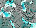
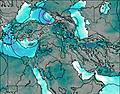
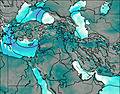
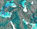
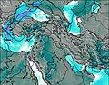
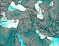
This table gives the weather forecast for Qornet As Sawda at the specific elevation of 2500 m. Our advanced weather models allow us to provide distinct weather forecasts for several elevations of Qornet As Sawda. To see the weather forecasts for the other elevations, use the tab navigation above the table. For a wider overview of the weather, consult the Weather Map of Lebanon.
| Weather Station | Temp. | Weather | Wind | Gusts | Cloud / Visibility |
|---|---|---|---|---|---|
Har -Knaan (Zefat) | |||||
BEZET | |||||
SEA OF GALILEE | |||||
MIGDAL ISRAEL | |||||
SHAVE ZIYYON | |||||
BEACH CLUB MAAGAN | |||||
BAT GALIM | |||||
7winds Har Shaul |
* NOTE: not all weather observatories update at the same frequency which is the reason why some locations may show data from stations that are further away than known closer ones.