– Lat/Long: 52.47° N 3.79° W
 Pumlumon Fach – Climbing, Hiking & Mountaineering information

Pumlumon Fach Guide
- Elevation: 668
- Difficulty: Easy
- Best months to climb: all year
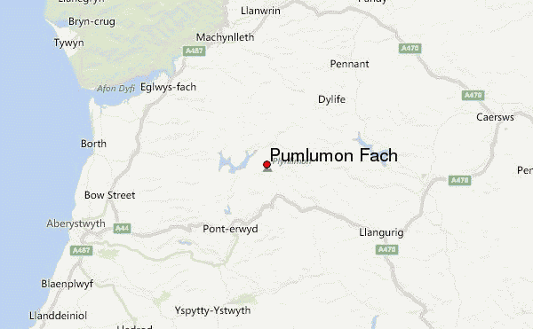
- Convenient center: Aberystwyth
Pumlumon Fach climbers NotesBe the first to submit your climbers note! Please submit any useful information about climbing Pumlumon Fach that may be useful to other climbers. Consider things such as access and accommodation at the base of Pumlumon Fach, as well as the logistics of climbing to the summit. |
| Select a
mountain summit from the menu |
||
|
Select a Mountain Summit
|
||
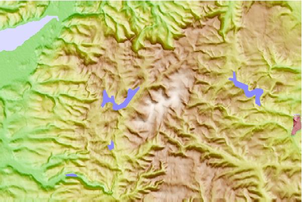
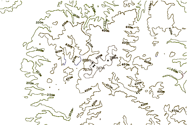
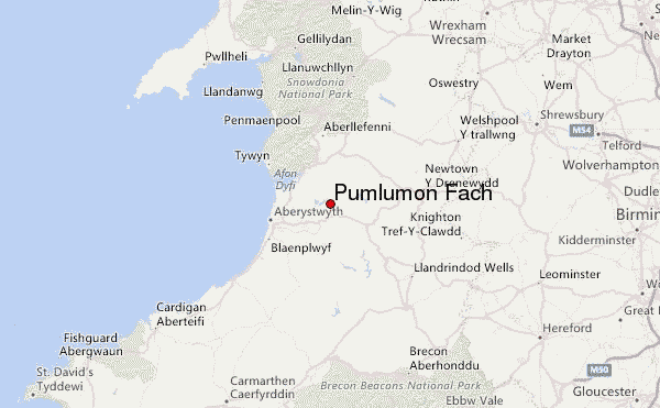
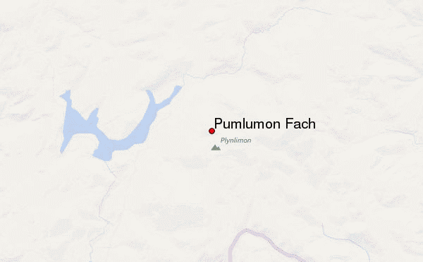
Use this relief map to navigate to mountain peaks in the area of Pumlumon Fach.
10 other mountain peaks closest to Pumlumon Fach:
| 1. | Plynlimon Fawr (752 m) | 0.4 km |
| 2. | Pen Pumlumon Llygad-Bychan (727 m) | 0.5 km |
| 3. | Y Garn (Plynlimon) (684 m) | 2.6 km |
| 4. | Pen Pumlumon Arwystli (741 m) | 2.7 km |
| 5. | Nant Syddion (310 m) | 8.4 km |
| 6. | Nant Rhys (466 m) | 9.5 km |
| 7. | Pen y Garn (610 m) | 10.3 km |
| 8. | Tarrenhendre (634 m) | 19.7 km |
| 9. | Tarren y Gesail (667 m) | 20.0 km |
| 10. | Lluest Cwm Bach (350 m) | 20.3 km |