
– Lat/Long: 8.53° N 71.03° W
 Pico Bonpland
Weather Forecast, VenezuelaIssued: 1 pm Wed 22 Jul Local TimeUpdates in: hr min sUpdate imminent
Issued: 1 pm Wed 22 Jul Local Time
Updates in:
Update imminent hr min s

Issued: 1 pm Wed 22 Jul Local Time
Updates in:
Update imminent hr min s
Days 1–4 Weather SummaryMild with light rain (total 3mm) on Wed afternoon Becoming colder with a light covering of snow, mostly falling on Thu afternoon. Temperatures will be slightly above freezing (max 3°C on Wed afternoon, min 1°C on Wed night). Wind will be generally light. | Days 5–7 Weather SummaryA moderate fall of snow, heaviest on Sun night. Freeze-thaw conditions (max 3°C on Tue morning, min 0°C on Mon morning). Wind will be generally light. | ||||||||||||||||
Wed 22 | Thursday 23 | Friday 24 | Saturday 25 | Sunday 26 | Monday 27 | ||||||||||||
PM | night | AM | PM | night | AM | PM | night | AM | PM | night | AM | PM | night | AM | PM | night | |
risk tstorm | some clouds | rain shwrs | light snow | light snow | snow shwrs | rain shwrs | rain shwrs | rain shwrs | snow shwrs | snow shwrs | snow shwrs | snow shwrs | mod. snow | light snow | snow shwrs | some clouds | |
Cloud base (m) | 2850 | 2800 | 2850 | 2800 | 2800 | 2800 | 4900 | 3550 | 2900 | 2900 | 2900 | 2900 | 2800 | 2800 | 2950 | 4850 | |
km/h | |||||||||||||||||
 |  |  |  |  |  | ||||||||||||
— | — | — | 2 | 4 | 1 | — | — | — | 2 | 2 | 1 | 2 | 6 | 2 | 2 | — | |
mm | 2 | — | 0.2 | — | — | — | 0.6 | 0.2 | 0.1 | — | — | — | — | — | — | — | — |
max °C | 3 | 2 | 2 | 2 | 2 | 2 | 3 | 2 | 3 | 2 | 2 | 2 | 2 | 1 | 1 | 2 | 2 |
min °C | 2 | 1 | 1 | 2 | 1 | 1 | 3 | 2 | 2 | 2 | 1 | 1 | 2 | 1 | 0 | 1 | 1 |
chill °C | 1 | 0 | -2 | -1 | -3 | -3 | 0 | -1 | -2 | 0 | -2 | -1 | 0 | 0 | -5 | -3 | -2 |
Freezing level m | 4900 | 4750 | 4900 | 4800 | 4700 | 4900 | 5050 | 4800 | 5000 | 4850 | 4800 | 4800 | 4800 | 4650 | 4550 | 4800 | 4800 |
— | — | 6:33 | — | — | 6:33 | — | — | 6:33 | — | — | 6:35 | — | — | 6:35 | — | — | |
7:06 | — | — | 7:06 | — | — | 7:06 | — | — | 7:06 | — | — | 7:06 | — | — | 7:06 | — | |
Loading...
Pico Bonpland Weather (Days 0-3):
The weather forecast for Pico Bonpland is: Mild with light rain (total 3mm) on Wed afternoon Becoming colder with a light covering of snow, mostly falling on Thu afternoon. Temperatures will be slightly above freezing (max 3°C on Wed afternoon, min 1°C on Wed night). Wind will be generally light.
Pico Bonpland Weather (Days 3-6):
A moderate fall of snow, heaviest on Sun night. Freeze-thaw conditions (max 3°C on Tue morning, min 0°C on Mon morning). Wind will be generally light.
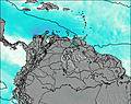
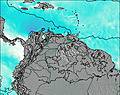
This table gives the weather forecast for Pico Bonpland at the specific elevation of 4500 m. Our advanced weather models allow us to provide distinct weather forecasts for several elevations of Pico Bonpland. To see the weather forecasts for the other elevations, use the tab navigation above the table. For a wider overview of the weather, consult the Weather Map of Venezuela.
| Weather Station | Temp. | Weather | Wind | Gusts | Cloud / Visibility |
|---|---|---|---|---|---|
Arauc / antiago Pérez Quiroz Airport | |||||
Cúcut / amilo Daza International Airport | |||||
Barquisimeto Airport | |||||
Bucaramang / alonegro Airport | |||||
lightning 58km E of Cravo Norte | |||||
Valledupa / eropuerto Alfonso López Pumarejo Airport | |||||
Barrancabermej / ariguíes Airport | |||||
lightning 55km ENE of La Primavera |
* NOTE: not all weather observatories update at the same frequency which is the reason why some locations may show data from stations that are further away than known closer ones.