– Lat/Long: 46.00° N 6.45° E
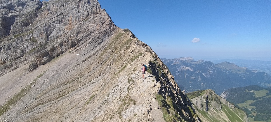
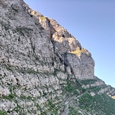
 Pic de Jallouvre
Weather Forecast, FranceIssued: 1 pm Mon 03 Aug Local TimeUpdates in: hr min sUpdate imminent
Issued: 1 pm Mon 03 Aug Local Time
Updates in:
Update imminent hr min s

Issued: 1 pm Mon 03 Aug Local Time
Updates in:
Update imminent hr min s
Days 1–4 Weather SummaryHeavy rain (total 25mm), heaviest during Mon afternoon. Warm (max 21°C on Mon afternoon, min 13°C on Tue night). Wind will be generally light. | Days 5–7 Weather SummaryLight rain (total 7mm), mostly falling on Thu afternoon. Very mild (max 17°C on Sat afternoon, min 11°C on Fri morning). Wind will be generally light. | ||||||||||||||||
Mon 3 | Tuesday 4 | Wednesday 5 | Thursday 6 | Friday 7 | Saturday 8 | ||||||||||||
PM | night | AM | PM | night | AM | PM | night | AM | PM | night | AM | PM | night | AM | PM | night | |
rain shwrs | risk tstorm | clear | rain shwrs | rain shwrs | clear | rain shwrs | risk tstorm | some clouds | mod. rain | risk tstorm | clear | rain shwrs | clear | clear | clear | clear | |
Cloud base (m) | 1850 | 8650 | 5800 | 2850 | 4250 | 4650 | 3050 | 6800 | 2600 | 900 | 2300 | ||||||
km/h | |||||||||||||||||
 |  |  |  |  |  | ||||||||||||
— | — | — | — | — | — | — | — | — | — | — | — | — | — | — | — | — | |
mm | 9 | 4 | — | 4 | 8 | — | 0.1 | 0.1 | — | 6 | 1.6 | — | 0.1 | — | — | — | — |
max °C | 21 | 17 | 16 | 17 | 15 | 15 | 17 | 17 | 15 | 14 | 13 | 12 | 15 | 15 | 14 | 17 | 17 |
min °C | 14 | 16 | 16 | 16 | 13 | 15 | 17 | 15 | 15 | 13 | 12 | 11 | 14 | 13 | 13 | 16 | 16 |
chill °C | 13 | 16 | 16 | 16 | 12 | 15 | 17 | 15 | 15 | 13 | 11 | 10 | 14 | 13 | 13 | 16 | 16 |
Freezing level m | 4400 | 4550 | 4450 | 4400 | 4400 | 4250 | 4300 | 4350 | 4250 | 4150 | 4200 | 4100 | 4200 | 4350 | 4350 | 4400 | 4500 |
— | — | 6:18 | — | — | 6:20 | — | — | 6:20 | — | — | 6:22 | — | — | 6:24 | — | — | |
— | 9:00 | — | — | 9:00 | — | — | 8:59 | — | — | 8:57 | — | — | 8:55 | — | — | 8:53 | |
Loading...
Pic de Jallouvre Weather (Days 0-3):
The weather forecast for Pic de Jallouvre is: Heavy rain (total 25mm), heaviest during Mon afternoon. Warm (max 21°C on Mon afternoon, min 13°C on Tue night). Wind will be generally light.
Pic de Jallouvre Weather (Days 3-6):
Light rain (total 7mm), mostly falling on Thu afternoon. Very mild (max 17°C on Sat afternoon, min 11°C on Fri morning). Wind will be generally light.
This table gives the weather forecast for Pic de Jallouvre at the specific elevation of 2000 m. Our advanced weather models allow us to provide distinct weather forecasts for several elevations of Pic de Jallouvre. To see the weather forecasts for the other elevations, use the tab navigation above the table. For a wider overview of the weather, consult the Weather Map of France.
| Weather Station | Temp. | Weather | Wind | Gusts | Cloud / Visibility |
|---|---|---|---|---|---|
lightning 5km NNE of Le Grand-Bornand | |||||
thunderstorm affecting Scionzier | |||||
lightning 4km WSW of La Clusaz | |||||
thunderstorm affecting La Tour | |||||
thunderstorm affecting Taninges | |||||
lightning 4km E of Araches-la-Frasse | |||||
lightning 4km WSW of Thones | |||||
lightning 5km N of Mieussy | |||||
lightning 4km WNW of Les Gets | |||||
thunderstorm affecting Talloires |
* NOTE: not all weather observatories update at the same frequency which is the reason why some locations may show data from stations that are further away than known closer ones.
Pic de Jallouvre Photos
View all
Savoy Alps photos (141) |
Alps photos (1485) |
photos from mountains in France (302) |
all photos
 Upload new photo
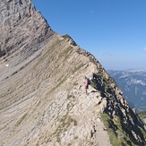
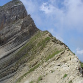
Col du Rasoir
Passage de la Cravatte
Pic de Jallouvre