– Lat/Long: 42.42° N 2.16° E
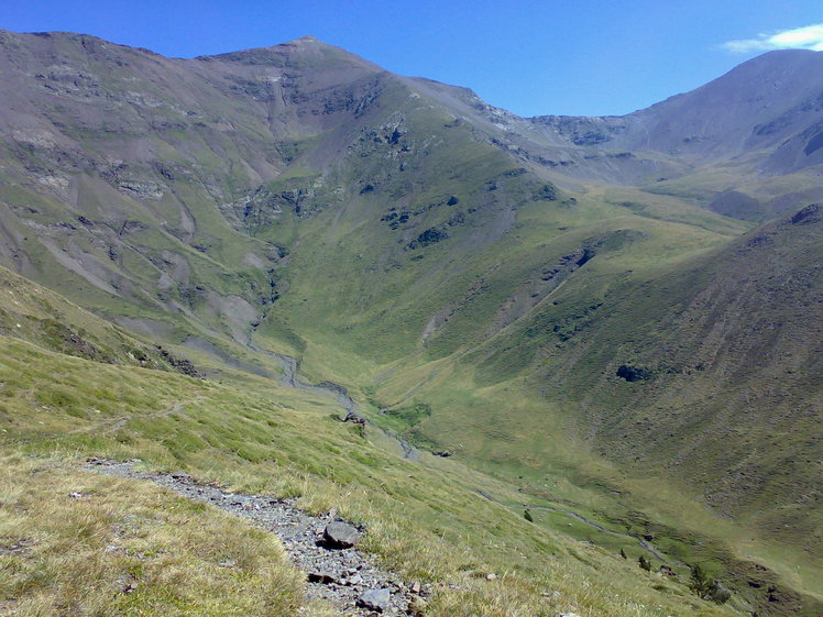
 Pic d'Eina
Weather Forecast, SpainIssued: 7 pm Sun 02 Aug Local TimeUpdates in: hr min sUpdate imminent
Issued: 7 pm Sun 02 Aug Local Time
Updates in:
Update imminent hr min s

Issued: 7 pm Sun 02 Aug Local Time
Updates in:
Update imminent hr min s
Days 1–4 Weather SummaryLight rain (total 8mm), mostly falling on Mon night. Very mild (max 13°C on Sun night, min 9°C on Mon night). Winds decreasing (fresh winds from the SW on Mon morning, calm by Tue night). | Days 5–7 Weather SummaryModerate rain (total 17mm), heaviest on Thu afternoon. Very mild (max 14°C on Sat afternoon, min 11°C on Wed night). Winds increasing (light winds from the WSW on Wed night, fresh winds from the WSW by Thu night). | ||||||||||||||||||
Monday 3 | Tuesday 4 | Wednesday 5 | Thursday 6 | Friday 7 | Saturday 8 | ||||||||||||||
night | AM | PM | night | AM | PM | night | AM | PM | night | AM | PM | night | AM | PM | night | AM | PM | night | |
risk tstorm | clear | cloudy | risk tstorm | clear | light rain | risk tstorm | clear | light rain | risk tstorm | risk tstorm | risk tstorm | risk tstorm | rain shwrs | risk tstorm | risk tstorm | clear | risk tstorm | risk tstorm | |
Cloud base (m) | 9250 | 7000 | 3300 | 3400 | 3150 | 3500 | 9650 | ||||||||||||
km/h | |||||||||||||||||||
 |  |  |  |  |  |  | |||||||||||||
— | — | — | — | — | — | — | — | — | — | — | — | — | — | — | — | — | — | — | |
mm | 0.2 | — | — | 2 | — | 1.2 | 3 | — | 1.1 | 4 | 0.5 | 4 | 2 | 0.1 | 3 | 3 | — | 1.1 | 3 |
max °C | 13 | 13 | 13 | 13 | 11 | 12 | 11 | 12 | 13 | 12 | 12 | 12 | 11 | 12 | 13 | 12 | 13 | 14 | 12 |
min °C | 12 | 12 | 13 | 9 | 10 | 11 | 10 | 11 | 12 | 11 | 11 | 12 | 11 | 11 | 12 | 12 | 12 | 14 | 10 |
chill °C | 12 | 10 | 11 | 7 | 9 | 9 | 10 | 11 | 11 | 9 | 9 | 10 | 8 | 8 | 10 | 10 | 9 | 12 | 6 |
Freezing level m | 4700 | 4650 | 4600 | 4250 | 4300 | 4500 | 4450 | 4550 | 4550 | 4600 | 4500 | 4500 | 4650 | 4600 | 4650 | 4650 | 4600 | 4650 | 4500 |
— | 6:45 | — | — | 6:46 | — | — | 6:47 | — | — | 6:48 | — | — | 6:48 | — | — | 6:50 | — | — | |
— | — | — | 9:08 | — | — | 9:07 | — | — | 9:07 | — | — | 9:05 | — | — | 9:04 | — | — | 9:02 | |
Loading...
Pic d'Eina Weather (Days 0-3):
The weather forecast for Pic d'Eina is: Light rain (total 8mm), mostly falling on Mon night. Very mild (max 13°C on Sun night, min 9°C on Mon night). Winds decreasing (fresh winds from the SW on Mon morning, calm by Tue night).
Pic d'Eina Weather (Days 3-6):
Moderate rain (total 17mm), heaviest on Thu afternoon. Very mild (max 14°C on Sat afternoon, min 11°C on Wed night). Winds increasing (light winds from the WSW on Wed night, fresh winds from the WSW by Thu night).
This table gives the weather forecast for Pic d'Eina at the specific elevation of 2789 m. Our advanced weather models allow us to provide distinct weather forecasts for several elevations of Pic d'Eina. To see the weather forecasts for the other elevations, use the tab navigation above the table. For a wider overview of the weather, consult the Weather Map of Spain.
| Weather Station | Temp. | Weather | Wind | Gusts | Cloud / Visibility |
|---|---|---|---|---|---|
La Molina | |||||
Cap del Rec | |||||
VIGNE DEL REY | |||||
Perpignan | |||||
1336 | |||||
Giron / osta Brava | |||||
Port Ainé Massís de l'Orri | |||||
Gare Maritime PV |
* NOTE: not all weather observatories update at the same frequency which is the reason why some locations may show data from stations that are further away than known closer ones.
Pic d'Eina Photos
View all
photos (101) |
Pyrenees photos (143) |
photos from mountains in Spain (451) |
all photos
 Upload new photo
Pic d'Eina