– Lat/Long: 42.24° N 1.70° E
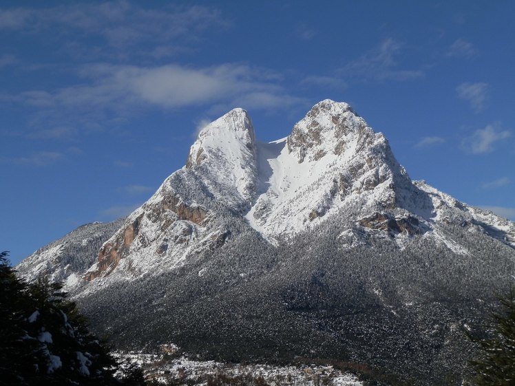
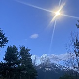
 Pedraforca
Weather Forecast, SpainIssued: 1 am Mon 03 Aug Local TimeUpdates in: hr min sUpdate imminent
Issued: 1 am Mon 03 Aug Local Time
Updates in:
Update imminent hr min s

Issued: 1 am Mon 03 Aug Local Time
Updates in:
Update imminent hr min s
Days 1–3 Weather SummaryLight rain (total 9mm), mostly falling on Mon night. Very mild (max 16°C on Mon afternoon, min 11°C on Mon night). Wind will be generally light. | Days 4–6 Weather SummaryLight rain (total 4mm), mostly falling on Thu night. Very mild (max 17°C on Fri afternoon, min 12°C on Thu night). Wind will be generally light. | |||||||||||||||||
Monday 3 | Tuesday 4 | Wednesday 5 | Thursday 6 | Friday 7 | Saturday 8 | |||||||||||||
AM | PM | night | AM | PM | night | AM | PM | night | AM | PM | night | AM | PM | night | AM | PM | night | |
clear | some clouds | rain shwrs | clear | some clouds | risk tstorm | clear | some clouds | rain shwrs | clear | some clouds | risk tstorm | rain shwrs | risk tstorm | clear | clear | clear | rain shwrs | |
Cloud base (m) | 5500 | 3750 | 4100 | 4400 | 4150 | 3750 | 7950 | 3550 | 4200 | 4950 | ||||||||
km/h | ||||||||||||||||||
 |  |  |  |  |  | |||||||||||||
— | — | — | — | — | — | — | — | — | — | — | — | — | — | — | — | — | — | |
mm | — | — | 8 | — | — | 1 | — | — | 0.1 | — | — | 4 | 0.1 | 0.2 | — | — | — | 0.1 |
max °C | 15 | 16 | 14 | 13 | 16 | 14 | 14 | 16 | 15 | 14 | 16 | 13 | 14 | 17 | 16 | 16 | 17 | 16 |
min °C | 13 | 15 | 11 | 12 | 15 | 13 | 13 | 16 | 13 | 13 | 15 | 12 | 12 | 15 | 14 | 14 | 17 | 15 |
chill °C | 12 | 14 | 10 | 11 | 15 | 12 | 12 | 16 | 13 | 12 | 14 | 10 | 10 | 14 | 13 | 13 | 17 | 14 |
Freezing level m | 4600 | 4550 | 4250 | 4300 | 4550 | 4500 | 4550 | 4600 | 4550 | 4450 | 4600 | 4650 | 4650 | 4700 | 4800 | 4700 | 4700 | 4800 |
6:47 | — | — | 6:48 | — | — | 6:48 | — | — | 6:50 | — | — | 6:50 | — | — | 6:52 | — | — | |
— | — | 9:09 | — | — | 9:08 | — | — | 9:07 | — | — | 9:07 | — | — | 9:05 | — | — | 9:04 | |
Loading...
Pedraforca Weather (Days 0-3):
The weather forecast for Pedraforca is: Light rain (total 9mm), mostly falling on Mon night. Very mild (max 16°C on Mon afternoon, min 11°C on Mon night). Wind will be generally light.
Pedraforca Weather (Days 3-6):
Light rain (total 4mm), mostly falling on Thu night. Very mild (max 17°C on Fri afternoon, min 12°C on Thu night). Wind will be generally light.
This table gives the weather forecast for Pedraforca at the specific elevation of 2495 m. Our advanced weather models allow us to provide distinct weather forecasts for several elevations of Pedraforca. To see the weather forecasts for the other elevations, use the tab navigation above the table. For a wider overview of the weather, consult the Weather Map of Spain.
| Weather Station | Temp. | Weather | Wind | Gusts | Cloud / Visibility |
|---|---|---|---|---|---|
Cap del Rec | |||||
La Molina | |||||
Port Ainé Massís de l'Orri | |||||
San Lorenzo | |||||
* NOTE: not all weather observatories update at the same frequency which is the reason why some locations may show data from stations that are further away than known closer ones.
Pedraforca Photos
View all
photos (101) |
Pyrenees photos (143) |
photos from mountains in Spain (451) |
all photos
 Upload new photo
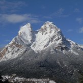
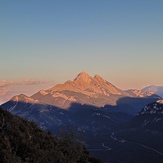
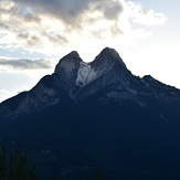
Pedraforca
Pedraforca
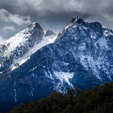
El nacimiento del arcoíris! ❤️
Una noche mágica!!!
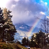
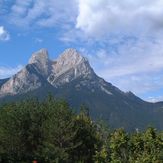
Pedraforca
Pedraforca from saldes