– Lat/Long: 34.23° N 117.62° W
 Ontario Peak
Weather Forecast, United StatesIssued: 4 am Mon 03 Aug Local TimeUpdates in: hr min sUpdate imminent
Issued: 4 am Mon 03 Aug Local Time
Updates in:
Update imminent hr min s

Issued: 4 am Mon 03 Aug Local Time
Updates in:
Update imminent hr min s
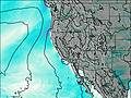
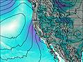
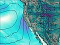
Days 1–3 Weather SummaryMostly dry. Warm (max 25°C on Tue afternoon, min 22°C on Mon morning). Wind will be generally light. | Days 4–6 Weather SummaryMostly dry. Warm (max 25°C on Fri morning, min 23°C on Fri night). Wind will be generally light. | |||||||||||||||||
Monday 3 | Tuesday 4 | Wednesday 5 | Thursday 6 | Friday 7 | Saturday 8 | |||||||||||||
AM | PM | night | AM | PM | night | AM | PM | night | AM | PM | night | AM | PM | night | AM | PM | night | |
clear | clear | clear | clear | clear | clear | clear | clear | clear | clear | clear | clear | clear | some clouds | clear | clear | clear | clear | |
Cloud base (m) | 5400 | 6500 | 5450 | |||||||||||||||
km/h | ||||||||||||||||||
 |  |  |  |  |  | |||||||||||||
— | — | — | — | — | — | — | — | — | — | — | — | — | — | — | — | — | — | |
mm | — | — | — | — | — | — | — | — | — | — | — | — | — | — | — | — | — | — |
max °C | 24 | 24 | 23 | 24 | 25 | 24 | 24 | 24 | 24 | 24 | 24 | 24 | 25 | 25 | 25 | 24 | 25 | 24 |
min °C | 22 | 24 | 22 | 23 | 25 | 23 | 23 | 24 | 22 | 24 | 24 | 24 | 24 | 25 | 23 | 23 | 25 | 23 |
chill °C | 22 | 24 | 22 | 23 | 25 | 23 | 23 | 24 | 22 | 24 | 24 | 24 | 24 | 25 | 23 | 23 | 25 | 23 |
Freezing level m | 5500 | 5600 | 5600 | 5500 | 5550 | 5500 | 5500 | 5500 | 5500 | 5400 | 5500 | 5450 | 5450 | 5600 | 5550 | 5450 | 5500 | 5400 |
6:01 | — | — | 6:03 | — | — | 6:03 | — | — | 6:03 | — | — | 6:05 | — | — | 6:05 | — | — | |
— | 7:50 | — | — | 7:49 | — | — | 7:47 | — | — | 7:46 | — | — | 7:45 | — | — | 7:45 | — | |
Loading...
Ontario Peak Weather (Days 0-3):
The weather forecast for Ontario Peak is: Mostly dry. Warm (max 25°C on Tue afternoon, min 22°C on Mon morning). Wind will be generally light.
Ontario Peak Weather (Days 3-6):
Mostly dry. Warm (max 25°C on Fri morning, min 23°C on Fri night). Wind will be generally light.
This table gives the weather forecast for Ontario Peak at the specific elevation of 2000 m. Our advanced weather models allow us to provide distinct weather forecasts for several elevations of Ontario Peak. To see the weather forecasts for the other elevations, use the tab navigation above the table. For a wider overview of the weather, consult the Weather Map of California.
| Weather Station | Temp. | Weather | Wind | Gusts | Cloud / Visibility |
|---|---|---|---|---|---|
Chino Airport | |||||
AJX - CSS | |||||
Riverside Airport | |||||
Corona Municipal Airport (California) | |||||
San Bernardino Airport | |||||
EL Monte Airport | |||||
Mount Wilson Airport | |||||
* NOTE: not all weather observatories update at the same frequency which is the reason why some locations may show data from stations that are further away than known closer ones.
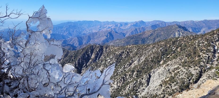
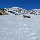
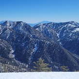
Ontario Peak Photos
View all
San Gabriel Mountains photos (155) |
Pacific Coast Ranges photos (1060) |
photos from mountains in United States (3056) |
all photos
 Upload new photo
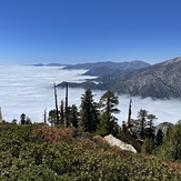
 See 12 more Ontario Peak photos
Cloudy day
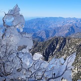
Frozen branches
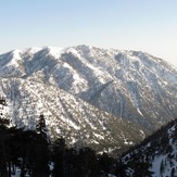
Ontario Peak
I want to see mountains
The great views
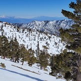
On the snow
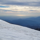
The view