
– Lat/Long: 43.52° S 170.37° E
 Mt Aylmer
Weather Forecast, New ZealandIssued: 5 pm Mon 03 Aug Local TimeUpdates in: hr min sUpdate imminent
Issued: 5 pm Mon 03 Aug Local Time
Updates in:
Update imminent hr min s

Issued: 5 pm Mon 03 Aug Local Time
Updates in:
Update imminent hr min s
Days 1–4 Weather SummaryA dusting of new snow. Temperatures will be below freezing (max -3°C on Mon afternoon, min -11°C on Tue morning). Winds decreasing (strong winds from the SSW on Mon night, calm by Thu morning). | Days 5–7 Weather SummaryA heavy fall of snow, heaviest during Fri night. Temperatures will be below freezing (max -2°C on Fri night, min -6°C on Thu afternoon). Wind will be generally light. | ||||||||||||||||
Mon 3 | Tuesday 4 | Wednesday 5 | Thursday 6 | Friday 7 | Saturday 8 | ||||||||||||
PM | night | AM | PM | night | AM | PM | night | AM | PM | night | AM | PM | night | AM | PM | night | |
light snow | clear | clear | clear | clear | clear | clear | clear | clear | some clouds | some clouds | mod. snow | light snow | mod. snow | mod. snow | mod. snow | some clouds | |
Cloud base (m) | 1550 | 1700 | 1750 | 7450 | 8850 | 1600 | 1600 | 1000 | 1550 | 1500 | 1500 | 1650 | |||||
km/h | |||||||||||||||||
 |  |  |  |  |  | ||||||||||||
1 | — | — | — | — | — | — | — | — | — | — | 6 | 5 | 10 | 6 | 6 | — | |
mm | — | — | — | — | — | — | — | — | — | — | — | — | — | — | — | — | — |
max °C | -3 | -5 | -9 | -9 | -6 | -4 | -4 | -5 | -4 | -4 | -5 | -3 | -3 | -2 | -2 | -3 | -4 |
min °C | -3 | -8 | -11 | -10 | -9 | -6 | -6 | -6 | -6 | -6 | -6 | -4 | -3 | -3 | -2 | -3 | -4 |
chill °C | -9 | -17 | -22 | -20 | -18 | -11 | -10 | -8 | -6 | -6 | -8 | -10 | -9 | -8 | -5 | -7 | -7 |
Freezing level m | 1450 | 600 | 0 | 400 | 0 | 850 | 1350 | 700 | 700 | 1150 | 450 | 1150 | 1500 | 1550 | 1650 | 1550 | 1250 |
— | — | 7:48 | — | — | 7:48 | — | — | 7:46 | — | — | 7:45 | — | — | 7:43 | — | — | |
5:38 | — | — | 5:39 | — | — | 5:40 | — | — | 5:42 | — | — | 5:43 | — | — | 5:44 | — | |
Loading...
Mt Aylmer Weather (Days 0-3):
The weather forecast for Mt Aylmer is: A dusting of new snow. Temperatures will be below freezing (max -3°C on Mon afternoon, min -11°C on Tue morning). Winds decreasing (strong winds from the SSW on Mon night, calm by Thu morning).
Mt Aylmer Weather (Days 3-6):
A heavy fall of snow, heaviest during Fri night. Temperatures will be below freezing (max -2°C on Fri night, min -6°C on Thu afternoon). Wind will be generally light.
This table gives the weather forecast for Mt Aylmer at the specific elevation of 2000 m. Our advanced weather models allow us to provide distinct weather forecasts for several elevations of Mt Aylmer. To see the weather forecasts for the other elevations, use the tab navigation above the table. For a wider overview of the weather, consult the Weather Map of New Zealand.
| Weather Station | Temp. | Weather | Wind | Gusts | Cloud / Visibility |
|---|---|---|---|---|---|
Franz Josef AWS | |||||
Franz - Greens Rd | |||||
Whataroa | |||||
Glentanner | |||||
Clayton | |||||
Hakatere | |||||
* NOTE: not all weather observatories update at the same frequency which is the reason why some locations may show data from stations that are further away than known closer ones.
Mt Aylmer Photos
View all
Southern Alps photos (37) |
New Zealand photos (156) |
photos from mountains in New Zealand (160) |
all photos
 Upload new photo
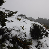
Mt Arthur hut ridge
Mt Arthur hut ridge