– Lat/Long: 36.42° S 148.25° E
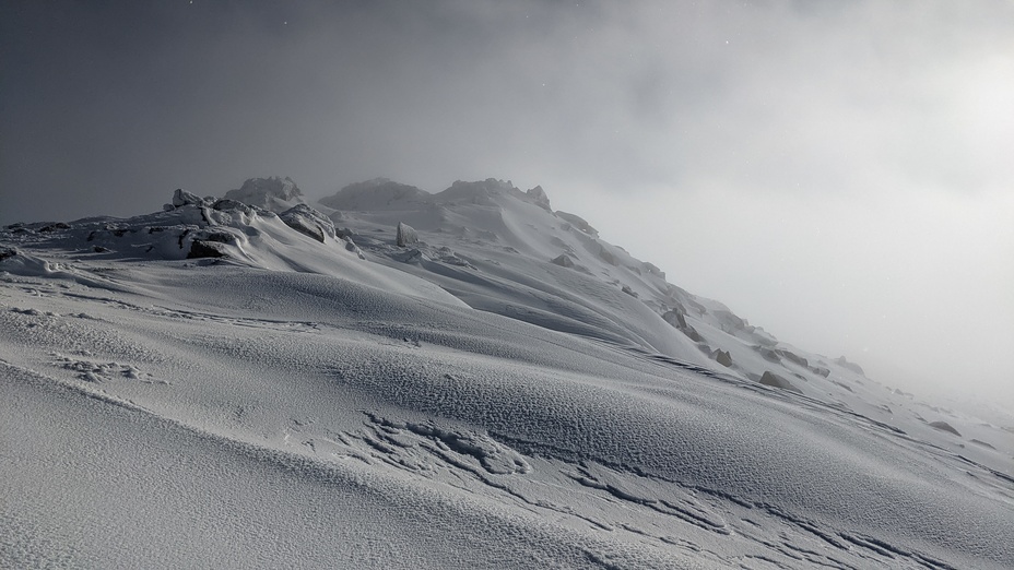
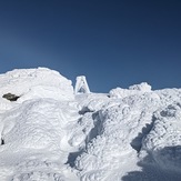
 Mount Tate
Weather Forecast, AustraliaIssued: 3 am Mon 03 Aug Local TimeUpdates in: hr min sUpdate imminent
Issued: 3 am Mon 03 Aug Local Time
Updates in:
Update imminent hr min s

Issued: 3 am Mon 03 Aug Local Time
Updates in:
Update imminent hr min s
Days 1–3 Weather SummaryA moderate fall of snow, heaviest on Wed morning. Temperatures will be below freezing (max -2°C on Mon morning, min -6°C on Mon night). Winds decreasing (strong winds from the WNW on Mon morning, light winds from the SW by Wed night). | Days 4–6 Weather SummaryMostly dry. Freeze-thaw conditions (max 2°C on Fri afternoon, min -3°C on Thu morning). Winds increasing (calm on Fri afternoon, near gales from the NW by Sat night). | |||||||||||||||||
Monday 3 | Tuesday 4 | Wednesday 5 | Thursday 6 | Friday 7 | Saturday 8 | |||||||||||||
AM | PM | night | AM | PM | night | AM | PM | night | AM | PM | night | AM | PM | night | AM | PM | night | |
some clouds | some clouds | snow shwrs | snow shwrs | light snow | light snow | light snow | light snow | clear | some clouds | some clouds | clear | clear | clear | clear | clear | some clouds | some clouds | |
Cloud base (m) | 2300 | 1900 | 900 | 900 | 900 | 900 | 900 | 900 | 900 | 900 | 950 | 1650 | 950 | 1650 | 2300 | 1600 | 6400 | |
km/h | ||||||||||||||||||
 |  |  |  |  |  | |||||||||||||
— | — | 2 | 1 | 2 | 3 | 4 | 1 | — | — | — | — | — | — | — | — | — | — | |
mm | — | — | — | — | — | — | — | — | — | — | — | — | — | — | — | — | — | — |
max °C | -2 | -2 | -3 | -5 | -5 | -4 | -4 | -3 | -3 | -2 | -2 | -1 | 0 | 2 | 2 | 2 | 2 | 1 |
min °C | -3 | -3 | -6 | -5 | -5 | -5 | -4 | -4 | -3 | -3 | -2 | -1 | -1 | 1 | 0 | 0 | 2 | 0 |
chill °C | -12 | -10 | -14 | -12 | -12 | -12 | -10 | -10 | -7 | -8 | -7 | -5 | -4 | 1 | -4 | -5 | -3 | -8 |
Freezing level m | 1650 | 1750 | 1300 | 1100 | 1200 | 1200 | 1300 | 1350 | 1250 | 1250 | 1400 | 1800 | 1700 | 2250 | 2600 | 2200 | 2450 | 2250 |
7:03 | — | — | 7:01 | — | — | 7:01 | — | — | 7:00 | — | — | 6:58 | — | — | 6:58 | — | — | |
— | 5:22 | — | — | 5:23 | — | — | 5:24 | — | — | 5:24 | — | — | 5:25 | — | — | 5:27 | — | |
Loading...
Mount Tate Weather (Days 0-3):
The weather forecast for Mount Tate is: A moderate fall of snow, heaviest on Wed morning. Temperatures will be below freezing (max -2°C on Mon morning, min -6°C on Mon night). Winds decreasing (strong winds from the WNW on Mon morning, light winds from the SW by Wed night).
Mount Tate Weather (Days 3-6):
Mostly dry. Freeze-thaw conditions (max 2°C on Fri afternoon, min -3°C on Thu morning). Winds increasing (calm on Fri afternoon, near gales from the NW by Sat night).
This table gives the weather forecast for Mount Tate at the specific elevation of 2068 m. Our advanced weather models allow us to provide distinct weather forecasts for several elevations of Mount Tate. To see the weather forecasts for the other elevations, use the tab navigation above the table. For a wider overview of the weather, consult the Weather Map of New-South-Wales.
Mount Tate Photos
View all
South NSW Great Dividing Range photos (14) |
Great Dividing Range photos (112) |
photos from mountains in Australia (242) |
all photos
 Upload new photo
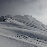
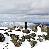

winter view
Spring summit 06/09/2022
peak view
Mount Tate