
– Lat/Long: 44.23° S 169.77° E
 Mount Sutton
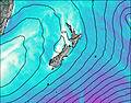
Weather Forecast, New ZealandIssued: 11 am Wed 01 Jul Local TimeUpdates in: hr min sUpdate imminent
Issued: 11 am Wed 01 Jul Local Time
Updates in:
Update imminent hr min s

Issued: 11 am Wed 01 Jul Local Time
Updates in:
Update imminent hr min s
Days 1–3 Weather SummaryA light covering of new snow mostly falling on Fri night. Freeze-thaw conditions (max 1°C on Thu night, min -1°C on Wed morning). Winds increasing (light winds from the NW on Wed afternoon, gales from the NNW by Fri night). | Days 4–6 Weather SummaryA heavy fall of snow, heaviest during Sat morning. Temperatures will be below freezing (max -1°C on Sat morning, min -9°C on Sun night). Winds decreasing (near gales from the N on Sat morning, calm by Sun morning). | |||||||||||||||||
Wednesday 1 | Thursday 2 | Friday 3 | Saturday 4 | Sunday 5 | Monday 6 | |||||||||||||
AM | PM | night | AM | PM | night | AM | PM | night | AM | PM | night | AM | PM | night | AM | PM | night | |
clear | clear | clear | clear | clear | some clouds | cloudy | cloudy | mod. snow | heavy snow | heavy snow | snow shwrs | light snow | mod. snow | heavy snow | light snow | light snow | light snow | |
km/h | ||||||||||||||||||
 |  |  |  |  |  | |||||||||||||
— | — | — | — | — | — | — | — | 6 | 29 | 24 | 10 | 1 | 10 | 11 | 3 | 4 | 5 | |
mm | — | — | — | — | — | — | — | — | — | — | — | — | — | — | — | — | — | — |
max °C | -1 | 0 | 0 | 0 | 0 | 1 | 0 | 0 | 0 | -1 | -3 | -6 | -7 | -7 | -8 | -8 | -7 | -5 |
min °C | -1 | 0 | 0 | -1 | 0 | 0 | 0 | 0 | -1 | -2 | -3 | -7 | -8 | -8 | -9 | -8 | -7 | -6 |
chill °C | -4 | -3 | -2 | -4 | -4 | -5 | -6 | -7 | -10 | -11 | -12 | -16 | -8 | -17 | -20 | -18 | -18 | -16 |
Freezing level m | 1500 | 1850 | 1950 | 1600 | 2000 | 2100 | 2150 | 2000 | 2150 | 1750 | 1400 | 950 | 700 | 900 | 650 | 600 | 700 | 650 |
Cloud base (m) | 1050 | 1000 | 1000 | 1000 | 900 | 1750 | 750 | 700 | 700 | 750 | 750 | 700 | 750 | 750 | 750 | 750 | ||
8:17 | — | — | 8:17 | — | — | 8:17 | — | — | 8:15 | — | — | 8:15 | — | — | 8:15 | — | — | |
— | 5:12 | — | — | 5:12 | — | — | 5:13 | — | — | 5:14 | — | — | 5:14 | — | — | 5:15 | — | |
Loading...
Mount Sutton Weather (Days 0-3):
The weather forecast for Mount Sutton is: A light covering of new snow mostly falling on Fri night. Freeze-thaw conditions (max 1°C on Thu night, min -1°C on Wed morning). Winds increasing (light winds from the NW on Wed afternoon, gales from the NNW by Fri night).
Mount Sutton Weather (Days 3-6):
A heavy fall of snow, heaviest during Sat morning. Temperatures will be below freezing (max -1°C on Sat morning, min -9°C on Sun night). Winds decreasing (near gales from the N on Sat morning, calm by Sun morning).
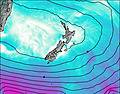
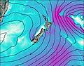
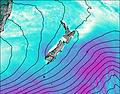
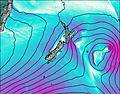
This table gives the weather forecast for Mount Sutton at the specific elevation of 2007 m. Our advanced weather models allow us to provide distinct weather forecasts for several elevations of Mount Sutton. To see the weather forecasts for the other elevations, use the tab navigation above the table. For a wider overview of the weather, consult the Weather Map of New Zealand.
Mount Sutton Photos
View all
Southern Alps photos (37) |
New Zealand photos (151) |
photos from mountains in New Zealand (155) |
all photos
 Upload new photo
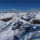
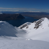
Ohau backcountry
Slack country above Ohau Ski Field