– Lat/Long: 46.85° N 121.76° W
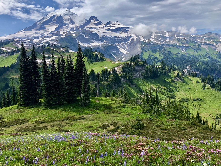
 Mount Rainier
Weather Forecast, United StatesIssued: 10 pm Sun 02 Aug Local TimeUpdates in: hr min sUpdate imminent
Issued: 10 pm Sun 02 Aug Local Time
Updates in:
Update imminent hr min s

Issued: 10 pm Sun 02 Aug Local Time
Updates in:
Update imminent hr min s
Days 1–4 Weather SummaryMostly dry. Freeze-thaw conditions (max 3°C on Wed afternoon, min -10°C on Sun night). Winds decreasing (near gales from the NW on Sun night, light winds from the WNW by Tue afternoon). | Days 5–7 Weather SummaryMostly dry. Freeze-thaw conditions (max 4°C on Wed night, min -1°C on Fri night). Winds increasing (fresh winds from the WSW on Thu afternoon, near gales from the W by Fri night). | ||||||||||||||||||
Monday 3 | Tuesday 4 | Wednesday 5 | Thursday 6 | Friday 7 | Saturday 8 | ||||||||||||||
night | AM | PM | night | AM | PM | night | AM | PM | night | AM | PM | night | AM | PM | night | AM | PM | night | |
clear | clear | clear | clear | clear | clear | clear | clear | clear | clear | clear | clear | clear | clear | clear | clear | clear | clear | clear | |
Cloud base (m) | 9750 | 9450 | |||||||||||||||||
km/h | |||||||||||||||||||
 |  |  |  |  |  |  | |||||||||||||
— | — | — | — | — | — | — | — | — | — | — | — | — | — | — | — | — | — | — | |
mm | — | — | — | — | — | — | — | — | — | — | — | — | — | — | — | — | — | — | — |
max °C | -6 | -5 | -3 | -1 | -1 | 0 | 2 | 2 | 3 | 4 | 3 | 4 | 4 | 2 | 0 | -1 | -1 | -1 | -1 |
min °C | -10 | -5 | -4 | -2 | -2 | -1 | 1 | 2 | 2 | 3 | 3 | 3 | 2 | 1 | 0 | -1 | -1 | -1 | -3 |
chill °C | -22 | -11 | -10 | -7 | -8 | -5 | -3 | -3 | -3 | -3 | -3 | -3 | -5 | -7 | -8 | -10 | -9 | -9 | -12 |
Freezing level m | 3400 | 3700 | 3950 | 4200 | 4100 | 4400 | 4650 | 4750 | 4850 | 4850 | 4800 | 4950 | 4800 | 4550 | 4350 | 4150 | 4250 | 4300 | 4050 |
— | 5:48 | — | — | 5:50 | — | — | 5:50 | — | — | 5:52 | — | — | 5:52 | — | — | 5:54 | — | — | |
— | — | — | 8:36 | — | — | 8:35 | — | — | 8:32 | — | — | 8:31 | — | — | 8:30 | — | — | 8:29 | |
Loading...
Mount Rainier Weather (Days 0-3):
The weather forecast for Mount Rainier is: Mostly dry. Freeze-thaw conditions (max 3°C on Wed afternoon, min -10°C on Sun night). Winds decreasing (near gales from the NW on Sun night, light winds from the WNW by Tue afternoon).
Mount Rainier Weather (Days 3-6):
Mostly dry. Freeze-thaw conditions (max 4°C on Wed night, min -1°C on Fri night). Winds increasing (fresh winds from the WSW on Thu afternoon, near gales from the W by Fri night).
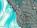
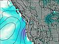
This table gives the weather forecast for Mount Rainier at the specific elevation of 4392 m. Our advanced weather models allow us to provide distinct weather forecasts for several elevations of Mount Rainier. To see the weather forecasts for the other elevations, use the tab navigation above the table. For a wider overview of the weather, consult the Weather Map of Washington.
| Weather Station | Temp. | Weather | Wind | Gusts | Cloud / Visibility |
|---|---|---|---|---|---|
Pierce County Airport - Thun Field - Puyallup (Washington) | |||||
Fort Lewi / ray Army Airfield Airport | |||||
BUOY-TCNW1 | |||||
BUOY-TCMW1 | |||||
* NOTE: not all weather observatories update at the same frequency which is the reason why some locations may show data from stations that are further away than known closer ones.
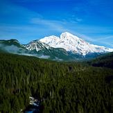
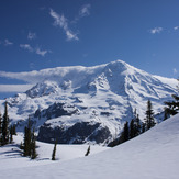
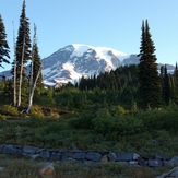
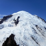
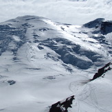
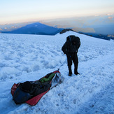
Mount Rainier Photos
View all
Cascade Range photos (451) |
Pacific Coast Ranges photos (1060) |
photos from mountains in United States (3056) |
all photos
 Upload new photo
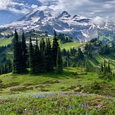
 See 32 more Mount Rainier photos
Wonderful Trail-Cowlitz Divide
Mount Rainier
Mt. Rainier, WA
Rainier from Paradise - July 2015
Mount Rainier
Emmons Route 6-20-12
Anthony Vito Fiore - Rescue - Mount Rainier