– Lat/Long: 36.45° S 148.27° E
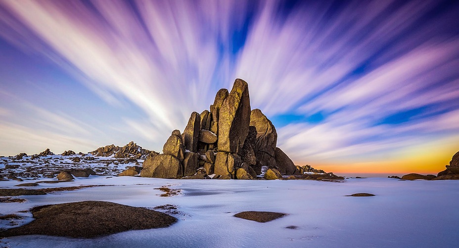
 Mount Kosciusko
Weather Forecast, AustraliaIssued: 3 pm Mon 03 Aug Local TimeUpdates in: hr min sUpdate imminent
Issued: 3 pm Mon 03 Aug Local Time
Updates in:
Update imminent hr min s

Issued: 3 pm Mon 03 Aug Local Time
Updates in:
Update imminent hr min s
Days 1–4 Weather SummaryA dusting of new snow. Temperatures will be below freezing (max -2°C on Mon afternoon, min -6°C on Mon night). Winds decreasing (strong winds from the WNW on Mon afternoon, light winds from the WSW by Wed night). | Days 5–7 Weather SummaryA moderate fall of snow, heaviest on Sun morning. Freeze-thaw conditions (max 1°C on Fri afternoon, min -3°C on Thu afternoon). Winds increasing (calm on Fri afternoon, severe gales from the NW by Sun morning). | ||||||||||||||||
Mon 3 | Tuesday 4 | Wednesday 5 | Thursday 6 | Friday 7 | Saturday 8 | ||||||||||||
PM | night | AM | PM | night | AM | PM | night | AM | PM | night | AM | PM | night | AM | PM | night | |
some clouds | light snow | some clouds | some clouds | cloudy | light snow | light snow | some clouds | some clouds | clear | some clouds | clear | clear | clear | some clouds | some clouds | some clouds | |
Cloud base (m) | 1850 | 900 | 900 | 900 | 900 | 900 | 900 | 900 | 900 | 900 | 900 | 950 | 1600 | 1500 | |||
km/h | |||||||||||||||||
 |  |  |  |  |  | ||||||||||||
— | 2 | — | — | — | 1 | 1 | — | — | — | — | — | — | — | — | — | — | |
mm | — | — | — | — | — | — | — | — | — | — | — | — | — | — | — | — | — |
max °C | -2 | -4 | -5 | -6 | -5 | -5 | -4 | -3 | -3 | -3 | -2 | 0 | 1 | 1 | 1 | 1 | 0 |
min °C | -3 | -6 | -5 | -6 | -6 | -5 | -5 | -4 | -3 | -3 | -3 | -2 | 1 | 0 | 0 | 1 | -1 |
chill °C | -11 | -15 | -13 | -13 | -14 | -12 | -12 | -10 | -9 | -8 | -9 | -7 | -1 | -4 | -6 | -5 | -11 |
Freezing level m | 1850 | 1350 | 1250 | 1200 | 1250 | 1350 | 1400 | 1300 | 1300 | 1450 | 1600 | 1550 | 2400 | 2300 | 2100 | 2500 | 2250 |
— | — | 7:01 | — | — | 7:01 | — | — | 7:00 | — | — | 6:58 | — | — | 6:58 | — | — | |
5:22 | — | — | 5:23 | — | — | 5:23 | — | — | 5:24 | — | — | 5:25 | — | — | 5:27 | — | |
Loading...
Mount Kosciusko Weather (Days 0-3):
The weather forecast for Mount Kosciusko is: A dusting of new snow. Temperatures will be below freezing (max -2°C on Mon afternoon, min -6°C on Mon night). Winds decreasing (strong winds from the WNW on Mon afternoon, light winds from the WSW by Wed night).
Mount Kosciusko Weather (Days 3-6):
A moderate fall of snow, heaviest on Sun morning. Freeze-thaw conditions (max 1°C on Fri afternoon, min -3°C on Thu afternoon). Winds increasing (calm on Fri afternoon, severe gales from the NW by Sun morning).
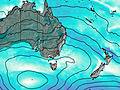
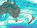
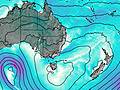
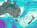
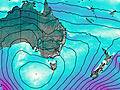
This table gives the weather forecast for Mount Kosciusko at the specific elevation of 2228 m. Our advanced weather models allow us to provide distinct weather forecasts for several elevations of Mount Kosciusko. To see the weather forecasts for the other elevations, use the tab navigation above the table. For a wider overview of the weather, consult the Weather Map of New-South-Wales.
| Weather Station | Temp. | Weather | Wind | Gusts | Cloud / Visibility |
|---|---|---|---|---|---|
Thredbo Aws | |||||
Thredbo Village | |||||
Perisher Valley Aws | |||||
Khancoban Aws | |||||
Cabramurra Smhea Aws | |||||
Cabramurra Smhea Aws | |||||
Cooma Airport Aws | |||||
Cooma Airport Aws | |||||
Hunters Hill |
* NOTE: not all weather observatories update at the same frequency which is the reason why some locations may show data from stations that are further away than known closer ones.
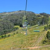
Mount Kosciusko Photos
View all
Snowy Mountains photos (4) |
Great Dividing Range photos (112) |
photos from mountains in Australia (242) |
all photos
 Upload new photo
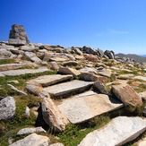
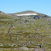
Mt Kosciuszko climb
Mt Kosciuszko track
Thredbo Chairlift