– Lat/Long: 39.12° N 106.44° W
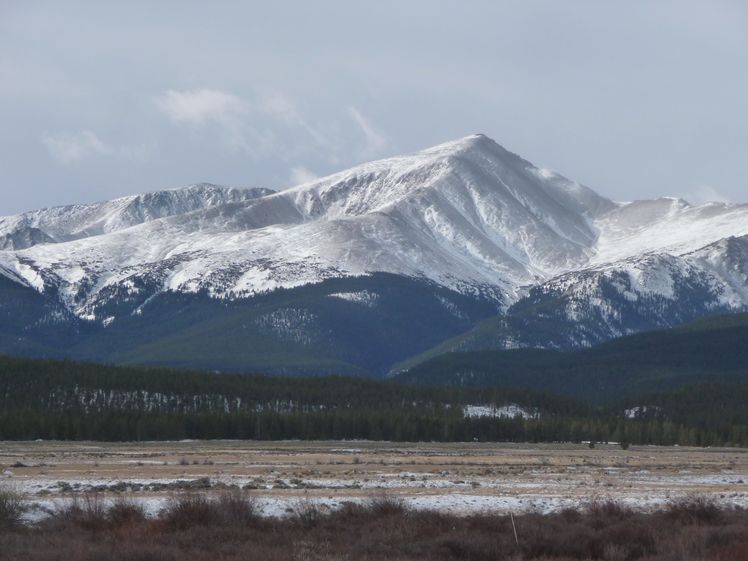
 Mount Elbert
Weather Forecast, United StatesIssued: 5 am Mon 03 Aug Local TimeUpdates in: hr min sUpdate imminent
Issued: 5 am Mon 03 Aug Local Time
Updates in:
Update imminent hr min s

Issued: 5 am Mon 03 Aug Local Time
Updates in:
Update imminent hr min s
Days 1–3 Weather SummaryMostly dry. Very mild (max 11°C on Mon afternoon, min 1°C on Mon night). Winds increasing (light winds from the W on Mon night, fresh winds from the W by Tue morning). | Days 4–6 Weather SummaryMostly dry. Very mild (max 12°C on Fri afternoon, min 5°C on Sat night). Wind will be generally light. | |||||||||||||||||
Monday 3 | Tuesday 4 | Wednesday 5 | Thursday 6 | Friday 7 | Saturday 8 | |||||||||||||
AM | PM | night | AM | PM | night | AM | PM | night | AM | PM | night | AM | PM | night | AM | PM | night | |
some clouds | some clouds | some clouds | some clouds | some clouds | clear | clear | clear | clear | clear | clear | clear | clear | some clouds | clear | clear | some clouds | clear | |
Cloud base (m) | 6350 | 6050 | 6300 | 6250 | 6200 | 6950 | 6950 | 6800 | 6500 | |||||||||
km/h | ||||||||||||||||||
 |  |  |  |  |  | |||||||||||||
— | — | — | — | — | — | — | — | — | — | — | — | — | — | — | — | — | — | |
mm | — | — | — | — | — | — | — | — | — | — | — | — | — | — | — | — | — | — |
max °C | 10 | 11 | 8 | 9 | 10 | 6 | 8 | 10 | 6 | 9 | 10 | 8 | 10 | 12 | 9 | 11 | 12 | 7 |
min °C | 9 | 11 | 1 | 6 | 10 | 3 | 6 | 10 | 4 | 7 | 10 | 6 | 9 | 12 | 6 | 9 | 11 | 5 |
chill °C | 6 | 8 | -3 | 2 | 6 | -2 | 2 | 6 | 0 | 4 | 8 | 3 | 8 | 11 | 4 | 8 | 10 | 3 |
Freezing level m | 5550 | 5650 | 5100 | 5300 | 5500 | 5200 | 5250 | 5550 | 5200 | 5300 | 5500 | 5150 | 5450 | 5650 | 5300 | 5450 | 5650 | 5200 |
6:07 | — | — | 6:07 | — | — | 6:09 | — | — | 6:09 | — | — | 6:11 | — | — | 6:11 | — | — | |
— | 8:15 | — | — | 8:14 | — | — | 8:13 | — | — | 8:12 | — | — | 8:10 | — | — | 8:09 | — | |
Loading...
Mount Elbert Weather (Days 0-3):
The weather forecast for Mount Elbert is: Mostly dry. Very mild (max 11°C on Mon afternoon, min 1°C on Mon night). Winds increasing (light winds from the W on Mon night, fresh winds from the W by Tue morning).
Mount Elbert Weather (Days 3-6):
Mostly dry. Very mild (max 12°C on Fri afternoon, min 5°C on Sat night). Wind will be generally light.
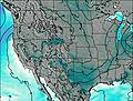
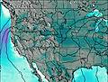
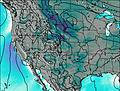
This table gives the weather forecast for Mount Elbert at the specific elevation of 4399 m. Our advanced weather models allow us to provide distinct weather forecasts for several elevations of Mount Elbert. To see the weather forecasts for the other elevations, use the tab navigation above the table. For a wider overview of the weather, consult the Weather Map of Colorado.
| Weather Station | Temp. | Weather | Wind | Gusts | Cloud / Visibility |
|---|---|---|---|---|---|
Leadville Airport | |||||
Cottonwood Pass (CO) | |||||
Buena Vista Airport | |||||
Red Cliff Pass Airport | |||||
* NOTE: not all weather observatories update at the same frequency which is the reason why some locations may show data from stations that are further away than known closer ones.
Mount Elbert Photos
View all
Sawatch Range photos (40) |
Rocky Mountains (USA) photos (298) |
photos from mountains in United States (3056) |
all photos
 Upload new photo
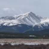


 See 15 more Mount Elbert photos
Mount Elbert North East Ridge
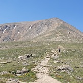
Final push to the summit.
Mount Elbert Summit
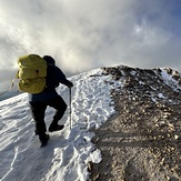
Elbert north trail just almost at 13,000 - slippery section ahead
Mount Elbert
Summit of Mt. Elbert
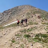
Elbert north trail about 12,500'