
– Lat/Long: 39.30° S 174.07° E
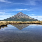
 Mount Egmont/Taranaki (Mount Egmont-Taranaki)
Weather Forecast, New ZealandIssued: 5 am Mon 03 Aug Local TimeUpdates in: hr min sUpdate imminent
Issued: 5 am Mon 03 Aug Local Time
Updates in:
Update imminent hr min s

Issued: 5 am Mon 03 Aug Local Time
Updates in:
Update imminent hr min s
Days 1–3 Weather SummaryA dusting of new snow. Temperatures will be below freezing (max 0°C on Mon morning, min -7°C on Tue afternoon). Winds decreasing (gales from the SW on Mon night, moderate winds from the SW by Wed night). | Days 4–6 Weather SummaryA moderate fall of snow, heaviest on Sat afternoon. Temperatures will be below freezing (max 0°C on Fri night, min -4°C on Thu morning). Winds increasing (light winds from the SW on Thu afternoon, strong winds from the WNW by Fri afternoon). | |||||||||||||||||
Monday 3 | Tuesday 4 | Wednesday 5 | Thursday 6 | Friday 7 | Saturday 8 | |||||||||||||
AM | PM | night | AM | PM | night | AM | PM | night | AM | PM | night | AM | PM | night | AM | PM | night | |
clear | some clouds | clear | some clouds | snow shwrs | clear | clear | clear | clear | clear | clear | clear | some clouds | light snow | light snow | light snow | light snow | clear | |
Cloud base (m) | 550 | 800 | 500 | 500 | 500 | 650 | 700 | 800 | 700 | 850 | 900 | 650 | 600 | 500 | 350 | 500 | 300 | 350 |
km/h | ||||||||||||||||||
 |  |  |  |  |  | |||||||||||||
— | — | — | — | 1 | — | — | — | — | — | — | — | — | 2 | 2 | 2 | 4 | — | |
mm | — | — | — | — | — | — | — | — | — | — | — | — | — | — | — | — | — | — |
max °C | 0 | 0 | -1 | -4 | -7 | -6 | -6 | -5 | -4 | -4 | -3 | -1 | -1 | -1 | 0 | -1 | -1 | -1 |
min °C | 0 | -1 | -3 | -5 | -7 | -7 | -6 | -6 | -5 | -4 | -4 | -2 | -2 | -1 | -1 | -2 | -2 | -2 |
chill °C | -9 | -11 | -13 | -15 | -18 | -19 | -16 | -14 | -13 | -11 | -7 | -6 | -10 | -9 | -8 | -8 | -7 | -8 |
Freezing level m | 1900 | 1900 | 1650 | 1150 | 850 | 700 | 950 | 1100 | 1050 | 1300 | 1350 | 1400 | 1450 | 1700 | 2000 | 1850 | 1700 | 1850 |
7:26 | — | — | 7:24 | — | — | 7:22 | — | — | 7:22 | — | — | 7:20 | — | — | 7:20 | — | — | |
— | 5:34 | — | — | 5:35 | — | — | 5:36 | — | — | 5:37 | — | — | 5:37 | — | — | 5:37 | — | |
Loading...
Mount Egmont/Taranaki Weather (Days 0-3):
The weather forecast for Mount Egmont/Taranaki is: A dusting of new snow. Temperatures will be below freezing (max 0°C on Mon morning, min -7°C on Tue afternoon). Winds decreasing (gales from the SW on Mon night, moderate winds from the SW by Wed night).
Mount Egmont/Taranaki Weather (Days 3-6):
A moderate fall of snow, heaviest on Sat afternoon. Temperatures will be below freezing (max 0°C on Fri night, min -4°C on Thu morning). Winds increasing (light winds from the SW on Thu afternoon, strong winds from the WNW by Fri afternoon).
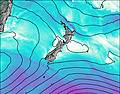
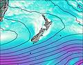
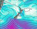
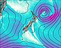
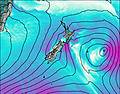
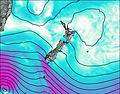
This table gives the weather forecast for Mount Egmont/Taranaki at the specific elevation of 2000 m. Our advanced weather models allow us to provide distinct weather forecasts for several elevations of Mount Egmont/Taranaki. To see the weather forecasts for the other elevations, use the tab navigation above the table. For a wider overview of the weather, consult the Weather Map of New Zealand.
| Weather Station | Temp. | Weather | Wind | Gusts | Cloud / Visibility |
|---|---|---|---|---|---|
Koru | |||||
Opunake | |||||
Brois Street | |||||
surfzone | |||||
Kapurau Lane | |||||
New Plymouth City | |||||
Eltham | |||||
* NOTE: not all weather observatories update at the same frequency which is the reason why some locations may show data from stations that are further away than known closer ones.
Mount Egmont/Taranaki Photos
View all
North Island Volcanics photos (45) |
New Zealand photos (156) |
photos from mountains in New Zealand (160) |
all photos
 Upload new photo
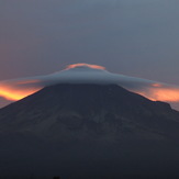

 See 25 more Mount Egmont/Taranaki photos
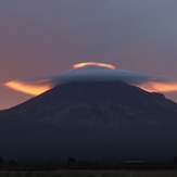
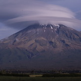
Wind cloud
Wind cloud
wind cloud
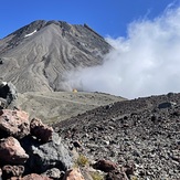
Lonely Syme Hut
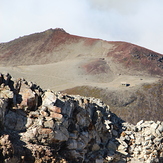
Fantham’s Peak in April
Fanthams Peak