
– Lat/Long: 39.30° S 174.07° E
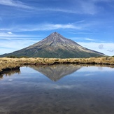
 Mount Egmont/Taranaki (Mount Egmont-Taranaki)
Weather Forecast, New ZealandIssued: 5 am Tue 04 Aug Local TimeUpdates in: hr min sUpdate imminent
Issued: 5 am Tue 04 Aug Local Time
Updates in:
Update imminent hr min s

Issued: 5 am Tue 04 Aug Local Time
Updates in:
Update imminent hr min s
Days 1–3 Weather SummaryA dusting of new snow. Temperatures will be below freezing (max -4°C on Thu night, min -10°C on Tue afternoon). Winds decreasing (gales from the S on Tue night, calm by Thu night). | Days 4–6 Weather SummaryA heavy fall of snow, heaviest during Sat night. Temperatures will be below freezing (max -2°C on Fri night, min -4°C on Sat morning). Winds decreasing (severe gales from the NW on Sat night, calm by Sun night). | |||||||||||||||||
Tuesday 4 | Wednesday 5 | Thursday 6 | Friday 7 | Saturday 8 | Sunday 9 | |||||||||||||
AM | PM | night | AM | PM | night | AM | PM | night | AM | PM | night | AM | PM | night | AM | PM | night | |
snow shwrs | snow shwrs | clear | clear | clear | clear | clear | clear | clear | some clouds | cloudy | light snow | snow shwrs | light snow | heavy snow | cloudy | cloudy | mod. snow | |
Cloud base (m) | 600 | 400 | 650 | 700 | 700 | 750 | 400 | 500 | 700 | 800 | 850 | 450 | 350 | 2300 | 300 | 450 | 850 | 400 |
km/h | ||||||||||||||||||
 |  |  |  |  |  | |||||||||||||
1 | 3 | — | — | — | — | — | — | — | — | — | 4 | 2 | 4 | 11 | — | — | 8 | |
mm | — | — | — | — | — | — | — | — | — | — | — | — | — | — | — | — | — | — |
max °C | -5 | -9 | -7 | -7 | -7 | -6 | -6 | -6 | -4 | -3 | -3 | -2 | -3 | -3 | -2 | -3 | -3 | -3 |
min °C | -7 | -10 | -8 | -7 | -7 | -7 | -6 | -6 | -5 | -3 | -3 | -3 | -4 | -4 | -3 | -3 | -4 | -3 |
chill °C | -19 | -23 | -21 | -17 | -16 | -16 | -14 | -13 | -10 | -10 | -11 | -12 | -14 | -14 | -13 | -11 | -10 | -8 |
Freezing level m | 1250 | 800 | 700 | 900 | 1100 | 1000 | 1250 | 1350 | 1200 | 1400 | 1900 | 2000 | 1900 | 1800 | 1950 | 1950 | 1800 | 1850 |
7:24 | — | — | 7:22 | — | — | 7:22 | — | — | 7:20 | — | — | 7:20 | — | — | 7:18 | — | — | |
— | 5:35 | — | — | 5:36 | — | — | 5:37 | — | — | 5:37 | — | — | 5:37 | — | — | 5:38 | — | |
Loading...
Mount Egmont/Taranaki Weather (Days 0-3):
The weather forecast for Mount Egmont/Taranaki is: A dusting of new snow. Temperatures will be below freezing (max -4°C on Thu night, min -10°C on Tue afternoon). Winds decreasing (gales from the S on Tue night, calm by Thu night).
Mount Egmont/Taranaki Weather (Days 3-6):
A heavy fall of snow, heaviest during Sat night. Temperatures will be below freezing (max -2°C on Fri night, min -4°C on Sat morning). Winds decreasing (severe gales from the NW on Sat night, calm by Sun night).
This table gives the weather forecast for Mount Egmont/Taranaki at the specific elevation of 2518 m. Our advanced weather models allow us to provide distinct weather forecasts for several elevations of Mount Egmont/Taranaki. To see the weather forecasts for the other elevations, use the tab navigation above the table. For a wider overview of the weather, consult the Weather Map of New Zealand.
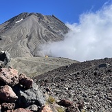
Mount Egmont/Taranaki Photos
View all
North Island Volcanics photos (45) |
New Zealand photos (156) |
photos from mountains in New Zealand (160) |
all photos
 Upload new photo
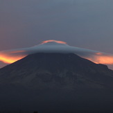


 See 25 more Mount Egmont/Taranaki photos
Wind cloud
Wind cloud
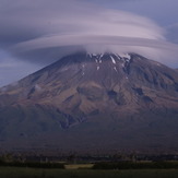
wind cloud
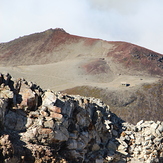
Lonely Syme Hut
Fantham’s Peak in April
Fanthams Peak